
WALKS IN WEST DUNBARTONSHIRE
The following is both a list and summary with, in many cases, cross references to places mentioned elsewhere on this website.
There are many routes to walk in West Dunbartonshire : Some fully paved and fairly flat; some core paths with varied terrain as set out by the council; some paths set out by the council around some specific feature; some incidental from regular use.
Some are shared with cyclists.
Some are are more suitable for disabled users than others.
Some of these are features in their own right and have been discussed elsewhere on the website. These are cross linked. Those that are core paths set out by the council are also given links.

ANTONINE WALL
This is theoretically all the way from the River Clyde where the Wall starts / ends next to Old Kilpatrick Fort to Bo'Ness on the Firth of Forth. Our end of the Wall varies in clarity and direct access.
index.asp?pageid=716092 Follow this link through to the specific forts aloing the route.
AUCHNACRAIG PARK See Cochno Stones.
This is an extensive park. It has some well laid out paths although some have become rather weathered. The park offers a variety of walk, but you can also use it as a starting point to explore further afield such as Cochno and Jaw Reservoir.
For those wishing some more options here is one that starts near here at Whitehill Farm, Cochno Road, Faifley (NS 512 737) and heads towards the A809 (Stockiemuir Road), former Craigton School, Milngavie (NS 528 760) over a distance of 3km.
index.asp?pageid=719197 Auchnacraig Woodland Park.
index.asp?pageid=715987 Cochno Stones.
http://www.heritagepaths.co.uk/pathdetails.php?path=60 Whitehill / Milngavie route.
BALLOCH AREA
https://www.plotaroute.com/search?keyword=balloch&searchfor=routes&ccode=&locality= This suggests several routes. Make sure you are looking at the correct "Balloch".
BALLOCH PARK Disabled accessible.
This is a great park with extensive grounds, a castle, a walled garden, a slipway and a play park.
BOWLING HARBOUR Disabled accessible.
You can combine this with a longer walk along the tow path or simply visit the upper and lower canal basins.
CARMAN MUIR
You can combine this with a walk up the Hundred Steps following the old Drovers Road and going around the reservoir or head up Carman Hill. It is possible to vary the walk at will and even go all the way to Stoneymollan.
index.asp?pageid=717183 ; index.asp?pageid=716244 ; index.asp?pageid=715665 ; index.asp?pageid=715971
CARMAN HILL / MOUNT MALLOW
Carman Hill can be considered as the southern crest of the larger hill of Mount Mallow. Opinions differ. Anyway it is the former that has the hillfort on it and offers great views.
CASTLE CIRCULAR PATH
This can be started at Dumbarton East Station or Greenhead Gardens which is where the National Cycle Route 7 links with it. It takes in the Clyde Shore, Dumbarton Castle and Knoxland Sqaure. The section along the Clyde shore is in need of attention again. Map available on the WDC website : :http://https://www.west-dunbarton.gov.uk/media/813280/castle_circular_walk_final_file.pdf
CHRISTIES PARK Disabled accessible.
This is a very easy walk right in the centre of Alexandria.
CLYDESIDE COMMUNITY PARK Disabled accessible.
A small park with a short section of "esplanade" along the shore.
CLYDE SHORE DALMUIR See Clydeside Community Park above.
CLYDE SHORE DUMBARTON ROCK
It will eventually be possible to walk all the way from Dumbarton's town centre to Dumbarton Rock. You can of course go directly to the foot of the Rock and simply amble about. For something more see the Castle Circular Path above.
index.asp?pageid=715736 Dumbarton Waterfront Path.
CLYDE SHORE LEVENGROVE AND HAVOC
This easy walk takes you from Levengrove Park through to Havoc and beyond.
index.asp?pageid=715801 Levengrove Park.
index.asp?pageid=715664 Havoc Hole.
CLYDE SHORE AT OLD KILPATRICK : See The Saltings.
COCHNO AND LAW RESERVOIRS
The walk up can be a long slog, but it is well worth it.
COCHNO AREA
https://www.plotaroute.com/search?keyword=cochno There are several walks on this website.
The CRAGS CIRCULAR PATH
This is a variation on the Langcraigs route noted below and much longer.
WDC offer this map : https://www.west-dunbarton.gov.uk/media/813277/crags_circular_final_file.pdf
DALMUIR PARK Disabled accessible.
DILLICHIP LOOP, lower Bonhill. Disabled accessible.
This is on a tarred path along the east side of the Leven and then back along Main Street. (This is the old main street which is quiet, not the busy Stirling Road). The route along the riverside is through trees and very picturesque. You can do the walk in any direction and park along Main Street.
Start or end point https://w3w.co/alternate.fizzy.prevented Junction with Main Street https://w3w.co/gadgets.alright.stupidly
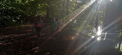
Late sunlight mirrors off the river in September.
DUMBARTON WATERFRONT PATH Disabled accessible.
This links Dumabrton town centre with Dumbarton Castle. Much is still to be constructed, but that which is complete is great and can be started at the Riverside Lane parking or from behind Lidl near the Denny Tank Museum.
http://index.asp?pageid=715736
DRUMKINNON WOODS Disabled accessible with care.
DUNCOLM
Duncolm is the highest point in the Kilpatrick Hills. The route starts at the Gas Governor near Old Kilpatrick passing Loch Humphrey (or up the Cochno Road passing the Cochno and Jaw Reservoir).
ALL TRAILS website : https://www.alltrails.com/explore/trail/scotland/glasgow/three-duncolm-loop-bowling?mobileMap=false&ref=sidebar-static-map&ref=sidebar-view-full-map.
FORTH AND CLYDE CANAL TOW PATH Most is disabled accessible.
This potentially can take you all the way to Grangemouth and Edinburgh (Linking with the Union Canal).
GALANGAD CAIRN AND WATERFALL
You can cycle to the starting point or go by car. Once there it is necessary to walk. Some over rough ground and heather.
A longer walk is from Milngavie to Balloch along the John Muir Way which passes close by these features.
https://www.plotaroute.com/route/1052635
GOLDENHILL PARK Much is disabled accessible with shallow slopes.
A laid out park with the added interest of being a Roman Fort location.
GREENSIDE RESERVOIR
One of those walks with a long walk up.
CRAIGANDRO WOOD / HUNDRED STEPS / DROVERS ROAD and then CARMAN RESERVOIR
An easy walk over and through varied terrain.
index.asp?pageid=715967 and index.asp?pageid=715966
WDC provide this map : https://www.west-dunbarton.gov.uk/media/813271/carman_reservoir_final_file.pdf
FISHERS WOOD
This is more a fun detour than a walk in itself. If you walk into Fishers Wood behind the Lomond Rowing Club and VOLDAC buildings behind the barrage you will enjoy some lovely forest. Someone small but sufficient to be worth it. This can be linked in to walks up or down the Leven Towpath.
Take care over the steep slope to the north end and the small iron spikes where there had once been a fence around the drain sluice and settlement tank.
Also see FISHERS WOOD & BOATHOUSE WOOD
HUNDRED STEPS
See the combined walk above.
KILPATRICK HILLS
https://www.plotaroute.com/search?keyword=kilpatrick+hills&searchfor=routes&ccode=&locality= This suggests two routes.
KILT WALK
£42.5 MILLION RAISED FOR 3,300 CHARITIES IN 8 YEARS
Kiltwalk is Scotland’s largest mass participation walking event with over 145,000 people taking part since 2016.
The kind-hearted Kiltwalk community have taken big strides for charities close to their hearts and together with The Hunter Foundation, have managed to raise a staggering £42.5 million to date. All funds raised have been distributed to 3,330 Scottish Charities. [The Kiltwalk website]. There are similar efforts in other cities, but that which passes through West Dunbartonshire is from Glasgow. The route is mainly along cycle paths and almost flat. 22.6 miles from Glasgow Green. Last Sunday in April.
The Kiltwalk fundraising model ensures all fundraising goes to your charity PLUS all eligible Gift Aid (up to 25% extra*). Find out more about the new 2023 fundraising model here.
*Your selected Charity is responsible for any eligible gift aid on your fundraising. For more information on Gift Aid declaration please visit www.gov.uk/claim-gift-aid/gift-aid-declarations
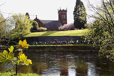
The Kilt Walk 2024 passes Renton Trinity Church along the towpath.
KIPPEROCH ROAD
This path / track takes you from near the Dalmoak House Lodge on the Renton Road right through to Cardross. You pass through farmland with livestock and steadings. It is possible to use the bus to get to the Dalmoak starting point and return by bus or train.
https://www.west-dunbarton.gov.uk/media/813289/kipperoch_road_final_file.pdf
LANGCRAIGS
Also see the Crags Circular Path above.
An easy walk if you keep to the low path. The upper path needs care. The small revine to come down through is not easy for all.
LEVENGROVE PARK Disabled accessible.
A great park with lots of interest.
LEVEN TOW PATH Disabled accessible.
This links Dumbarton and Loch Lomond. Paved all the way.
LEVEN RIVER FROM TOWN CENTRE TO DUMBARTON CASTLE – see Dumbarton Waterfront Path
LOCH HUMPHREY
A long walk up, but worth it.
LOMOND SHORES
There are two very short and easy walks here. Both disabled accessible.
Tree Loop & Meadow Walk - Go past the rectangular building through a small gate (not that obvious) and you will be under part of the TreeZone course. Follow the paths around a loop that takes you through trees, to the shore and around a small "meadow". You can reach this from Cameron House too.
Drumkinnon Bay and Drumkinnon Wood Walks - You can walk all the way from Balloch Bridge to Drumkinnon Bay and Lomond Shores. This takes you through a length of woods alongside the Leven. The actual Drumkinnon Woods though was a cluster just north of the Drumkinnon Gate housing and the overflow carpark for Lomond Shores. It survives in the form of maintained trees that encircle that carpark.
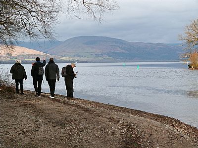
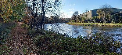
The shore as the Leven leaves Loch Lomond seen here with a photography themed walk with the Vale of Leven Trust. Febuary 2025
LUSSET GLEN Mostly disabled accessible.
This is a short walk amongst trees below the northern end of the Erskine Bridge.
OVERTOUN ESTATE Some routes are disabled accessible.
The estate is extensive. There are two main options to enter it and once there there are a few options for routes including up to the Langcraigs. Access from Milton Brae off the A82 in Milton OR from Campbell Avenue (off Garshake Avenue). It is actually possible to walk all the way along a path from close to the police station in Stirling Road, Dumbarton. Another option is the rougher path which starts off from Barnhill Road. It is in fact the same road as the Milton Brae noted above which was meant to be a loop, but the surface is rough here.
OVERTOUN HOUSE CIRCULAR ROUTE Also see the Overtoun Estate Walk above.
WDC suggest this route up from Dumbarton Central Station.
https://www.west-dunbarton.gov.uk/media/813286/overton_house_final_file.pdf
PAPPERTS WELL
This walk takes you up above Bonhill onto the hill amongst trees and heather.
WDC provide this map : https://www.west-dunbarton.gov.uk/media/813274/pappert_hill_final_file.pdf
RENTON / ALEXANDRIA- Faerie Glen and Secret Waterfall
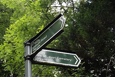
Start : Overtoun Road in Alexanria. This leads up to the cemetery gates, but turn left along the farm road (///jogging.tech.marsh) and then look for the tarred path to the left again (///tokens.amounting.moped). This takes you back down into Renton. Keep going along Hillside Road to where it joins Turnbull Avenue with a small playpark. Keep going ahead along the path and you will eventually come to a corrugated iron fence and gate. If you peer through it you will see the waterfall. (index.asp?pageid=715965). If you continue on through the tunnel below the railway you will then be back on Renton's Main Road and you will see Milburn Park diagonally across it .
This is a short walk that is often combined with other wanderings. A Vale of Leven Trust ACTIVE HUB favourite! Faerie Glen is a stretch of wooded pathway along which faerie abodes and messages have mysteriously appeared over the years. You have the option to go up to Carman Hillfort from here (index.asp?pageid=715665), but an easier alternative is to wander down to the "secret waterfall" that eminates from the burn of Poachy Glen (index.asp?pageid=715965) and runs down behind the Millburn compound. From there you can continue across Renton's Main Road into the Milburn Park in Renton and on to the Leven towpath from where you can head up or downstream. It is up to you whether you turn left / upstream or right / downstream from there.
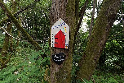
Signs of faeries everywhere
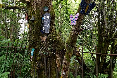
The butterfly faerie clan
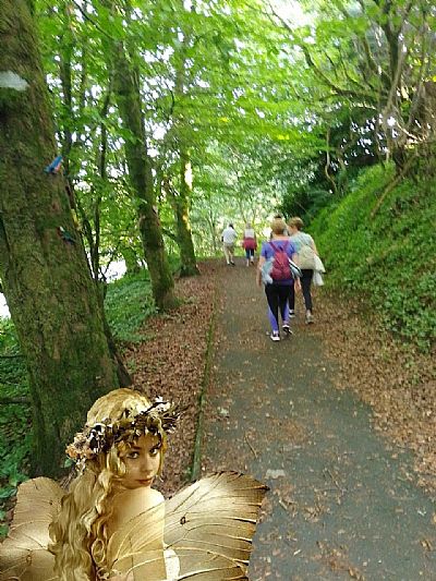
We have never actually seen any faeries here, but they must be around somewhere
 .
.
Some directional help along the way
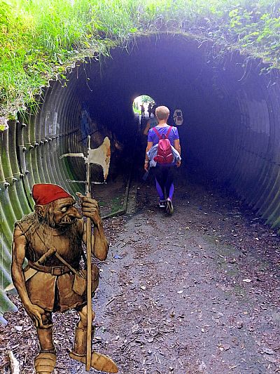
As you return via this underpass you may have the unsettling feeling of being watched, perhaps being expected to pay some sort of toll.
Also see POACHY GLEN. The waterfall is at the bottom of the glen and you can see it (through fencing) as you pass : index.asp?pageid=715965
The SALTINGS Disabled accessible.
This is a fascinating walk amongst trees under the Erskine Bridge and between the Forth and Clyde Canal and the River Clyde. The name comes from the saline water that creeps in part of this area and high tides.
The SHORE AND CASTLEHILL
WDC suggest this route along the Clyde shore taking in Dalmoak and part of the Leven.
https://www.west-dunbarton.gov.uk/media/813283/the_shore_and_castlehill_final_file.pdf
STONEYMOLLAN
This walk takes you up from Balloch across the M8 via a footbridge and up the hill. It is possible to walk all the way to Cardross from here.
https://www.plotaroute.com/route/352088 Balloch to Cardross.
STRATHLEVEN HOUSE
Also see the localised walk below. WDC though suggest this walk from Dumbarton to Strathleven House.
https://www.west-dunbarton.gov.uk/media/813212/strathleven_final_file.pdf
STRATHLEVEN WALK (Vale of Leven Industrial Estate)
This is almost all along the river bank within mature trees although it skirts the industrial area that it encircles. There is a section where you will pass through the light industry if you wish to complete the circle back to your starting point.
STUCKIE BRIDGE & LEVEN WALK
Stuckie Bridge end at Main Road Jamestown ///hydrant.tried.outnumber
End towards Bonhill Bridge ///gratuity.chopper.spouting
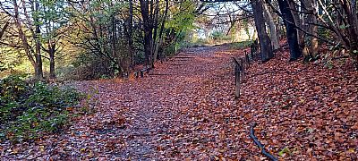
This runs across the Leven, on the east side from the Tow Path. If you live in the Bonhill or Jamestown areas, you most likely use this path quite often. But for most of us it is somewhat obscur. Even though there is a large are of open grass and planting, that remains little accessed due to subsequent housing development and the path cannot run here, what is easily accessible is pleasant as it runs amongst mature trees alongside the Leven. It must be pointed out that access from the Bonhill Bridge end involves walking alongsiide the busy road for some distance, but for those wishing a fairly substantial walk, Bonhill Bridge enabls you to do a loop circuit from it along this walk, across the Stuckie Bridge and back along the tow path on the west side of the Leven.
The walk described here runs from (or over the Stuckie Bridge) from where one needs to look for a way down towards the river. This is either immediately where the Stuckie Bridge path meets Main Road via a few houses or further down where there are shallow steps;
The path then leads for some distance downstream before leading back up to the Main Rad, in Jamestoun.
The path is mainly surfaced and for some distance runs between a high stone retaining wall and the river.
This is one of the mid-way links up to Main Road, but the path continues to the left.
The path runs opposite the tow path on the west side. Here we see Lomond Distillery premises.
This is the point at which the path over the Stuckie Bridge meets Main Road in Jamestown. From here you need to double back towards the river. This can be done almost immediiately across grass past houses and then along a path behind them OR walking towards Bonhill Bridge / Dumbarton along the road until you see shallow steps going down.
For the Stuckie Bridge and its relevance to the textile industry see index.asp?pageid=718462
RESOURCES
The Vale of Leven Trust run an ACTIVE TRAVEL HUB from premises in Mitchell Way, Alexandria. Amongst their activities are group walks in the area. These include regular Tuesday evening rambles starting at 6pm from their premises (unless otherwise indicated). Simply show up or watch for details on FaceBook. Neither the weather nor lack of daylight are usually deterrents - the walks are simply varied to suit the conditions. Join them for an easy stroll and meet other local people. See details below.
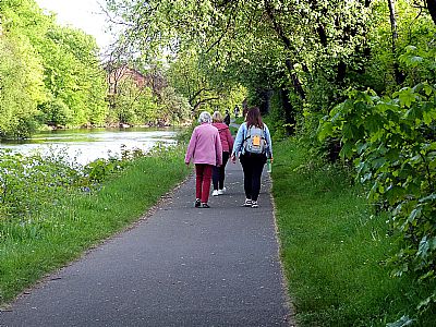
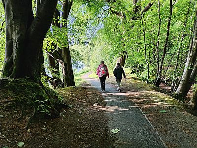
A lovely spring walk, this time along the Leven towpath, in good company one Tuesday evening in May.
ACTIVE TRAVEL HUB - Vale of Leven Trust : https://www.facebook.com/valeofleventrust/ and https://vale-of-leven-trust-active-travel-hub-sports-club.business.site/
Other links :
ALL TRAILS website :
https://www.alltrails.com/scotland/west-dunbartonshire/wildlife This has a great range of trails and useful maps.
KOMOOT website :
https://www.komoot.com/guide/68891/hiking-in-west-dunbartonshire This gives excellent suggestions around West Dunbartonshire for the more adventurous.
PLOT A ROUTE :
https://www.plotaroute.com/ This excellent website allows you or your group to plan a walk and plot it on a map. What you see are walks experienced by many others - world wide.
WALKABOUT WD : https://www.wdwalkabout.com/ Even more options.
WALK FRIENDLY WEST DUNBARTONSHIRE : https://bit.ly/WFWD-WalkingGroups
WALKHIGHLANDS :
https://www.walkhighlands.co.uk/ This gives details mainly, but not only, for the more adventurous and provides some good maps.
WEST DUNBARTONSHIRE COUNCIL :
https://www.west-dunbarton.gov.uk/leisure-parks-events/countryside-facilities-and-wildlife/countryside-and-leisure/walking/dumbarton-walks-maps/ Walks with maps.
https://www.west-dunbarton.gov.uk/roads-parking-travel/road-safety/road-safety-walking-cycling/ Policy and objectives.
https://open-walks.co.uk/Directory/West-Dunbartonshire/
WILDVALE : http:// https://www.woodlandtrust.org.uk/visiting-woods/woods/lang-craigs/
