
DUMBARTON CASTLE AND ROCK
Scheduled monument.
ACCESS : By car from Castle Road. On foot or cycle from Castle Road or along the Waterfron Path (under construction). If coming into Dumbarton by rail, Dumbarton East Station is the closest, but Dumbarton Central Station can also be used atlhough with a longer walk.
///chins.warm.runner The entrance to the castle.
Dumbarton Rock, a volcanic plug on the confluence of the River Leven where it spills into the mighty Clyde, has seen history through numerous calm and tumultuous eras from the Iron Age to Romans to Vikings and into the Medieval Period. And it still attracts many visitors today.
With such a varied and rich history it is hardly possible to do it justice on a webpage such as this. You are strongly advised to read up on the various periods in better sources. What is given here is merely a taster.
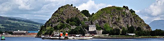
An iconic vew from across the Clyde with the Waverley paddling past.
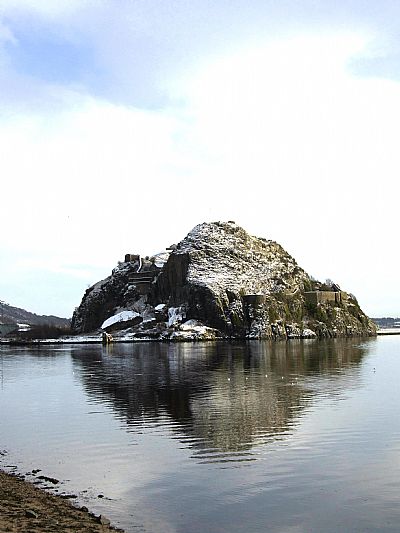
A wintry view from Levengrove Park.
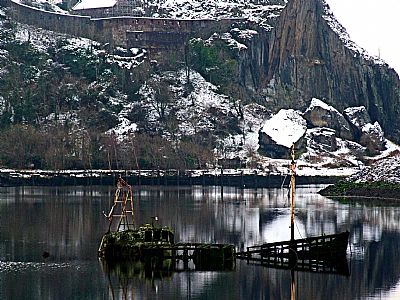
This view from across the Leven basin not only shows a wrecked boat in the foreground, but the cliff face and boulders below the French Prison.
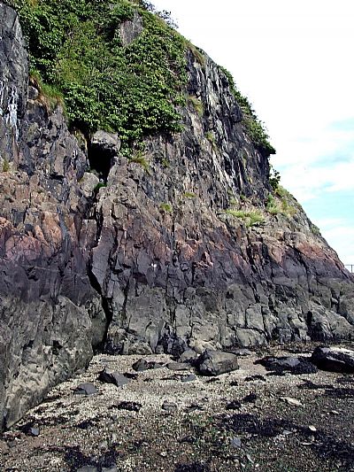
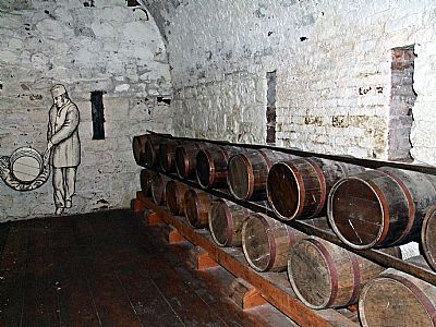
Local lore mentions a cave. This may be it.
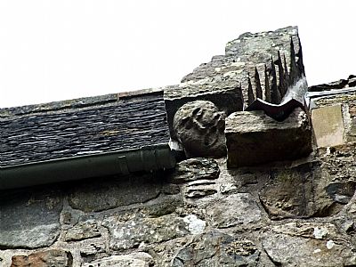
This grimacing face was probably built in as a talisman to ward off evil spirits or bad luck. It became to be known as "the False Menteith", the governor responsible for William Wallace's imprisonment.
The powder magazine at one of the highest parts of the Rock dates from 1748. It held 150 barrels of gunpowder. (Very close to it is the watch tower struck by lightning just a few years ago!).
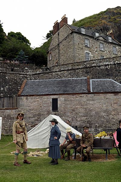
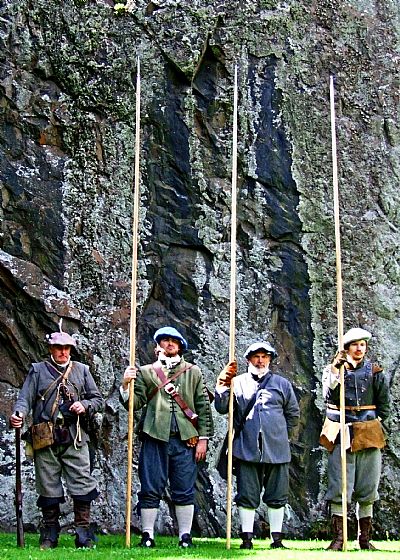
Each year there is a Rock of Ages event during which reenactments from various periods take place.
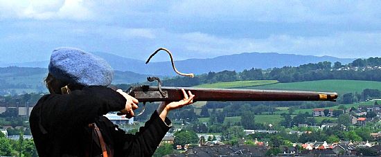
This soldier hasn't quite got the knack of it yet.
Dumbarton Castle makes the most of this strategically located geological vantage point. There are various buildings and a perimeter wall rather than a single castle, and it is imbued with a great sense of place and time. From being known as Alt Clut, ‘Rock of the Clyde’, it changed to Dun Breatann, ‘Fortress of the Britons’) from which the name Dumbarton is derived.
In the medieval period Dumbarton Castle became an important royal castle, although for refuge rather than as a residence. In 1333 King David II (Robert the Bruce's son) and his wife, Queen Joan, took refuge here after the Scottish defeat at Halidon Hill near Berwick-upon-Tweed. Mary, Queen of Scots sheltered at the castle for several months in 1548, after the Battle of Pinkie, east of Edinburgh, before moving to France. The castle was taken by Oliver Cromwell's troops in 1652, but it declined in importance after his death in 1658. New defences were built in the 18th century in response to threats posed by Jacobites. The military left in 1865, but the army made use of it again during both world wars.
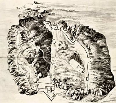
This early map of Dumbarton Castle is by Paul Sandby. You can make out a track running to the front, ie the Clyde side, from the east. This was and still is the main entrance. But look to the Leven side, ie the north side, and you can make out a feint track there as well. NLS © as ref below.
Now compare that to the sketch below by John Slezer.
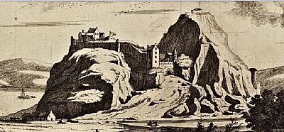
There was an entrance on the north side too. It was very steep. To the one side we see those very large boulders that broke off eons ago and which are now popular with rock climbers. The steeply sloping access road disappeared with the advent of the shipyards below. NLS © as ref below.
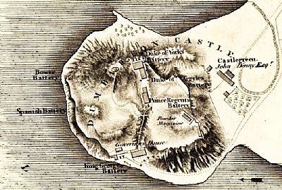
This is more like we know it today. In John Wood's map of 1818 we can see the Governor's House almost centrally overlooking the Clyde to the south. To the left of that, ie west, is the King George barry. Canon are arranged in front of them facing the Clyde. To the left, ie west, is the Spanish Battery. Also facing in that direction but a little further on is the Bower Battery. Overlooking the cliff over to the Leven and the town is the Duke of York's Battery supported behind that by the Duke of Argyle's Battery and the Prince Regent Battery. On the hilltop behind them is the Powder Magazine. Below the castle to the east is the Castlegreen with premises of John Denny Esq from where his larger shipyard would develop. (His original shipyard was at Woodyard on the west bank of the Leven).
While it has always been seen as the primary castle with the most impressive, strategic and defensivible location, it played out some of its role on the Clyde in tandem with Dunglass Castle a little upstream. Seeindex.asp?pageid=715802
But for all that, nature, not invading armies, took a swipe at it just recently in early 2017, when a lightning bolt caused severe damage to a wall turret. That was so very close to the powder magazine. If that had occurred when it was in use, just imagine what could have happened.
A visit to Dumbarton Castle is highly recommended, but you are warned that the same impediments to invaders face visitors too. Lots and lots and lots of steps.
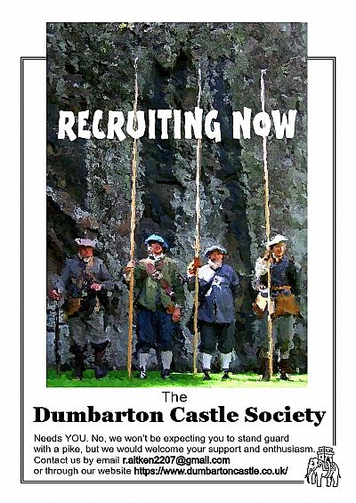
It is just not possible to do justice to the history of the castle in this brief discussion. The shop at the entrance has some books on it and most books on the history of Dumbarton cover it too. Membership of Historic Scotland will get you free access to the castle. But another way to get both access and feel more involved is to join the Dumbarton Castle Society. See the link below. The Society has a number of objectives amongst which is the promotion of the Castle within the local context and society. Its unique membership card entitles the card holder to free access to free visits to the Castle for a year including the annual Rock of Ages event.
As for its amazing geological form, that is a fascinating subject in its own right. It is the westernmost of a series of basaltic plugs and necks, extending in a broad belt for more than 25 km in an ENE direction as far as the Campsie Fells, that define the Dumbarton–Fintry volcanotectonic line [GeoGuide website].
BBC : http://www.bbc.co.uk/history/scottishhistory/darkages/trails_darkages_britons.shtml
CANMORE : https://canmore.org.uk/site/43376/dumbarton-castle
DUMBARTON CASTLE SOCIETY : https://www.dumbartoncastle.co.uk/
GEOGUIDE website : https://geoguide.scottishgeologytrust.org/p/gcr/gcr27/gcr27_dumbartonrock
HISTORIC ENVIRONMENT SCOTLAND : ROCK OF AGES EVENTS : These two-day events are held over a weekend (entrance fee £10 per day). https://www.historicenvironment.scot/visit-a-place/places/dumbarton-castle/
NATIONAL LIBRARY OF SCOTLAND : MAPS :
Dumbarton - 'Their Ma'ties Castle of Dumbritton from the West'. "Ma'ties" refers to https://maps.nls.uk/view/91169108. 'Their Majesties' Castle of Dumbarton from the West'. The monarchs in the title are William and Mary, who jointly reigned from 1689.
MS.1649 Z.03/57, Sandby, Paul (Draughtsman). https://maps.nls.uk/military/surveyor/Sandby%2C%20Paul
Mapmaker: Wood, John, ca. 1780-1847; Extrct from : Title: Plan of Dumbarton; Date: 1818 https://maps.nls.uk/view/74400020
