
TURKEY RED : 9 - MILLBURN WORKS
ACCESS : The site can be seen from the Main Road, but us now a building material depot.
The Milburn Works was within what we now call Renton and opposite the Dillichip Works. The site is now occupied by the CPR Resurfacing and Civil Engineering depot. Water came from the Poachy Burn behind it. That water source is, at least at this lower level, Millburn Burn.
It is more properly called the Millburn Pyroligneous and Liquor Works, producing dyeing liquors distilled from wood. It was established by the Turnbull family in the early 1800’s to supply Dalquhurn and Cordale. As the name suggests, it produced dyeing liquors distilled from wood. It was one of several ancillary industries to supply the core texile dye and print industries. Besides dyes, others included block-makers, copperworks, engravers and colour manufacturers. [River Leven Heritage Trail]
There is nothing left that can be definitively associated with the works. The burn was channelled through the works and is channelled today, but completely altered. The underpass and watercourse below the railway probably date from this time, but they too appear modified to suit modern conditions. The actual works site has been raised and levelled to accomodate a depot that used to be used for material such as salt grit and in recent times that has been further adapted for the material used by the current engineering company.
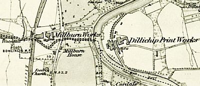
In this map we see the Millburn Works about where the CPR Resurfacing depot is now. Its water supply was from Poachy Glen. The track alongside that is visible as a double dashed line.
NLS ©
The very name Millburn indicates that there should be or have been a mill on the burn, but "mill" should be seen to mean workshop or works; in other words it is associated directly with this works. The burn passes from the works / depot down through the Millburn Park to the Leven. The Dillichip Print Works is not far away, but on the other side of the Leven.
Fresh water in this instance came from POACHY GLEN, CARMAN MUIR ABOVE RENTON The burn being by this time Millburn Burn.
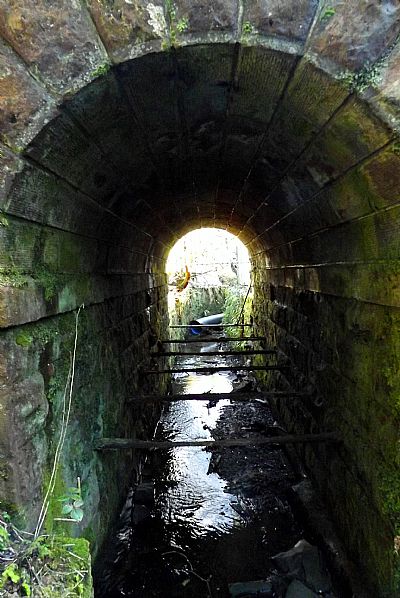
This photograph shows the burn as it passes under the railway. It has been canalised much as a lade. From here it passes under Main Road and then through the park to the Leven.
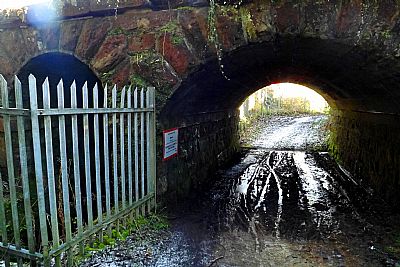
What you see here is the track alongside the works that ran below the railway and up the side of Poachy Burn.
COLOURING THE NATION - Wordpress - Project run by the University of Edinburgh and the National Museums Scotland : https://colouringthenation.wordpress.com/turkey-red-in-scotland/
NATIONAL LIBRARY OF SCOTLAND (NLS) : The maps here are reproduced with the permission of the National Library of Scotland.
1860 : Archive title : " Dumbartonshire, Sheet XVIII (includes: Bonhill; Dumbarton; Kilmar... Survey date: 1860 , Publication date: 1864". https://maps.nls.uk/view/74426619
1914 : Archive title : "Dumbartonshire Sheet nXVIII (includes: Bonhill; Cardross; Dumbart. Date revised: 1914, Publication date: 1923" : https://maps.nls.uk/view/75827346
NATIONAL MUSEUMS SCOLAND : https://blog.nms.ac.uk/2012/06/22/turkey-red-a-study-in-scarlet/
VALE OF LEVEN PROJECT website : http://www.valeofleven.org.uk/valeindustry3.html
WEST DUNBARTONSHIRE COUNCIL : Textile Industry in the Vale of Leven. https://www.west-dunbarton.gov.uk/leisure-parks-events/museums-and-galleries/collections/industry/textiles-and-mills/ and The River Leven Heritage Trail . https://www.west-dunbarton.gov.uk/media/2619077/vale_of_leven.pdf
WIKIPEDIA : https://en.wikipedia.org/wiki/Turkey_red
