
TURKEY RED : 11 - CORDALE PRINT WORKS, Renton
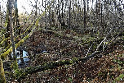
ACCESS : It is easy to get to get to the perimeter, but the site itself is very overgrown and has rough ground from the demolition with some pits. If you do venture across it, be very aware of holes partially obscured by vegetation and debris. While the site is considered "contaminated", unless it is disturbed, it should not pose a threat.
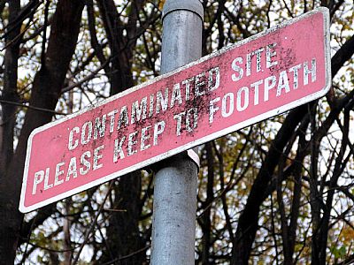
Warnings about the contamination of the site.
///tonal.memory.stated and ///published.emulated.loyal outgoing lades
///published.emulated.loyal remaining tower
Also see CORDALE
The Cordale Print Works were situated within the tight meandering curve of the River Leven. to get to it, go to either end of Cordale Avenue where it is in sight of the river and walk along the towpath. While the tarred surface of the towpath takes a short cut past this promontory, a muddy track can take you all the way around.
All the buildings were demolished years ago,with one exception, the electrical building which served it, but which was outwith the works. Unlike the Dalquhurn Works a short distance downstream, this one was pretty much constrained by the form of the river.
The works appear to have covered part of Cordale Point too. At least one large, but shallow rectangular pit or pond can still be made out although the site is very overgrown. (Not to be confused with the drying yard at the end of the point).
The demolition squad did a thorough job. There is very little in the way of remnants of buildings. So often building material is recovered for reuse or as fill elsewhere. The lades, sometimes covered, can be seen, but have suffered collapse and misuse from dumping.
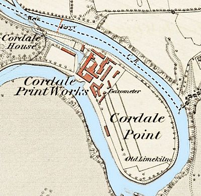
In this map from 1860 has been overcoloured for clarity. The buildings are in red and the river and lade blue. You can make out the weir that guided some of the Leven's main flow down into the lade which passed through the works and out on the opposite side of Cordale Point which was how the curve of the river was envisaged. There was also a ferry up near the weir. At the lower end of the site there were open fields in which you can see linear structures for drying on. There is also reference to a lime kiln. It is unknown whether this was to do with the works or not, NLS ©
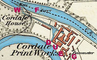
This is an extract from the same map above. We are not told very much about what is where, but we do see some features. The weir that guides flow from the Leven into the lade is at W. Just downstream from that was the ferry crossing. The lade goes through the works and splits. One goes right through and exits downstream at D. The other exits a little upstream at U. The gasometer is at G. There is an offset in the buildings which provides a suitable entrance at E. This is as it was in 1860.
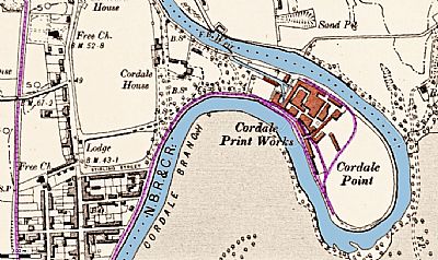
As the premises were developed a railway was introduced, here shown highlighted in purple. The line within the works looped around the towpath and linked with the main line from Dumbarton to Balloch. NBR & CR refers to the Northern British Railway and the Caledonian Railway.
Also see TEXTILE WORKS LADES and RAILWAYS which discusses the railways at the upper end of the Vale of Leven. These were two separate companies which cooperated along this stretch.
Gasometer : Coal gas could not be produced on demand, so had to be stored to meet the demand at peak times. The huge storage tanks were known as gasometers - pronounced with the stress on the 'om' (like in 'Tom') - and were located at gasworks. They really were massive, dwarfing nearby houses - and anyone born after 1960 would be forgiven for thinking that aliens had landed! [1900s website]
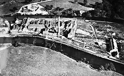
An oblique aerial photograph taken facing north-east. If you compare it to the map above you can make our some of the changes over time. Britain from Above By the time that this photo was taken in 1927 much had changed. There is no sign of the gasometer and the electrical tower building is obscured by other buildings, but there is a tall chimney and various other buildings have been added. A row of lower buildings lines the side facing the river to the south and even along both that side and to the east of what was probably the drying yard. NCAP as per link below ©
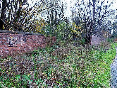
The offset walls were each side of the main entrance. If you look at the map above, you will see how a railway line was squeezed in along the same route up to this point, but it passed here and entered the site further along. Persumably by this time the towpath was little used as such and all cartage was by road and rail.
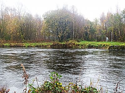
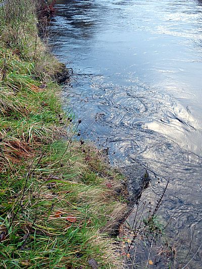
That is the inflow to the Cordale works as seen from the opposite bank. "W" on the map. The weir that guided water into the lade is hardly visible on this ocassion. It depends on the water level to see it, but you can see the disturbance to the river flow by the remnants of rocks below the surface.
There is a route along the tow path that still circuits the meander of the river. The towpath is tarred for all of its length - except for this loop (and that at Dalquhirn), but you can walk right around it if you don't mind a rough and often muddy track. The cycle / walk path takes a short cut past this site. From both upstream and downstream. you will first come to a modern workshop / storage compound (opposite ends of the same place). Prominent next to it on the southern / downstream side is a squat brick tower. Judging from the map this was either outwith the works or right on the side - the right / east side of the works. Look at the map again. It appears that this modern compound is situated in or next to the clear area which was perhaps a bleach field.
Coming through the works was a lade which appears to go underground for some distance as a pipe. It splits in two as can be seen in the maps above.
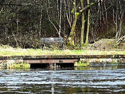
This is the larger of the two outflows.
If you peer over the edge of the path you will see this - the remains of a sluice control.. "D" on the map. This is the one just a few paces downstream of the othe one.
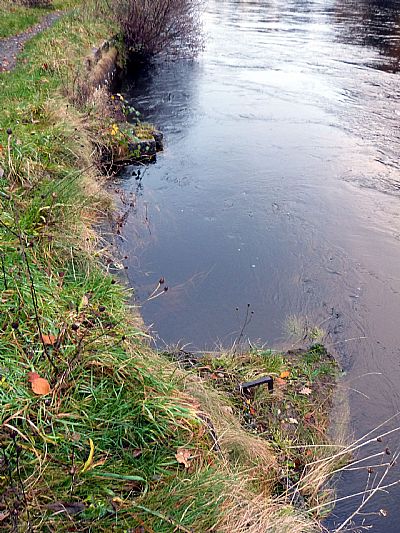
and the other(upstream) looks almost identical. "U" on the map.
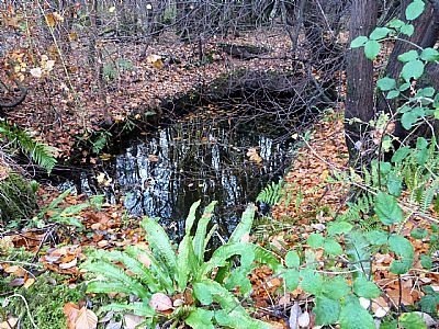
A section of lade exits from a vaulted covered section. This view is from just off the towpath. It is taken while standing on a small "bridge" within the site. The lade then goes below that and the towpath before flowing out into the Leven.
Sections of the lades are partially covered over with vaulted structures topped with slabs.
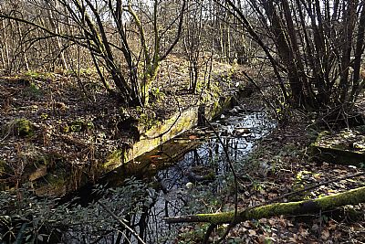
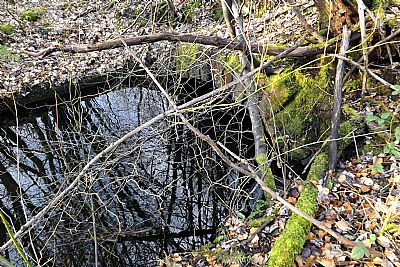
A remnant of the wider lade before it reached its outflow.
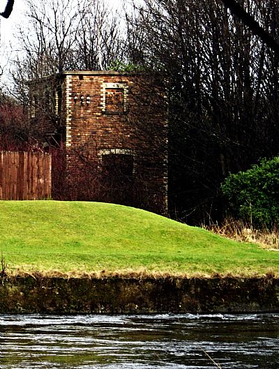
The electrical building : This brick tower is located close by the current compound used by some small commercial enterprises. It is thought that the works themselves stretched out to the right (east) of this tower, but although it evidently served it, did not actually include it.
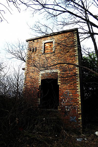
The approach to the tower.
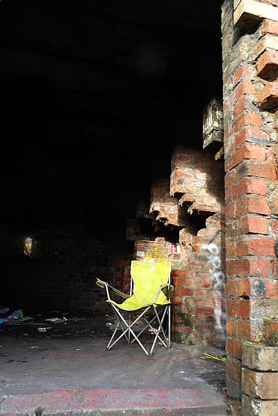
The tower appears to have housed some heavy electrical gear. It has several corbelled brick piers internally on one side with a bottom channel. This impression of its purpose is supported by Lairich Rig writing on Geograph.org and the remnants of isolation connectors on the west wall. Someone has decided to relax here.
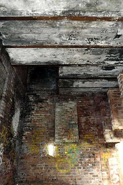
The upper floor is concrete supported by universal steel joists. The hole in the slab is for the stairs or ladder.
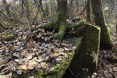
Although several buildings can be made out there is almost nothing left of them. This is a tree that has crept into the side of a slab.
This is a pit that is very overgrown and silted up.
BRITAIN FROM ABOVE : SPW019590 SCOTLAND (1927). Cordale Works U.T.R. [United Turkey Red] Co. Ltd., Cordale Point, Vale of Leven. An oblique aerial photograph taken facing north-east. https://www.britainfromabove.org.uk/image/SPW019590
CANMORE : https://canmore.org.uk/site/312252/vale-of-leven-renton-cordale-point-cordale-print-works
GEOGRAPH.ORG : https://www.geograph.org.uk/photo/2799434; https://www.geograph.org.uk/photo/3363339 and https://www.geograph.org.uk/photo/2799440
NATIONAL LIBRARY OF SCOTLAND (NLS) : The maps here are reproduced with the permission of the National Library of Scotland. Dumbartonshire, Sheet XVIII
Survey date: 1860, Publication date: 1864 https://maps.nls.uk/view/228777145
"Dumbartonshire Sheet nXVIII (includes: Bonhill; Cardross; Dumbart. Date revised: 1914, Publication date: 1923" : https://maps.nls.uk/view/75827346
Dumbartonshire Sheet XVIII.SW
Date revised: 1896, Date Published: 1899 https://maps.nls.uk/view/75498354
Ordnance Survey of Ireland Scotland, England and Wales : 1888-1915. https://maps.nls.uk/geo/explore/#zoom=16.6&lat=55.98640&lon=-4.57509&layers=6&b=ESRIWorld&o=100
NATIONAL MUSEUMS SCOLAND : https://blog.nms.ac.uk/2012/06/22/turkey-red-a-study-in-scarlet/
VALE OF LEVEN PROJECT website : http://www.valeofleven.org.uk/levenbridges.html
and http://www.valeofleven.org.uk/valeindustry3.html
WEST DUNBARTONSHIRE COUNCIL : Textile Industry in the Vale of Leven. https://www.west-dunbarton.gov.uk/leisure-parks-events/museums-and-galleries/collections/industry/textiles-and-mills/ and River Leven Heritage Trail : https://www.west-dunbarton.gov.uk/media/2619077/vale_of_leven.pdf
WIKIPEDIA : https://en.wikipedia.org/wiki/Turkey_red
1900s website : https://www.1900s.org.uk/1900s-1960s-gasometers.htm
