
LEVENGROVE PARK, Clydeshore Road, Veir Terrace, Woodyard Road, Dumbarton.
ACCESS : Easy access for all. Those with mobility limitations can be driven right to the Pavilion tea room from the service road off Woodyard Road.
Kirktonhill Conservation Area.
Also see the adjoining POSTIE'S PARK : POSTIES PARK, DUMBARTON where sports and other events such as fireworks and piping championships are held.
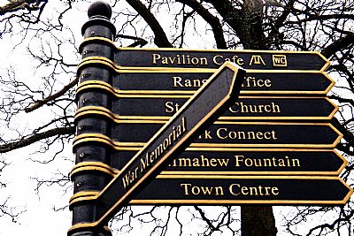
And PAVILION AND PLAY AREA : LEVENGROVE PARK : PAVILION CAFE & PLAY AREA ; ST SERF'S CHURCH index.asp?pageid=716577 ; SHIERS WELL index.asp?pageid=717290 and WAR MEMORIALS index.asp?pageid=715770.
https://w3w.co/raced.margin.phones Pergola at old bandstand site.
///darker.fell.deed Fountain.
For other features see the separate descriptions on the sub-tabs.
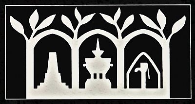
The logo of the park. Besides the plants, 4 things are represented here. Can you work out what each is?
Here are some clues.
Levengrove Park, together with the Posties Park sports fields, is located on a dramatic stretch of land where the River Leven meets the estuary of the River Clyde. It has impressive views across the Clyde to Renfrewshire and to the adjacent town and Dumbarton Rock on the other side of the Leven.
This Victorian park has recently undergone a £3.8 million transformation, thanks to investment from West Dunbartonshire Council and funding from the Heritage Lottery Fund.
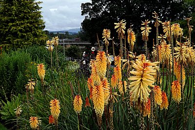
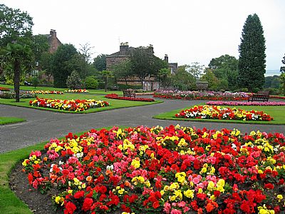
The warm colours of red-hot-pokers in a view looking towards Dumbarton Bridge.
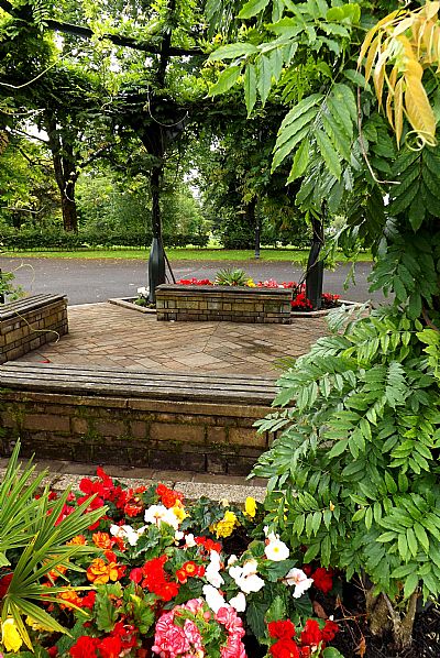
For a moment you feel as though you are entering a tropical jungle (at least in summer). This is a relatively new domed structure added as part of the improvements to the park on the site of the former bandstand. Unsurprisingly this is usually referred to as the "former bandstand", but it really should be "the gazebo pergola". There are benches within it to enjoy its lush setting.
Besides the mature trees and areas of formal garden there are other things to see. These include ST SERF'S CHURCH index.asp?pageid=716577, with links to Robert the Bruce, SHIERS WELL index.asp?pageid=717290, Kilmahew Fountain and the Cenotaph index.asp?pageid=717385. There are interesting information boards at strategic places. The new pavilion is the home of the popular Pavillion Café, complete with outside seating, and an adjacent upgraded play area for children.
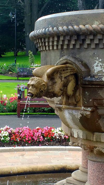
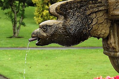
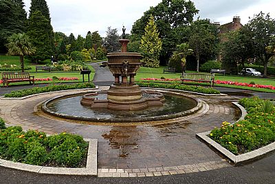
The fountain and surrounding flower beds.
The park also boasts a training suite with multiple opportunities for learning, a formal garden with extensive spring and summer bedding displays, an Arboretum, open grassland, and recreation facilities which include a basketball court.
Levengrove is home to a number of events throughout the year including a popular summer Gala Day, the annual Scottish Pipe Band Championships in July and a fireworks display each November.
The name of the park is apparently quite obvious. It is a grove next to the Leven. But there is more to it. There had been a house nearby of that name built by the Dixon family who owned the glassworks. See LEVENFORD HOUSE, HELENSLEE ROAD, DUMBARTON
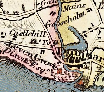
This is a small extract from a large map by John Wood and dated 1818. It shows all of the area around Dumbarton with main features and landowners noted. The River Leven, the Castle and Levengrove House have been overcoloured for clarity. While it shows a great deal, it is not that accurate. Levengrove here is the estate of "Dixon Esq" owner of the glassworks across the river. It appears that the Levengrove estate covers all of the area on the west side of the river up to and including what was to become Levengrove Park and the boatyards. NLS © as ref below.
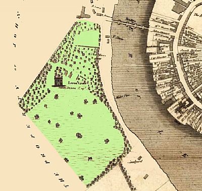
This is another John Wood map and also dates from 1818. This one though appears to be better surveyed than the one above and is in more detail. The estate is quite spacious, but does not reach as far as the Clyde. This house is again indicated by a typical icon by the cartographer. This is Leven Grove with the name of John Dixon Esq. Levenford would only be built to its immediate south some time later. Dixon owned several other smaller properties in the area too. Note the relationship to Dumbarton Bridge. This area subsequently became tenement housing bound by West Bridgend and Clydeshore Roads. This map also notes that the area to the immediate south is owned by Graham Esq of Gartmore (who also owned Ardoch). NLS © as ref below.
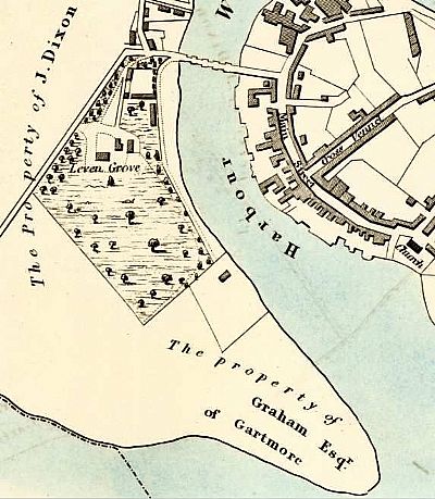
By 1832 the area looks much the same, but with more estate buildings. The estate of "Levengrove" still only applies to the area north of the park. NLS © as ref below.
There have been archaeological digs within Levengrove Park in the past and another is expected in 2025. It is expected that the remains of a building that could be a house are somewhere within the park. From the maps above, it is unlikely that this, if found, would be a main house, but could be a secondary building or one from the era of the heyday of the boatyard on the Leven.
It is also rumoured that there are graves within the park. If so one would expect them to be connected to St Serf's Church, but they need not be quite that old. The local residents may have interred their dead here. There is another theory. During the period when Catholics were barred from practicing within Dumbarton, it is thought that some used St Serf's Church. This was already long a ruin, but nevertheless a sacred place that could be utilised. Perhaps they buried their dead nearby - in secret. Also see ST SERF'S CHURCH, levengrove park, dumbarton
THE TRAINING CENTRE :
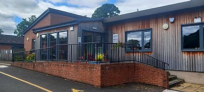
The Training suite was officially opened in 2019 as part of a £3.7million investment in the park. This included the Pavilion Cafe which is currently (2024) awaiting new operators. These venues are being run as a social enterprise by West Dunbartonshire Health and Social Partnership’s (WDHSCP) Work Connect service.
The approach to the training centre.
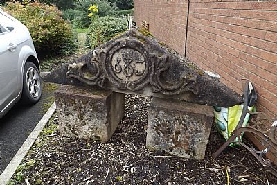
Within the carpark of the Training Centre is this carved stone pediment. Thanks to "PR" we learn that it was recovered from the old Crosslet House building prior to redevelopment. It sits here until it can either be introduced into the new grounds of the new premises in a suitable way (transport being an issue) or given a better setting here.
CANMORE : https://canmore.org.uk/site/196821/dumbarton-levengrove-park
HISTORIC ENVIRONMENT SCOTLAND website : http://portal.historicenvironment.scot/designation/LB24904
NATIONAL LIBRARY OF SCOTLAND : MAPS : Mapmaker: Wood, John, ca. 1780-1847. Title: Map of Dumbarton Shire from actual survey ... / by John Wood ... T. Clerk sculpt...Date: 1818. https://maps.nls.uk/view/216442554
Mapmaker: Wood, John, ca. 1780-1847. Title: Plan of Dumbarton. Date: 1818.https://maps.nls.uk/view/74400020
Mapmaker: Great Britain. Parliament. House of Commons.
Title: Dumbarton. Date: 1832. https://maps.nls.uk/view/74491839
WEST DUNBARTONSHIRE COUNCIL : https://www.west-dunbarton.gov.uk/leisure-parks-events/parks-and-greenspaces/parks/levengrove-park/hlf-project/ and https://www.west-dunbarton.gov.uk/leisure-parks-events/parks-and-greenspaces/parks/levengrove-park/history-of-levengrove-park/
