
CARMAN MUIR
ACCESS : This can be easily reached from Renton along Cardross Road or from Cardross on the Carman Road. Ideally it should be walked to and across. There is an excellent route up from Renton which is described under CRAIGANDRO WOOD, HUNDRED STEPS AND DROVERS ROAD.
Also see CARMAN CATTLE FAIR, CARMAN MUIR and CARMAN HILLFORT, CARMAN MUIR
///hovered.shred.thorax and ///engulfing.strikers.cakewalk and ///romantics.feuds.airless and ///jogged.bride.searcher - possible parking. (While parking is possible at the gates to the road up to the hillfort, it is essential to retain a clear route as this is used by the SEPA, the farmer and others. It is a private road used several times a day).
Recommended walk - in any direction.
OS maps point out the Carman Hillfort on what is the "citadel" and that in turn is a part of Carman Hill or Mount Mallow. It depends on your interpretation. Immediately to the north of Carman Hill is Milburn Muir, then Overtoun Muir and quickly after that is Bromley Muir. Topography is less discerning. The muir just flows on. The lines and edges are man-made. Perhaps cartographers just had to label all the bits and referred to locals to clarify. In historical and even prehistorical senses, Carman Muir is that gently rolling expanse of muirland from Carman Hill southwards all the way to the confluence of the Clyde and Leven. And wedged between Clyde and Leven. It is in this geographical context the the historical context is overlaid.
As urban and suburban environment overwhelmed much of that expanse, it has shrunk somewhat, but still retains sufficient for us to experience it in its rural splendour. And that is diverse.
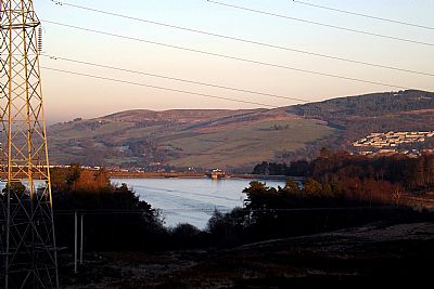
Looking back at the reservoir. Even the pylons marching by don't spoil that view.
There are fields grazed by sheep and cattle. There is grass and gorse and heather and woods and some almost secretive plants that only appear on rare occasions. There is a reservoir with fish. Birds of prey. Deer. And many other creatures if you are observant. it is a special place for those interested in moths. If you know how to look you will find the hillfort, burial mounds, hut rings, cornstone lime workings, bomb craters, starfish decoy sites and associated bunkers, the site of the stock fairs and the road that served that.
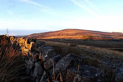
Looking across from near the trig point northwards towards Carman Hill.
Most of Carman Muir is designated as Local Nature Conservation Site within the Local Development Plan. Much is farmland. With Scotland's Right to Roam philosophy we are fortunate to be able to wander across it much as we wish. Of course this comes with responsiblity. Unfortunately we find it much misused through littering and bulk dumping and even fires.
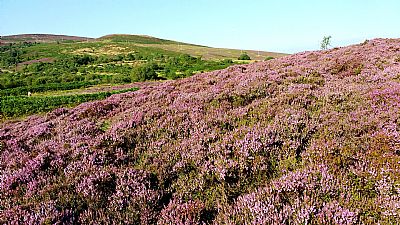
The heather varies in richness of colour from year to year. 2020 was a good year. In the distance you can see Carman Hill.
Having said that though, Carman Muir is there to be enjoyed. Besides fishing in the reservoir there is a scale model runway and you will frequently find scaled model aeroplanes buzzing overhead. ///home.envoy.blotting - parking with permission only.
It is advisable to keep to well defined footpaths. Carman Hill has great views, but so too does the high point at the trig point (Triangulation Pillar) which is located on high ground south of the reservoir and overlooking Dumbarton.
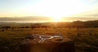
Looking south from the trig point. The Clyde shimmers in the distance. ///coil.register.frown
You will find several aspects of it such as CARMAN HILL FORT index.asp?pageid=715665 and CRAIGANDRO WOOD, HUNDRED STEPS AND DROVERS ROAD index.asp?pageid=715967 discussed separately.
OS MAPS : https://osmaps.ordnancesurvey.co.uk/55.97482,-4.59724,13
WIKIPEDIA : Nature of Carman Muir : https://commons.wikimedia.org/wiki/Category:Nature_of_Carman_Muir
There always seem to be some who are intent on spoling it. Also see LITTER PICKING AND FLY TIPPIN : index.asp?pageid=721880
