GARTOCHARN, village on Old Military Road (A811), within the Kilmaronock district.
ACCESS : Easy access by car and bus.
///twisty.noise.sofas ///eradicate.gradually.stray
Gartocharn is a village just east of Balloch and the southern of Loch Lomond on the Old Military Road otherwise known as the A811 and within the Kilmaronock district. But don't let the aparent feeling that this is just a drive through village fool you. This is a vibrant community and and the epicentre of much more. There is usually something going on at the community centre.
To see Gartocharn in its true perspective, you need to consider the wider parish district of Kilmaronock too. KILMARONOCK
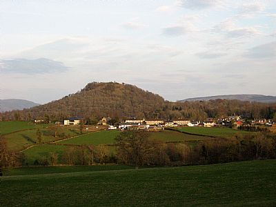
Close by are ROSS PRIORY, near Loch Lomond, DUNCRYNE HILL, NEAR GARTOCHARN and the RSPB LOCH LOMOND BIRD RESERVE.
For many years it was the home of Tom Weir MBE, remowned for his writing and tv documentaries on hillwalking, and his wife Rona, who for many years was the primary school headteacher.
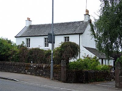
This house was the United Free Church manse and is C listed.
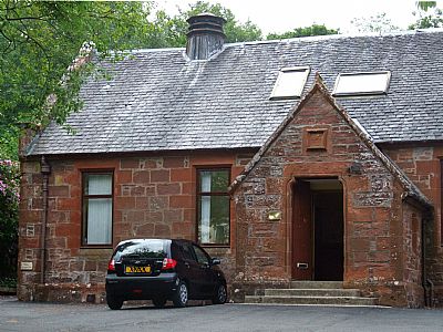
This building in School Road is now holiday accommodation.
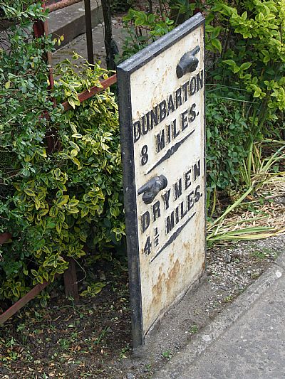

There is a walk from the Community Centre through to the shore of Loch Lomond. You may meet some of the locals along the way.
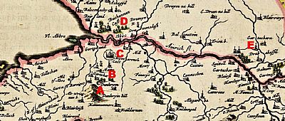
This is perhaps the earliest map we have of this area. It is by Timothy Pont, (about 1560-1614). While he achieved extraordinary accuracy for the time with just basic equipment, the location of some features need to questioned. Add to that the use of spellings not easily recognised by us today. He also uses very standardised icons. Almost all buildings look like little churches. NLS © as ref below.
To the left / west is Loch Lmond. The boundary with Stirling appears to the top right hand corner, not quite where it is today. The river running in to the Loch from the east is labelled "Ainrick fl". We know it today as the Endrick Water.
A = Dunkryin Hill ie Duncryne Hill. Below it is the word Dunkrym, apparently a farm name.; B = Gartohar which we can take as Gartocharn village; C = Kymaronock Caft ie Kilmaronock Castle; D = Buchanan Caft (Castle) and E = Gartocharn, evidently a farm of the same name. Is this simply an error?
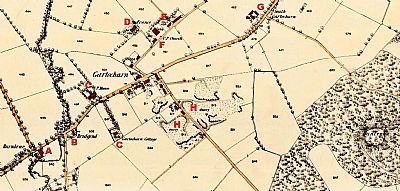
This map dates from 1859. There are by now numerous houses and other buildings. Duncryne Hill, the dumpling, is to the right. The main road, the Military Road. now known as the Old Military Road or A811 runs through from west to east in the direction of Stirling. NLS © as ref below.
A = Burnbrae; B = Bridgend; C = Gartocharn Cottage; D = France; E = School; F = U.P. Church; H x 2 = Quarries.
GARTOCHARN.ORG village website : https://gartocharn.org/
KILMARONOCK CUMMUNITY COUNCIL website : https://kilmaronockcc.org/
LOCH LOMOND AND THE TROSSACHS NATIONAL PARK website : https://www.lochlomond-trossachs.org/discover-the-park/towns-villages/drymen-gartocharn/#:~:text=Gartocharn%20can%20also%20boast%20of%20impressive%20historical%20remains,Lake%20in%201810%20and%20Rob%20Roy%20in%201871.
NATIONAL LIBRARY OF SCOTLAND : MAPS : Mapmaker: Pont, Timothy, 1560?-1614?; Blaeu, Joan, 1596-1673. Title: Levinia Vicecomitatus, [or],The Province of Lennox called the Shyre of Dun-Britt... Date: 1654 https://maps.nls.uk/view/00000438#zoom=6&lat=3621&lon=4051&layers=BT
and Dumbartonshire XIV.11 (Kilmaronock). Survey date: 1859, Publication date: 1862. https://maps.nls.uk/view/74941066
WIKIPEDIA : https://en.wikipedia.org/wiki/Gartocharn

