COLLEGE BOW, Municipal Buildings grounds, corner Church Street and Station Road, Dumbarton.
ACCESS : Easy.
Listed B.
This simple stone pointed arch is the sole remnant recovered from the tower of the demolished St Mary's Collegiate Church which stood nearby.
It dates from about 1453. It was removed in 1850 when Dumbarton Central Station was built and erected in Church Street, and then moved again to its present site next to the Municipal Buildings in 1907. During this period it served first as a gateway to the Old Burgh Academy and then to St Augustine's.
Quite a varied life for a simple stone arch!
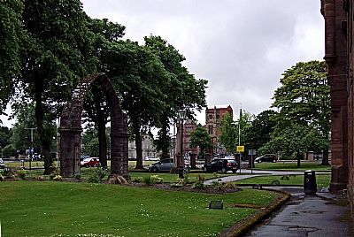
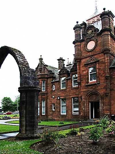
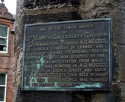
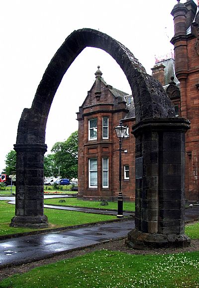
Besides the parish church in Dumbarton, there was the Collegiate establishment founded by Isabella, Duchess of Lennox, in 1450. After many years, the Collegiate Church, which was situated at the end of what is now known as the Broadmeadow, fell into disuse after the Reformation, and when the encroachments of the Leven had made it useless for any purpose, the stones were taken to help the embankment raised against the force of the current. On 22nd April, 1628, the Town Council resolved that the holes in the Kirk Vennel should be filled up with earth and stones taken from the College. An arched gateway remained standing at the Bankend till 1850, when the railway operations at that point caused the removal of this memorial of the structure reared in pious rememberance by the Duchess Isabella. [Irving p 149].
A collegiate church is a church where the daily office of worship is maintained by a college of canons, a non-monastic or "secular" community of clergy, organised as a self-governing corporate body, headed by a dignitary – in this case the Countess. College Street therefore refers to the Collegiate Church - not an educational establishment.
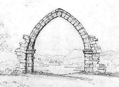
This old sketch (date unknown) shows the arch remaning, but with the surrounding buildings removed. Of note is the lagoon (now filled in and forming the Meadow Industrial Area) behind it and houses in the distance.
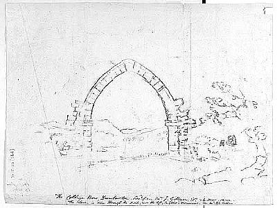
A similar sketch has notes but these are indecipherable.
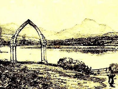
This sketch shows the arch overlooking the lagoon. Ben Lomond in the distance. Quite picturesque, at least at high tide. You can just make out the River Leven as a narrow strip beyond a spit of land. A few houses stand roughly where Renton would develop. This is solid land. The lagoon being not only wet, but marshy. This is the reason that the railway ran here and the reason for the arch being taken down.
These sketches have been gleaned from Google Images with little to no further details.
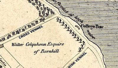
In this map of 1818 by John Wood we see the arch located overlooking the tidal basin. Cross Vennel became College Street and Kirk Vennel became Church Street. The basin was infilled. (Compare this to that below. North should be straight up, but is about 40 degrees to the right). NLS ©
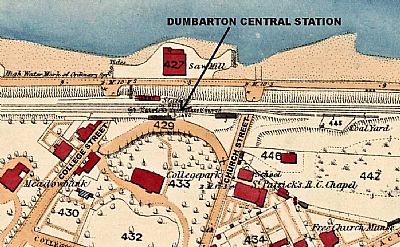
This map dates from 1860. The location of the bow shown in the previous map is unrecognisable. In its place is a saw mill. We are told in various sources that Dumbarton Central Station was built where St Mary's ie the collegiate church stood. But, here we see a note that "St Patrick's Collegiate Church" was where the station now stands. Either the cartographer got the name wrong or St Patricks superceded St Mary's roughly on the same site. NLS ©
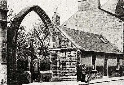
This photo is dated 1895. We need to be careful how we interpret it. We know that the arch was rebuilt at one time in Church Street and this is apparently how it then looked. Judging from the lack of masonry jointing / quoining and clean surfaces of the upper parts, it was most likely originally intended as a gateway arch much like this and this enabled it to stand while all around it crumbled.
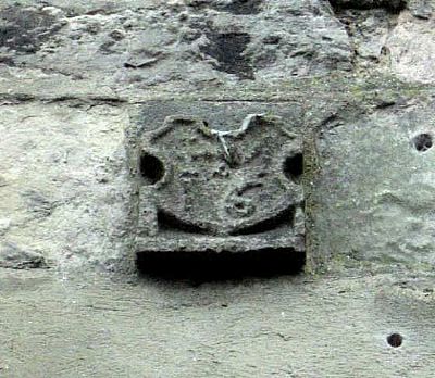
The following is highly speculative. At the rear of the tenenments with shops below in the High Street is the stone crest shown below. If so much trouble was taken to save the "College Bow", were any other features recovered too? Churches generally had quite ornate stonework. Was this also part of the Collegiate Church?
At the time of the Reformation the number of Catholics shrunk drastically.. Some would say they were eradicated. Yet over time a few met within the ruins of the Old Parish Church of Cardross which stands in the Levengrove policies. (St Patricks RC Church website). Eventually the number of Catholics had recovered and they were able to meet once a fortnight in a store in Kane's Pend in College Street where Holy Mass was celebrated secretly. College Street is of course the later name of Cross Vennel; a name still found near Dumbarton Central Station. College Street was named for the Collegiate Church of St. Mary established at its northern end but left to decay and pillaged after the Reformation. Did the 19th century builders recognise this stone as something special or simply build it in on casual impulse? As we have seen some stone of St Mary’s was removed in 1850 of which the College Bow bears tesimony. Was this crest from this time?
[## An aternative suggestion for the origin of this stone plaque is that it was once on a stone cross or some similar feature marking the town's market cross which was at the junction of the High Street and the cross vennel (a little to the west of the Artizans Centre ## ].
For more on this consideration, the historical context and what this crest signifies see the ARTICLES at the end : HISTORY - Local Mysteries. index.asp?pageid=715697
ALAMY : This is a very interesting detailed sketch of the bow standing alone on the shore of the Leven lagoon. https://www.alamy.com/stock-photo-ancient-records-of-dumbarton-and-glasgow-illustrations-etc-image-taken-132366668.html?imageid=29491A29-F15C-4241-BE23-8C68C5D4519E&p=379505&pn=1&searchId=8e9d00a520e3c5485100204204c45672&searchtype=0
BRITISH LISTED BUILDINGS with map : https://britishlistedbuildings.co.uk/200360983-college-bow-municipal-buildings-church-street-dumbarton-dumbarton#.X95oo3pxdPY
CANMORE : http://portal.historicenvironment.scot/designation/LB24876
IRVING, JOSPEPH. The Book of Dumbartonshire. Volume II Parishes. W. and A . K. Johnston. Edinburgh and London. 1879.
NATIONAL LIBRARY OF SCOTLAND : MAPS : Mapmaker: Wood, John, ca. 1780-1847 Title: Plan of Dumbarton. Date: 1818. https://maps.nls.uk/view/74400020
and Dumbartonshire XXII.6 (with extension XXII.7) (Dumbarton)
Survey date: 1860 to 1861. https://maps.nls.uk/view/74941048
SCOTTISH POST OFFICE DIRECTORY (Through the NLS) : https://digital.nls.uk/directories/browse/archive/74601784
ST PATRICK'S R C CHURCH website : http://www.stpatricksdumbarton.org.uk/images/After%20Reformation%20before%201830.pdf

