
OVERTOUN ESTATE, above Dumbarton
ACCESS : By road - From Milton Brae. Turn off the A82 in Milton next to Logspan. Park at Overtoun House - either at the house or on the approach drive which has an ample carpark. Or park in Campbell Avenue at the upper end of Garshake - look for the gates. There is a pleasant long walk up to Overtoun House on a tar path/road. From each of these there are also rougher tracks that provide great walks, but which need care.
WARNING : The footpaths vary in condition. Over the years some have become very overgrown; others are slippery and several have become oevrgrown or even collapsed becoming impassable. But keep the better paths and you should be fine. Children and pets require full supervision.
///removal.corporate.became Gates off Milton Brae, up from Milton.
///bibs.dizzy.carriage Gates off Campbell Avenue. (Reached from Garshake Road).
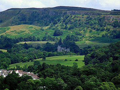
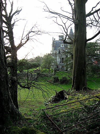
The main attraction of the estate is naturally OVERTOUN HOUSE itself But there are great walks within the extensive grounds and access from here to the Langcraigs.
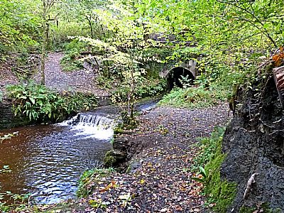
Besides the main house and the Gate Lodge off Stirling Road, there are other interesting features. Foremost of these is the main bridge, described separately and also the remains of a small hydro-electric plant.
The hydro-electric plant
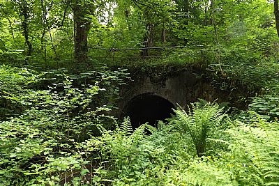
This plant looks today as little more than inconspicuous ruins and hard to find. But it is there. Canmore tells us : There was formerly a hydro-electric scheme based around the 'Lily Pond' which was formed by impounding the Overtoun Burn to the N of Overtoun Castle (NS47NW 30.00) and E of the Garshake Reservoir (NS47NW 38). The hydro-electric turbine was located in the small building situated in the deep glen formed by the Overtoun Burn and Gruggies Burn downstream from the house. This building has long since been vandalised and the turbine thrown further down into the glen. It was formerly white-tiled internally and 'packed with glass tubing' which may have formed part of a battery storage sustem or been connected with the use of the house as a maternity hospital.
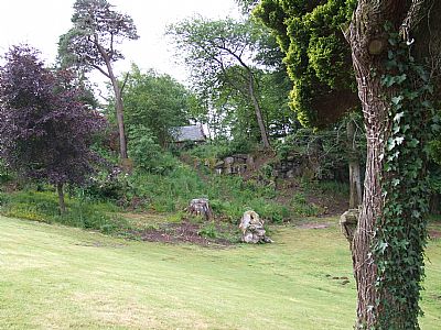
Our warning about the dire state of some paths applies here. In fact it is now impossible to get to the hydro electric plant ruins. The access path has completely collapsed into the burn. Even in living memory the ruins were little more than a few brick walls. It was located just downstream from the Spardie Linn, one of the more impressive cascades, a small waterfall.
Lairich Rig has researched it further and tells us The turbine house itself was divided into two compartments, one containing the turbines, the dynamos, and their associated equipment, and the other an accumulator. There were two turbines, each of 12 horsepower, mounted on separate base plates. Each turbine was coupled directly to the shaft that it drove. Each dynamo could supply 120 lamps of 16 candlepower each, or twice as many 8 candlepower lamps. This must have been quite impressive back in its day.
The Lily Pond which enabled greater consitency of water flow is no more. It would have flooded part of this burn and had a footpath around it with footbridges linking across.
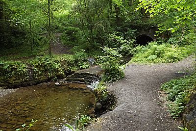
Walks in the grounds
The grounds that we can enjoy today are quite impressive. Large mature trees and a burn within a gorge. The original extent of the estate can be seen though by the two lodges way down on Stirling Street (A82). OVERTOUN ESTATE : WEST LODGE and OVERTOUN ESTATE : EAST LODGE That was one of the original entrances. Today a great deal is taken up by the police station and housing, but there is still much to enjoy.
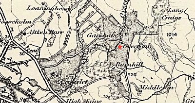
This map of 1861 shows the house as being of a moderate size (at the star) in spite of revisions to the map into the next century. To the right you can make out the cliffs of the Langcraigs while to the left are other properties whose names are familiar such as Garshake and Crosslet. NLS © as ref below.
A view from Camel's Hump.
A view across lawn towards an outbuilding.
One of the smaller bridges lower down.
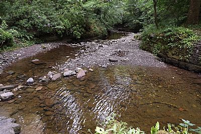
Overtoun Burn
Overtoun Burn
It looks like this after rain. Beyond is the tunnel / bridge that spans over this side burn.
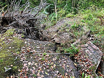
The path down to the hudro-electric plant ruins has collapsed over the years getting worse with each passing storm. While of interest, what remains is almost non-existent and not worth the dangerous scramble.
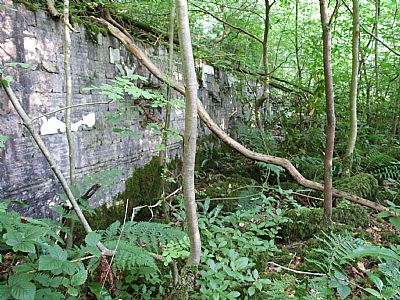
The rear wall. This was taken some years ago when access was relatively easy.
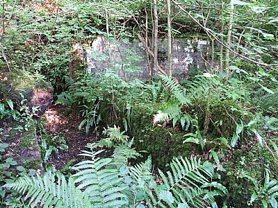
A view showing one side.
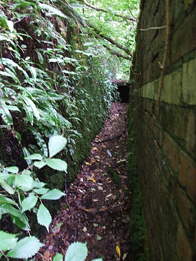
A small gap separates the rear wall from the excavated rockface.
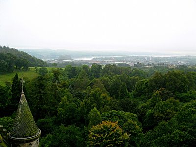
A view from the roof.
GEOGRAPH - Lairich Rig : https://www.geograph.org.uk/photo/1937599
NATIONAL LIBRARY OF SCOTLAND : MAPS : Sheet 30 - Glasgow
Publication date: Surveyed: 1855 to 1861, Revised: 1902, Published: 1905, Railways: 1914, Minor corrections: 1913. https://maps.nls.uk/view/189526735
VISIT SCOTLAND website : https://www.visitscotland.com/info/see-do/overtoun-estate-p248781
WOODLAND TRUST website : https://www.woodlandtrust.org.uk/visiting-woods/woods/overtoun-estate/
