
GOLDENHILL PARK, Duntocher, Dumbarton Road / Glasgow Road, Roman Road or upper Kilbowie Road.
ACCESS : Reached from : In Duntocher, Dumbarton Road becomes Glasgow Road. it is best to turn off into Roman Road before parking. Alternatively come right up to the top of Kilbowie Road and before the roundabout turn off westwards onto the remnant of the old Kilbowie Road where there is some parking space. Depending on your route, the slope is minimal for walkers.
///cabs.blanking.adjust Kilbowie Road entrance.
///prettiest.hacksaw.rising and ///grudges.boards.prickly Glasgow Road entrances.
///closes.ideals.grad Roman Road entrance.
///spaceship.month.motive The bridge.
///organs.thumbnail.processor The walk beyond the park where it meets Old Mill Road.
The Roman theme has been expressed in the children's playpark.
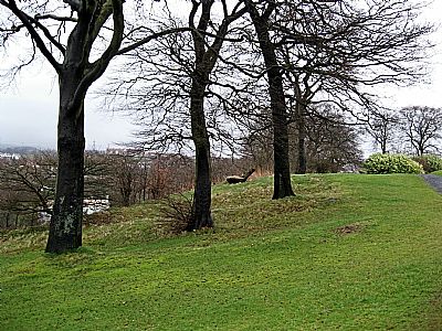
Goldenhill Park is renowned for the site of an simportant Roman Fort on the Antonine Wall. That is discussed under ANTONINE WALL : GOLDENHILL PARK. As noted there, much of the fort outline had been preserved through planting with wildflowers and careful mowing. Disappointingly, this has not been well maintained. Google satelite views of past years very clearly showed up the outline rather well. Today, if you visit, you can still make out the outline, but with some difficulty. You can still see a fenced section of exposed wall on the slope though.
The name of Goldenhill seems a little prententious, but this is explained in the Duntocher, Hardgate and Faifley Heritage Trail booklet. This area was originally known as the Gowdenhill and the name got transformed into what we recognise today.
There are pleasant views from up here towards the next Roman forts sites on the Antonine Wall, to the Kilpatrick Hills and over the surrounding houses. There is a small playpark and a sportsfield. But to really get a sense of location and context, you can walk from here a little further following the Duntocher Burn that runs alongside it. This green space is landscaped and has mature trees. The path leads around the Antonine Sports Centre to more sportsfields.
The bridge over the Duntocher Burn deserves a look. Although adapted for modern traffic, it retains a look that suggests antiquity. Some suggest that it is Roman, but this is not the case. Canmore tells us : This bridge, though reputedly Roman in origin, cannot be as old as that, though the stones of which it is built may have been used by the Romans. It may date from the time of Robert the Bruce (R Stuart 1852). Originally it was 8' wide, but it was widened by 6' in 1772 by Lord Blantyre. The Roman Bridge proper must have been lower down the stream. [Canmore].
The Heritage Trail booklet adds : The Roman Wall crossed the Duntocher Burn at this point, making it certain that there has been a bridge here since at least the second century.[Heritage Trail booklet]. Lord Blantyre had a stone erected near the bridge to commemorate an earlier repair in 1772 (collapsum restiuit) and this was built into the wall of the bridge in 1943. It is lettered to replicate the style of the Roman distance slabs. It may be that some of the bridge is pre 1772.
The blitz also destroyed the neighbouring Trinity church and damaged the adjacent WW1 war memorial. See DUNTOCHER TRINITY PARISH CHURCH and WAR MEMORIALS : DUNTOCHER
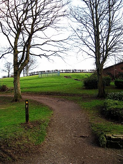
The walk up from Roman Road.
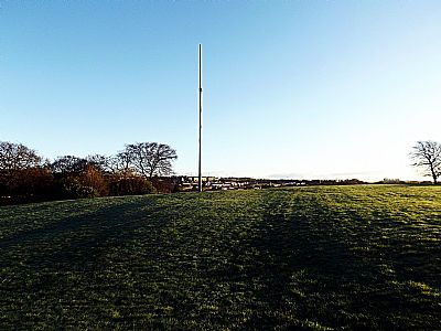
The view from the top.
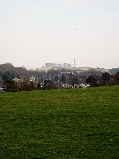
In this view you can see the next Roman fort on the Antonine Wall looking east. That is Castle Hill which today is marked by tall trees.
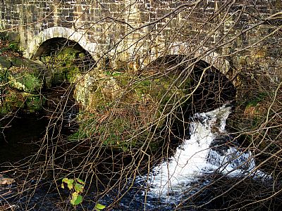
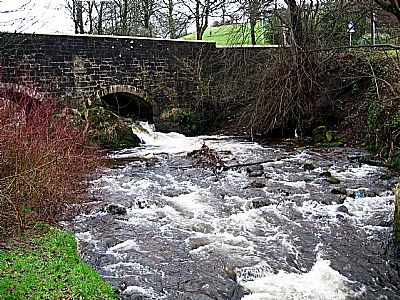
Two views of the bridge.
CANMORE : https://canmore.org.uk/site/43328/clydebank-duntocher
WEST DUNBARTONSHIRE COUNCIL HERITAGE TRAIL : DUNTOCHER, HARDGATE AND FAIFLEY : https://www.west-dunbarton.gov.uk/media/2619071/duntocher.pdf
