
LUSSET GLEN, Old Kilpatrick
ACCESS : Easy access for walkers and cyclists.
///tokens.runner.birthdays Lusset Glen road and beginning of the path.
///lung.campsites.food This is the point at which the path leaves the recreation ground off Station Road. The path passes below the Erskine Bridge.
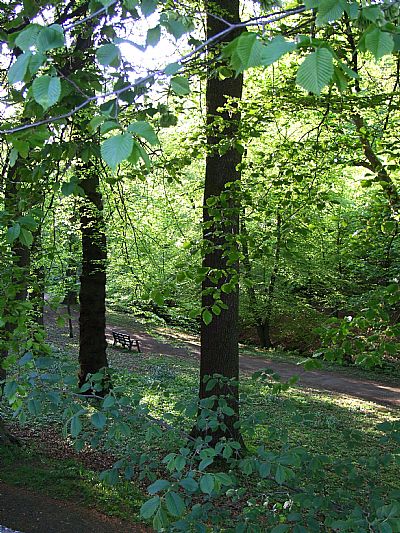
Lusset Glen is a very pleasant area with tall mature trees straddling the Dalnottar Burn. It stretches roughly easterly from Dumbarton Road under the railway until reaching Great Western Road. Glen Road is almost parallel with it for the first stretch and can be used as alternative parking to that on Dumbarton Road.
The glen once housed a dam supplying water power to the Dalnottar Iron Works. The Forth and Clyde canal (opened 1790) went through their site and most of the business was transferred to the Duntocher Burn at Milton in Duntocher where there was better water supply. [SG].
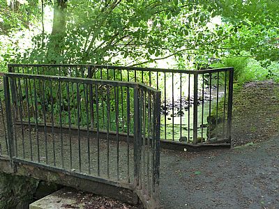
A footbridge over Dalnottar Burn.
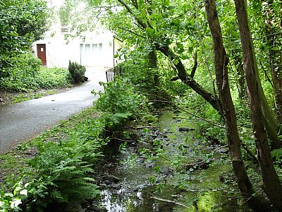
Looking back towards the road with the house to the left.
Lovely shady walks in summer.
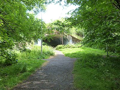
The paths pass northwards under the railway through a pair of arched bridges.
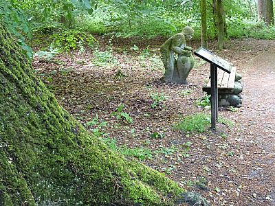
We are very close to the Old Kilpatrick Roman fort location and can therefore surmise that this burn was regularly used as a water source. Signage attests to this and refers to Roman artefacts found in the area. This sculpture by Gardner Malloy depicts an amphora in use.
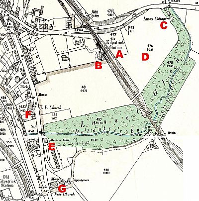
This composite and overmarked map dates from 1896. A =Kilpatrick Station; B = Lusset House; C = Lusset Cottage; D = the area where the sports fields were to be developed; E = Mission Hall; F = U. P. Church; G = Free Church. Much of the top end would be disturbed by the A82 and its feeder roads. NLS © as ref below.
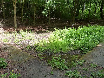
The dam supplying the iron works and the iron works itself are long gone. This neatly edged rectangular pond, since infilled, appears to be unrelated to that, but may be a later water feature or even a curling rink. Please comment if you know. It is towards the lower end of the west side of the burn.
GEOGRAPH.ORG : https://www.geograph.org.uk/photo/667406
NATIONAL LIBRARY OF SCOTLAND : MAPS : Dumbartonshire XXIII.9
Revised: 1896, Published: 1898 and Dumbartonshire XXIII.13
Revised: 1896, Published: 1898. https://maps.nls.uk/view/82875723 and https://maps.nls.uk/view/82875735
WEST DUNBARTONSHIRE COUNCIL website : https://www.west-dunbarton.gov.uk/leisure-parks-events/parks-and-greenspaces/woodlands/lusset-glen/
