STUCKIE BRIDGE
https://w3w.co/slimmer.worthy.club over the Leven.
https://w3w.co/worldwide.puzzles.rally over the lade.
Also see TEXTILE WORKS LADES and RAILWAYS
ACCESS : This bridge, in two parts, is now a popular pedestrian route.
We come across this bridge when discussing the textile works : Levenbank Print Works on the east bank and the Levenfield Bleach and Print Works which later became the combined Croftengea / Alexandria Works on the west bank. In fact it was independent of these being the originally a viaduct for the Forth and Clyde Junction Railway. But it did enable connections further on. The Levenfield works had the embankment as its northern boundary and you can still see the boundary wall at its base.
The Railscot website confirms that the present bridge replaced the original timber one in 1874. Jamestown Station was to the east and Croftengea siding to the west. Gordon Burns, writing about all the Leven bridges notes that The line was owned by the Forth and Clyde Junction Railway Company and ran on to Caldarvan, Buchlyvie and Stirling, but was closed to passengers in 1934. It has since been used as a pedestrian access providing a route between Alexandria at Rosshead over the Leven to Jamestown and Mill of Haldane.
Lairich Rig notes that it was informally known as the Stuckie Bridge, an obscure play on words which stuck and is still used toda. It is properly the "Stirling Bridge"; Stirling being one of the destinations of the line. This was first altered to "Starling", and then to "Stuckie" (the old Scots name for that bird).
This bridge was built as a railway bridge. It is today a popular foot and cycle bridge, but when used by the railways it would no have been suitable for pedestrians. Keeping in mind that there were numbers of textile works and works on both sides of the Leven and that the other bridges on the upper Leven post-date the Stuckie Bridge, how would the Leven be crossed. We see elsewhere that there were ferries at some points further down, but another clue can be seen in the map below. "F.B." indicates a footbridge immediately upstream of the Stuckie Bridge. A second such annotation indicates a smaller one crossing from the "mainland" and the spit of land forming the guiding wall of a lade on the other side; that of the Levenbank Print Works.
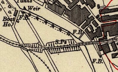
This map of 1914 shows a footbridge "F.B" upstream of the Stuckie Bridge when it was a railway bridge, and a smaller one linking the wall of the lade outlet of the Levenbank Print Works.
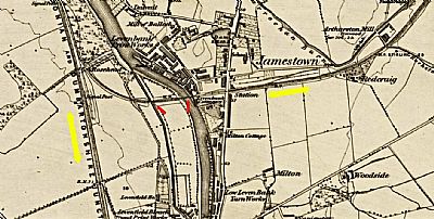
In this map from 1964 you see the sweep of the railway - yellow arrows - left / north-south that is the Caledonia Junction Railway and right east / west that is the Forth and Clyde Junction Railway. Jamestown Station was east of the main road, but there appears that a platform was also right alongside the Levenfield Works.
The stuckie bridges are shown with red arrows - left / west over the lade and right arrow / east over the Leven. You can make out the Jamestown Station and the point at which the railways merge. NLS © as ref below.
Also evident here is that the bridges are built on a high embankment which crosses through a section of land marked with boundaries. This area discected by the railway is still identifiable today. The lade forms the western edge with that against the towpath having a stone wall. it would have been part of the Levenfield Works to the south. It is very often flooded so we can expect it to have been little used for textile drying or storage. The trees shown along its edge were simply a cartographer's means of defining that edge, rather than formally planted trees.
Dense vegetation has grown over all of the fields over the years including many mature trees. Clearing of those trees over the south field commenced during 2024 even though much of the area was flooded at the time.
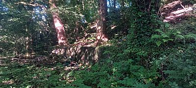
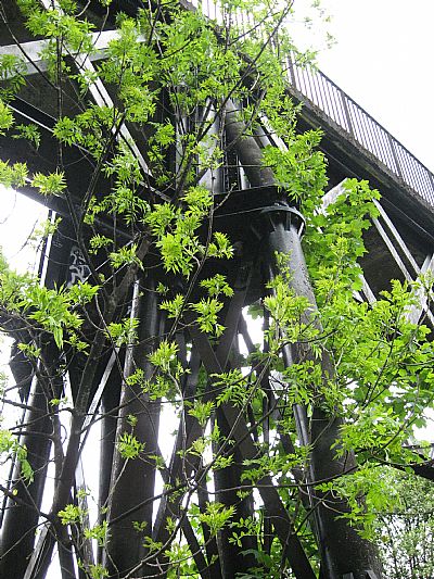
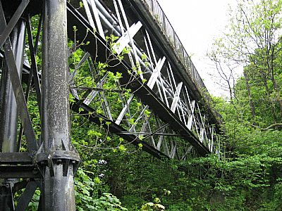
The pair of bridges is supported on much of its length on a high earthern embankment. On the south side this has been abutted by stone retaining walling. That has collapsed in several places, yet large trees are growing along it. Should that wall be disturbed, not only with the trees be affected but the stability of the bridges too.
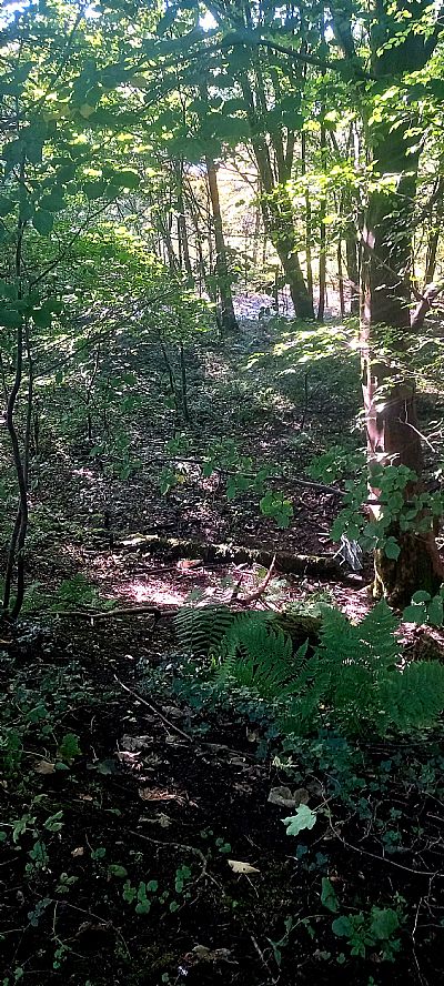
This view is from the footpath above looking down between the trees into the area beyond. The wall at this point is ivy covered; a fallen tree beyond it.
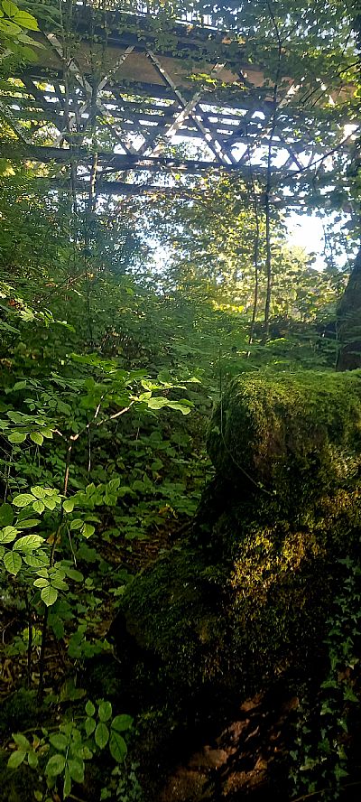
This is from the base of the embankment where the retaining wall meets the boundary wall along the towpath.
Interestlingly, while the bridge and the lade below are independent features, those operating the lade appear to have used the bridge structure as a means of water flow control. There is a wall across the lade immediately below the bridge over the lade which has a control point.
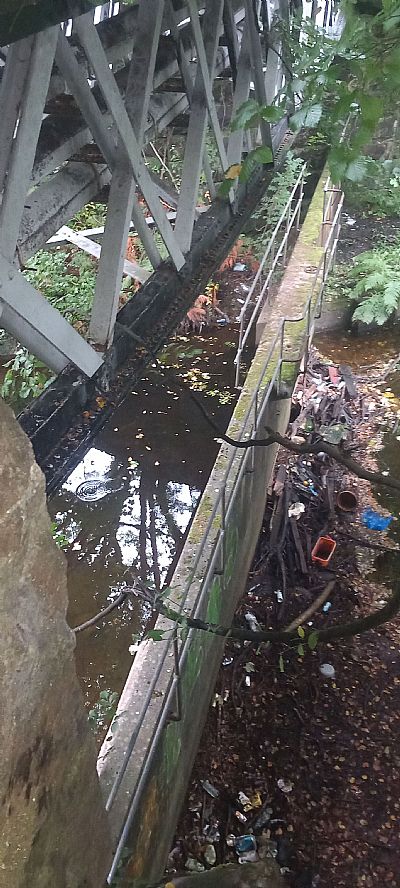
This is the control barrage immediately below the bridge across the lade. Note the railing to assist operators. Unfortunately ithout suitable maintenance and cleaning, this is currently blocked with debris and the water stagnant.
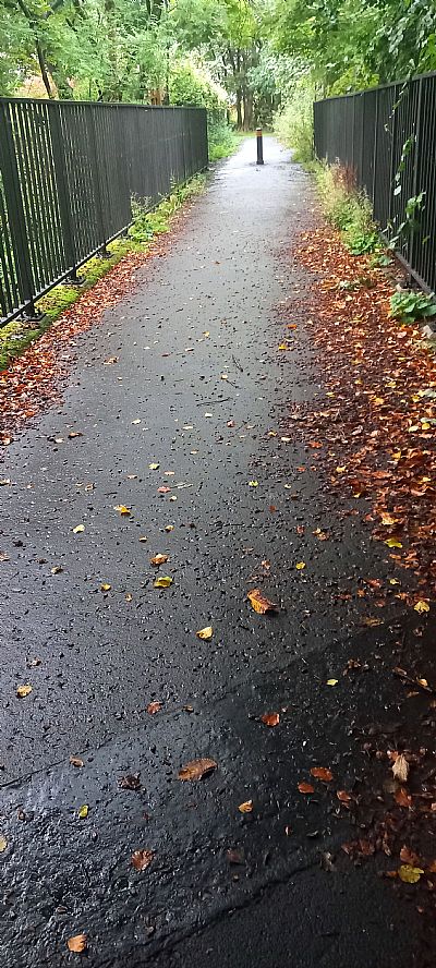
This is the west bridge looking westwards. The pair of Stuckie Bridges offers an important pedestrian and cycle route between Alexandria and Jamestown.
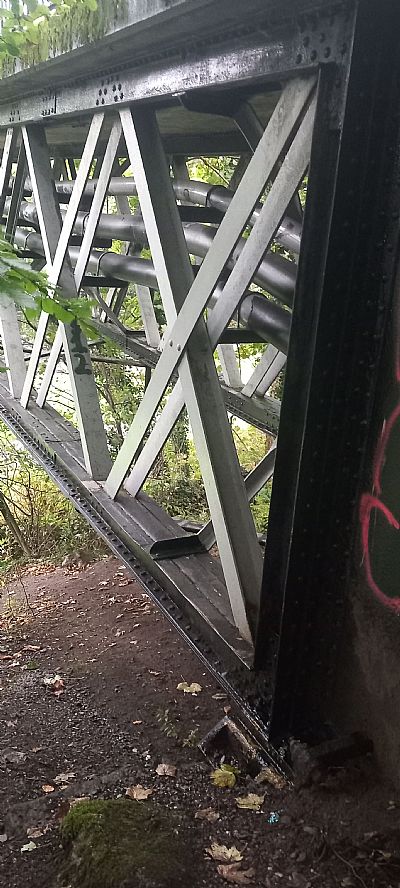
The pair of bridges also serve as supports to get services across the lade and river.
CANMORE including some early https://canmore.org.uk/site/165607/jamestown-railway-bridge?display=imagephotographs :
GEOGRAPH : LAIRICH RIG : https://www.geograph.org.uk/photo/1914800
NATIONAL LIBRARY OF SCOTLAND : MAPS : Dumbartonshire: Sheet XVIII; surveyed 1860. https://maps.nls.uk/view/228777145
and Dumbartonshire Sheet nXVIII Date revised: 1914, Date Published: 1923. https://maps.nls.uk/view/75827346
RAILSCOT ; https://www.railscot.co.uk/locations/J/Jamestown_Viaduct_Balloch/
VALE OF LEVEN PROJECT : BRIDGING THE LEVEN : GORDON BURNS : https://www.valeofleven.org.uk/levenbridges.html

