
CRAIGANDRO WOOD, HUNDRED STEPS AND DROVERS ROAD, Carman Muir
ACCESS : Easy walk. Offroad cyclists will need to negotiate a wooden stile.
Recommended walk.
///seducing.vineyard.proud The path up from Renton onto the footbridge over the A82.
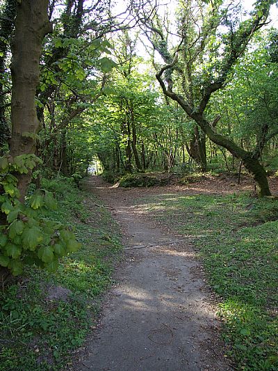
///bloodshot.dined.tonsils The start of the path through the woods.
///crescendo.suitably.tiny The start of the "100 steps" path.
///miracle.tram.engrossed The stile.
///look.slam.telephone The gate.
///enjoy.denoting.stunning The connection to Cardross Road.
This is a pleasant walk up from Renton onto Carman Muir. You can find the start of the route behind Renton Primary School. From there follow Carman Road until it reaches a footbridge over the A82. Cross the bridge onto Upper Carman Road. Go right until the last house and you will find a path up through the woods. This is Craigandro Wood.
There has been some speculation as to the origin of the name. "Craig" indicates a crag or rocky edge. Although there is little to indicate that, we need to imagine this area before the main road was cut through. It is certainly a sudden change in topography. It has been suggested that "Andro" may refer to St Andrew, patron saint of Scotland. While this is highly speculative, there may be something in this if we imagine this as the route for drovers and perhaps pilgrims heading northwards towards places such as Kilmahew or even further afield. A series of natural freshwater wells along this initial route may have meant it was a practical route. WE will come to such a well in due course.
The main path follows a stane dyke with a watercourse within a ditch, but there are secondary paths too, one of which crosses this burn.
As you emerge from the woods, turn right onto the farm track. Almost immediately you will find a path leading further up the hill. This is "The Hundred Steps". Don't be too surprised that there are no steps at all. The path was rebuilt some years ago with a good gravel base and flattened to make it more accessible. This straight section of path runs between fenced fields usually occupied by cows, although sometiems grazed by sheep too.
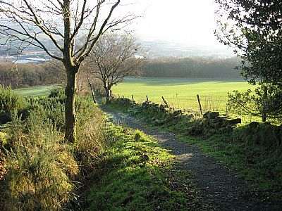
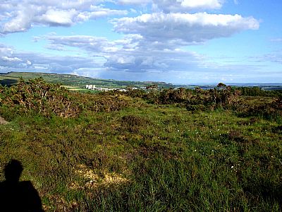
The "Hundred Steps"
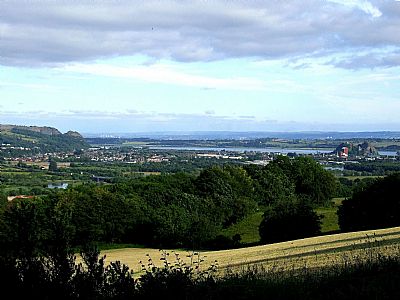
And the view.
You will then need to climb over a stile.
You are now on Carman Muir. The path is now across muirland of grass, heather and gorse. It is usually very muddy. However this informal path runs alongside what at one time was a very formal and wide route. This was the drovers road. As it was for droving livestock, it was naturally nevery surfaced. It is well defined by side embankments, but is otherwise very overgrown. The recognisable section of drovers road tends to loose distinction as it meets the dry stane dyke, but the footpath continues through a gate alongside the Carman Reservoir.
The path over this section of muir has abandoned the laid out "drovers road", but here it is right alongside and defined by low embankments and vegetation.
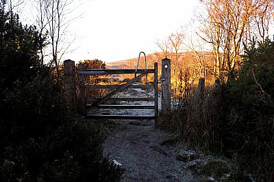
As you leave the drovers road and head towards the reservoir, you will pass through this gate.
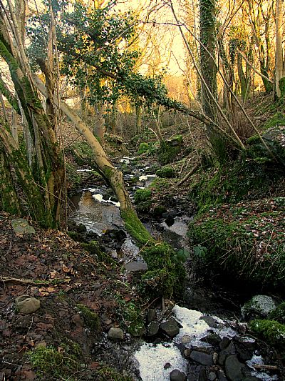
Along the way is the still functioning well complete with metal cup on a chain. Pure clean water percolates up from the ground, but unfortunately once in the small pond shelting under a large rock, it becomes contaminated by dogs and livestock.
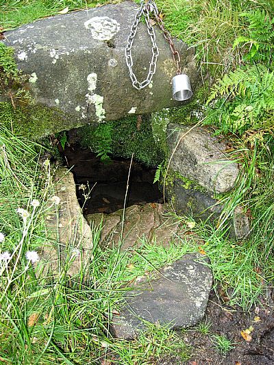
The well
The drovers road and this footpath are heading for what was the stock market on Carman Muir. That is discussed under its own section : CARMAN CATTLE FAIR, CARMAN MUIR Also see CARMAN RESERVOIR, carman muir
and CARMAN HILLFORT, CARMAN MUIR
If you continue walking you can pass around the far end of the reservoir or even go up Carman Hill. You have an option to return down Cardross Road or back the way you have come.
GEOGRAPH.ORG : https://www.geograph.org.uk/photo/3951242 and https://www.geograph.org.uk/photo/914876
TOUR SCOTLAND website : https://tour-scotland-photographs.blogspot.com/2018/02/old-travel-blog-photograph-drove-road.html This has an interesting old photograph of the drove road as it skirts the reservoir. The resrvoir appears to have already been increased in extent. If you look carefully, you can make out the trees on the rise to the left with what looks like the cottage. The trees are still there. The building has gone.
