
BLACK CASTLE, RENTON
ACCESS : To reach it go up the Hundred Steps path behind the Carman Reservoir CRAIGANDRO WOODS,100 STEPS & DROVERS ROAD. It is difficult to get to though and involves clambering over a partially collapsed dry stane dyke, passing through the woods and mud, mud, mud towards the north east corner. Note that some areas are steep and slippery.
https://w3w.co/excusing.shares.blackouts
Now here is somewhere that conjures up images of mystery in the mind. It is just that.
Almost anyone who has spent most of their lives in or near Renton will recall going there, perhaps on a Sunday School picnic. Yet most of a younger generation may not even have heard of it. So does it exist? Is it just in the imagination of the older folk? Well yes and no!.
Small quarries abounded at one time. Some were little more than borrow pits, while others were somewhat more than that. You can find one near Dalreoch. Another was on Carman Muir below Carman Hillfort - the works took away most of Faerie Knowe (another merging of reality and imagination). FAERIE KNOWE - CARMAN QUARRY, CARMAN HILL
This one though served mainly as a source of building stone for the Carman Reservoir. CARMAN RESERVOIR, carman muir The terrain here,, even within the limited area down from the reservoir is hilly. Dry stane dykes pass through on the south side and seem to suggest ancient structures of greater form than simply long walls. There is a bit of a "valley" that leads down to a pond. That pond was hand dug for stone and natural outcrops now form interesting "cliffs" around it. To the east side we find a "motte" typical of a small castle and even what looks like a ditch that suggest a dry moat, complete with a narrow crossing place. That is actually simply the spoil heap from the dug hole.
But any greater significance is purely imaginary.
Leading up from Cardross Road is what used to be a dirt access track. That is today simply very boggy. But in the days remembered by some locals that was still accessible and the way into the wooded area or glen for picnics.
As for the name, this appears to be purely imaginary, perhaps descriptive of the shadows cast by the trees. Some have suggested a Tobias Smollett inspiration source, but although he does allude to local places in his writings, this is not one of them.
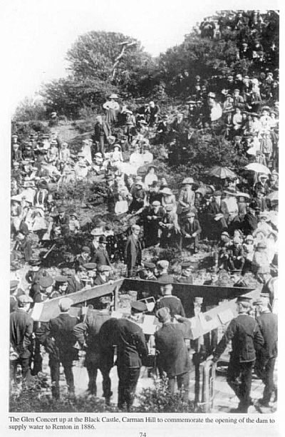
This picture is entitled "The Glen Concert up at the Black Castle, Carman Hill to commemorate the opening of the dam to supply water to Renton in 1886". This appears to show the band within an enclosure, a sort of orchestra pit, in the access road into the quarry. The enclosure has commemorative illustrations and text on it. The natural embankments act as tiered seating. The men wear flat caps while the women have great bonnets. Some have parasols. An important occassion. If you venture to this very place today, you will need wellies and a stick due to the deep mud, slippery slopes and vegetation. Unknown of picture source.
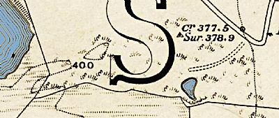
This map of 1860 shows Carman Reservoir on the left / west. The smaller area of water is the pond ie the excavated hole. You can see the basic access road coming in from near the sharp bend on Cardross Road. There is an indication of a high point, but that is natural. The "motte" to the right / east of the pond. The roughly hatched area is today densely wooded. That to the south of the lower east/west dyke is farmland, although that also includes many trees and gorse along its edges. NLS © as ref below. This being an extract of a larger map, the large "S" is part of the word "Cardross" into which parish this fell.
You can see more in winter when the vegetation has receded and this is when most photographs were taken.
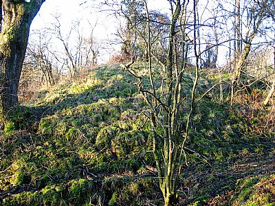
The "motte". The pond is directly to the far side of this view.
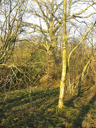
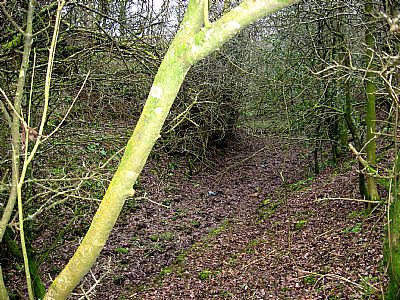
Some woodland to the east side with the "moat" embankment.
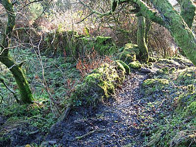
A section of "moat" below the "motte" with cattle tracks.
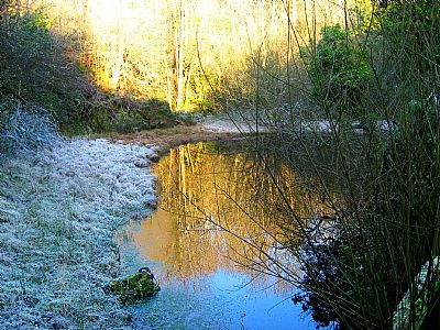
The pond below the "motte" mound.
The dry stane dyke does some odd bends and junctions which suggest to the imagination that these are ruins of structures, perhaps even of quarry buildings, but that is not the case.
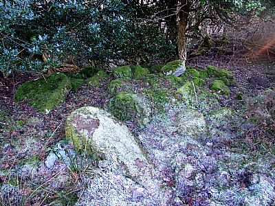
This is certainly a cairn and seems to reinforce a castle of some sort. But this is a clearance cairn ie rocks cleared from the nearby farm field and does not have any burial connotation.
LAIRICH RIG on Geograph : https://www.geograph.org.uk/photo/3685512
NATIONAL LIBRARY OF SCOTLAND : MAPS : Dumbartonshire, Sheet XVIII. Survey date: 1860, Publication date: 1864. https://maps.nls.uk/view/228777145
