FISHERS WOOD & BOATHOUSE WOOD, alongside the River Leven behind the Loch Lomond Rowing Club and the Vale of Leven and District Angling Club.
ACCESS : Easy access generally although some care is required. At one point there are small, but protruding remnants of a metal fence on the path. At another, the path becomes slippery.
There are several access points, of which the above reference is the main one.
Also see TEXTILE WORKS LADES and RAILWAYS and STORM EOWYN PHOTOS 2025
Note that with the removal of a clear edge between the two wood sections, the whole area is today considered Fishers Wood. This is close to a popular angling spot - now split by the barrage. The anglers set off by boat above the barrage. Or stand on the banks below it. Looking at old maps reminds us that there were two distinct sections of woods; the other being Boathouse Wood. There are also vestiges of the railway route that swept around from / to the Stuckie Bridges.
Fisherswood is popular with dog walkers, yet almost forgotten by the many people who walk by along the tow path. It is located between the railway and the back of the boat clubs. It appears on maps as Fisherswood, most likely to have been named after the fisher folk (raher than someone called Fisher). Perhaps it was a refuge from the weather before the clubhouse was built.
Boathouse Wood is to most people simply part of Fisherswood. The two sections are not as distinct today. But as you walk through the woods you will notice a sizeable depression and a concrete wall. These are remnants of the septic tank and filter beds. So close to the inlet for fresh water to the lade serving the nearby textile works - or perhaps because of them.
The road down, an extension of Heather Avenue and some modern features have changed the way we perceive this area. The map below shows that there was a boathouse, hence the name, way before the current ones, that faced directly onto the river very close to the inlet for the lade. We now see the woods split by the road, yet that was part of a large area that had already been split by the Stuckie Bridge from the yard of the Levenfield Works, later becoming part of the larger Alexandria / Croftengea Works. Over time that enabled many large trees to grow, a haven for wildlife. Downstream from the Stuckie Bridge, that remained part of those premises, yet became covered in trees. In spite of being susceptible to flooding, it was zoned as potential industrial area in the Local Development Plan and was cleared in 2024.
But back to the woods.
The main access points are a bit of a confusing. One sets off as a well set out tarred path through the low wall that was built as part of the engineer works here. But it abruptly stops. The area was worked on during the construction of the barrage and also at different periods when the drainage was improved. Once into the woods you will notice various intrusions such as these and at the far side you will come to the railway fence.
Not very promising so far. But wander further in and through the woods and it offers lovely sun dappled expanses. There is the main path close to the fence and some others that link it with the riverside. You can do a loop. Just mind your step. The path is generally flat once you are within the wood, but there are some roots and bits of fencing that you could trip on.
Also see STORM EOWYN PHOTOS 2025 and
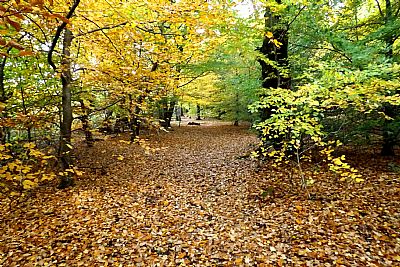
Fishers Wood : October brings a golden hue.
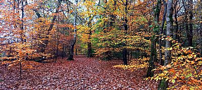
Fishers Wood : Autumn in November in the woods.
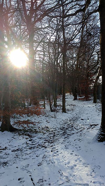

Fishers Wood in snow,
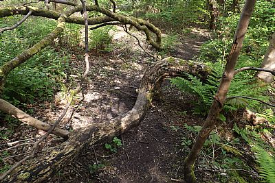
Fishers Wood : The fallen trees are easy to step over or around. But at this point you need to watch out for small remnants of a metal fence at ankle level.
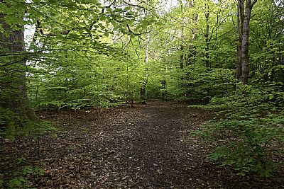
Fishers Wood : The path in summer.
As you get to know a forested area well, you notice how it is constantlky changing, not just with the seasons, but from year to year. New vegetation sprouts, trees mature, trees decay, storms uproot or break trees.
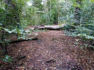
This large tree snapped and fell across the path during Storm Amy in October 2025. It broke near its base which had decayed to some extent.
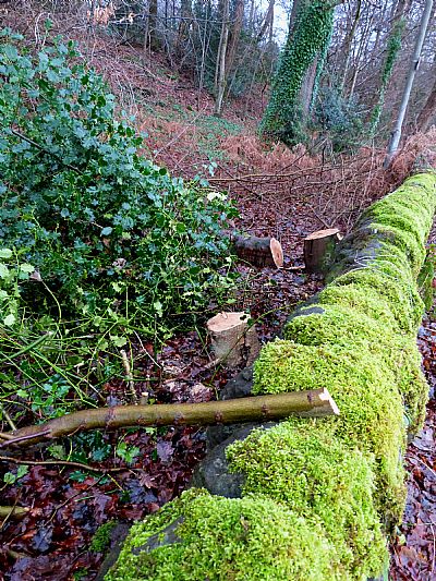
This is the boundary wall of Fishers Wood just upstream from the VOLDAC clubhouse. The picture was taken in January 2025. The cutting down of vegetation including small trees along the riverbank has been criticised in the past. Those involved claiming it is just pruning. Here we see mature trees within the woods being cut down. This is inexplicable.
Ironically, this damage paled in comparison to the damage caused by Storm Eowyn in January 2025. Heavy plant was needed to clear the large sections of cut fallen trees in the area just up from the Stuckie Bridges.
Just across the small road and downstream of Stuckie Bridge is more wood. This is not strictly part of Fishers Wood nor Boathouse Wood, having been within the textile works site. it is not as accessilble, but it is interesting for the lade which runs through it, a remnant of the textile industry which is described separately. See CROfTENGEA / ALEXANDRIA WORKS : index.asp?pageid=718466
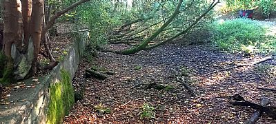 OK, not exactly attractive, but the wall and depression mark the junction of Fishers Woods and Boathouse Woods. These are the remnants of the septic tank.
Why would there be a water treatment works here, of all places? Well there were several textile works establishments downstream from here, the lade of one starting very close by. It was essential to ameliorate the dirty run-off from the nearby housing and keep it out of the works. You will see an iron sluce crossing the Croftengea lade - rather than leading into it - for the same reason.
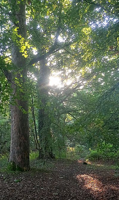
Boathouse Woods downstream of the road :Gorgeous mature trees and various other plants including garlic and bluebells. The lade runs along to the left.
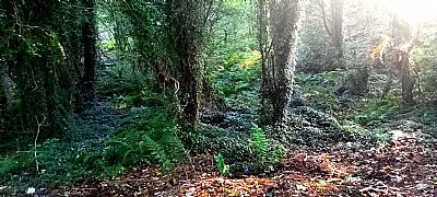
Boathouse Woods downstream of the road : It looks more ancient than it really is. Ferns and ivy cover much of the lower areas. The railway over the Stuckie Bridge used to curve around to the right.
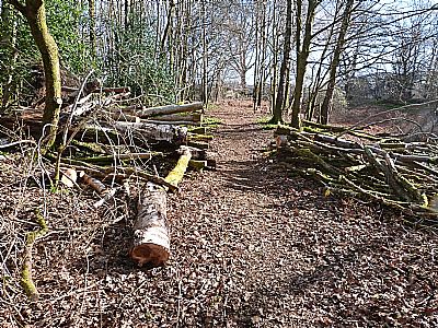
This tree fell in 2025 and altered the pathway route, but was cut through at the same time that many trees were cleared the following year. Such work creates a certain visual charm.
The woods downstream of the Stuckie Bridge. Other than the lade and a low wall against the towpath, there is nothing left to indicate that this was part of the works. In any case this was more open yard than buildings. Left to its own devices, woods have sprung up within it and these effectively have become part of Fishers Wood, with a variety of plants, birds, squirrels and rabbits. However, unlike Fishers Wood itself, it is low lying and when the Leven floods, so too does this wooded area. You may even find mallard paddling around the trees.
Some vagrants have built temporary structures within it and over 2023, there has even been someone camping there - only to be completely flooded out. Hmmm!
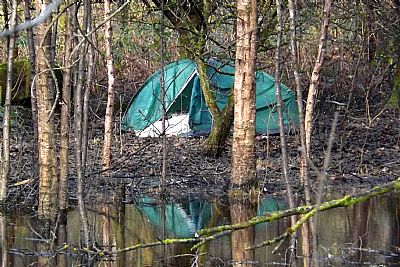
The woods downstream of the Stuckie Bridge : Someone found this a good place to camp - until it was flooded out. This is the tent once the flooding had abated a bit.
This whole area except for a narrow band below the Stuckie Bridge embankment and lade has been cleared and is in the process of being "grouted" with rubble for commercial use. (As per the LDP zoning).
When it becomes water logged over the winter in particular, it takes on an eerie monochrome atmosphere, the tall skeletal trees starkly mirrored in the still water which sometimes freezes over.
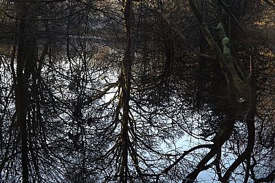
The woods downstream of the Stuckie Bridge : Up and down confuse as the stark trees reflect in the flooded woods in winter.

