COLLEGE WAY : from Dumbarton Central Station to the High Street through the Artizan Centre.
ACCESS : This is now a pedestrian route which is currently being redeveloped (2024).
We still refer to this as College Way, but this requires some clarification. It gets its name from St Mary's Collegiate Church which stood at this route's northern end overlooking the shallow tidal lagoon in the Leven. That lagoon was filled in to form what subsequently became Broadmeadow Industrial Estate. When the railways came through the lines were built on the solid edge of it, raised to meet up with the bridge westwards, something that is still evident from the high structures of Dumbarton Central Station. DUMBARTON CENTRAL STATION, station road, dumbarton
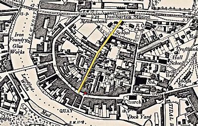
So far this is still College Way aligned much as it always was. But much has happened in the period since then and its alignment differs. You can see from this map that College Way may have begun simply as a through lane, but buildings, many residential, sprung up along its length. The curved sweep of the High Street and Church Street enveloped an area that begun to be quite densely urban. In retrospect we may think of this area as fascinating, even quaint. Somewhere similar to other ancient towns where you can still explore them. Full of character and characters.

College Way is highlighted in yellow. The current pedestrian route into the Artizan Centre is a little further eastwards opposite Riverside Lane. NLS ©
But the winds of change blew through after WWII. College Way was dropped under the wide traffic laden double carriage Glasgow Road with its excessively large and intimidating roundabout. And the abrupt and bland concrete Artizan Centre was built with a mall through to the High Street. Perhaps seen as smart, functional and efficient at the time, it fits the architectural term brutalist quite well.
The Artizan Centre has been revamped in the past and now in 2024 is being partially removed for a more thorough rebuild.
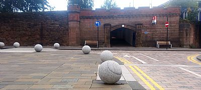
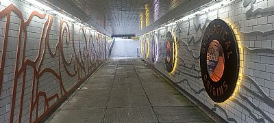
At the station end, improvements have already been realised with new paving around this side of Dumbarton Central Station and large ball bollards. The pedestrian underpass too has been much improved. This ties in with the Dumbarton Town Centre Conservation Area status. The rest of the route anticipates improvements too as part of the connectivity project or Connecting Dumbarton as part of the Levelling Up programme. The rebuild of the Artizan Centre though influences progress.

Looking towards the station entrance.

The pedestrian underpass with its new decorations. Above you are two lanes of heavy traffic.
A remant of the Collegiate Church also remains as an arch to one side of the Municipal Buildings MUNICIPAL BUILDINGS, COLLEGE ST, DUMBARTON
Dumbarton Central Station which is the key facility serving the town of Dumbarton is much in need of restoration and adaptation to modern access standards. College Way in fact goes below it, yet that section remains (2024) dark with damp dripping from above and pigeons fouling everywhere. The national cycle route passes through it.
NATIONAL LIBRARY OF SCOTLAND : maps : Dumbartonshire Sheet XXII NW. https://maps.nls.uk/view/75498375

