
FERRYDYKE BASCULE BRIDGE, COTTAGE & STABLES
ACCESS : These are readily accessible on foot or cycle from the Forth and Clyde Canal towpath or from Portpatrick Road in Old Kilpatrick.
///goodbye.immune.seagulls Bridge.
///skills.presenter.liberated Cottage.
///pavement.deflation.marriage Stables.
https://w3w.co/skills.presenter.liberated
Also see DONALD'S QUAY : index.asp?pageid=715956
This bascule bridge was established on the Forth and Clyde Canal here to serve DONALD'S QUAY. It is roughly in line with the wall of the Antonine Wall as it passes Old Kilpatrick Roman Fort heading for the banks of the Clyde. The canal passes through both the Antonine Wall and the fort. There is now nothing to see of either of those here anymore, but the canal and this small bridge are well worth seeing.
This is one of two remaining bascule bridges on the canal; the other being at Bowling. A bascule bridge is a type of drawbridge with a counterweight that continuously balances a span throughout its upward swing to provide clearance for boat traffic. The name comes from the French term for balance scale, which employs the same principle.
Next to the way through to the quay is a bridge-keeper's cottage and the ruins of the stables and stores. The latter are completely in ruins, but can be easily made out. Sadly the picturesque little cottage often photographed reflected in the still waters of the canal, was vandalised and set ablaze some years ago.
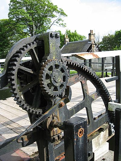
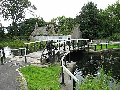
The Bascule bridge.
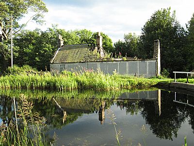
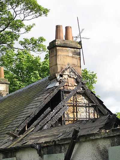
The cottage after the fire.
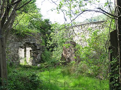
The remains of the stables.
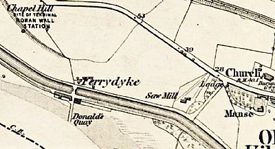
In this map of 1864 you can see the bascule bridge over the canal to serve Donald's Quay and the cottage (black) and stables (hatched). NLS © (This map shows "Chapel Hill" to the north west of Ferrydyke. It appears to be a bit a cartographer's interpretation and probably referst to Old Kilpatrick Church not that far away, the hill being the site of the Roman fort before redeveloped as warehousing. Alternatively, it was a local name for this locality. No reference to a chapel can be seen on old maps).
As of August 2024, plans have been approved to transform this building, or rather the site, into 3 level family home.
DAILY RECORD : https://www.dailyrecord.co.uk/news/local-news/plans-transform-derelict-old-kilpatrick-33475541
GEOGRAPH.ORG : https://www.geograph.org.uk/photo/1524163
NATIONAL LIBRARY OF SCOTLAND (NLS) MAPS : Dumbartonshire Sheet XXII Survey date 1860 Publication date 1864 ©
