
FLOODING
West Dunbartonshire is fortunate to not have a high proportion of land that does not drain readily when we have heavy and consistent rains. But we do nevertheless have flooding when we have heavy and consistent rain, when the rivers burst their banks, when the winter snows within the catchment areas melt and add to that already in the rivers and during extreme high tides such as the spring tides. If any of these occur at the same time, we experience readlly extreme conditions. We can add to these the likelihood of rising seas and more frequent extreme weather conditions as the world's climate changes.
SEPA, the Scottish Environmental Protection Agency publishes maps of areas at risk on its website for which there is a link below.
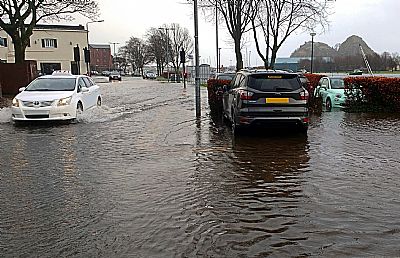
Some areas stand out. The intensity of the blue colour indicates the likelihood of flooding and with this comes the severity or depth. This does not necessarily mean danger. Standing water can cause damage to property. It may also cause your car to cut out. But it can mean that you cannot clearly see the edge of deep water and need to take great care. It goes without saying that you need to avoid any moving water. The strength of the current can be very misleading.
Dark blue = Each year this area has a 10% chance of flooding.
Medieum blue = Medium Likelihood
Each year this area has a 0.5% chance of flooding.
Light blue = Low Likelihood
Each year this area has a 0.1% chance of flooding.
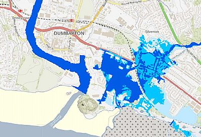
An extract from the SEPA flood map showing Dumbarton and its immediate areas.
This is just an example. By using the SEPA floodmaps you can see if your property or area is susceptible to flooding. If you have lived there for some time, you will know already, but this all helps get better context. You need to put in your postcode to identify your area, but once on the map, you can pan around to see the broader area. This is also useful when considering a move.
SEPA also advise on flood risk management. It is not just whether an area gets extremely wet, but how it is drained. Our drainage network includes some dated piping and changes to the urban environment can exacerbate this. As we develop and extend our urban areas, we are also adding more and more impervious surfaces. Roofing, roads, parking lots etc all contribute to the speed of run-off and the impact elsewhere. it is essential that we have areas of vegetation that can absorb some of the run-off and delay it adding to that impact. Sustainable urban drainage systems are required within any new development and can be applied to existing ones. These are generally referred to as SUDS. SUDS can take many forms ranging from permeable surfaces in parking lots to detention basins. You have most likely seen the large basin created at the junction of Garshake Road and the A82 / Stirling Road (where the Council offices used to be) to control the run-off down into the Gruggies Burn which would flood parts of the eastern part of Dumbarton.
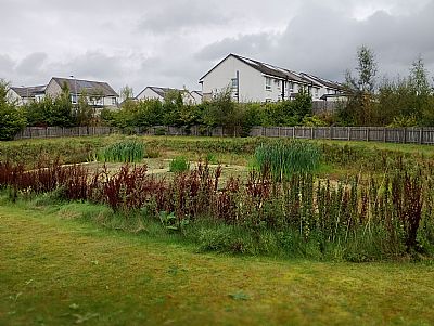
This moderately sized SUDS at Castlegate Avenue / Castlegate Lane near Dumbarton Rock ameliorates the heavy rainfall amongst these new houses and the nearby light industries before it enters the lower reaches of Gruggies Burn.
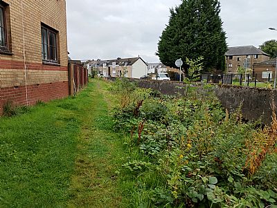
Just a little further upstream we find Gruggies Burn channelled and with raised walls to control flow at peak times. The proximity of some residential buildings is acutely obvious.
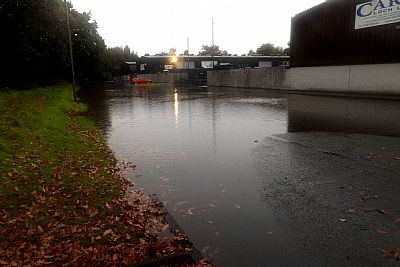
The River Leven overspills into the Riverside Lane carpark on a regular basis, every spring tide, to which excessive rain can exacerbate it. Also see RIVER LEVEN index.asp?pageid=716090
So much is influenced by the level of Loch Lomond and its run-off. See DUCK BAY index.asp?pageid=715895 and the RIVER LEVEN BARRAGE index.asp?pageid=718264
Standing water is very different to flowing water which need just be fast to be dangerous. There is therefore also a "River Levels" website to provide warnings for this. Note that the maps on the website indicate areas within which rivers and water courses are monitored and not overall flood levels.
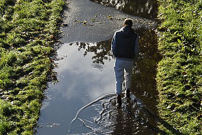
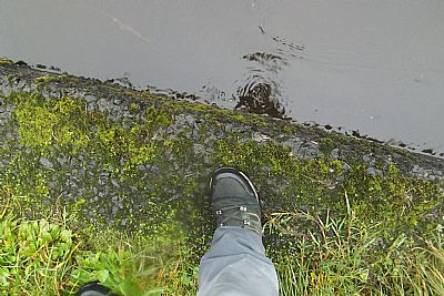
The towpath overspills a few times each year. Wellies advised for walking. Also note that some parts of the riverbank and the edge of the towpath surface are damaged. While something to watch out for most of the time, these are hardly visible under flood conditions. Beware. The edge is not easy to see.
The heavy rains in October 2023 caught many unawares. This time of year comes with the beginning of the autumnal shedding of leaves and these together with a lot of wash-off of gravel from side roads or silt can quickly block even the best of drains.
Cast iron manhole lids below Balloch Bridge are lifted by the flow from further up. While the water level of the River Leven was still not up as far as is sometimes experienced, the drain flow was extreme. Never underestimate the strength of flowing water. October 2023. The opening of the barrage just downstream of here had little effect at the time.
Not that further downstream is the Lomond Industrial Area. The lower units find their access road flooded 2 or 3 times a year. The water comes in part from the adjoining lade (just out of the picture to the left) and rises up the drains. It has been suggested that removing that flow will stop the flooding, but it has more to do with the overall relative levels of the river and the outflow. (October 2023). For more on the lade just out of sight in this photo to the left, see Croftengea Works index.asp?pageid=718466
While one would expect the fast flow of the river to draw the water from the lade where it exits, the relative levels just don't facilitate that. This is the point the lade meets the river and when in flood it is under water. Even cleaning and unblocking the lade at its inlet above the Stuckie Bridge is unlikely to assist the outflow. When comparing this situation with that where the drains are not coping as shown above, blocking the lade or even filling it in will simply isolate the flooding within this part of the industrial area.
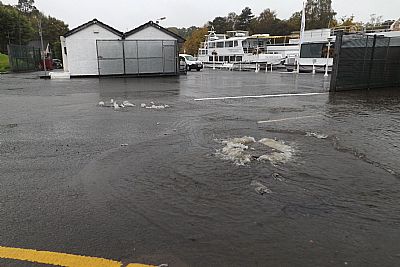
A regular incidence of flooding, in this case a few times each year, is the rising of the River Leven into the carpark of Riverside Lane in central Dumbarton. This is caused by spring tides which can be pretty excessive if heavy rains have occurred in the catchment area at the same time. (February 2022).
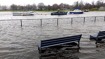
A great place to sit and relax with views of the river.
RIVER LEVELS : https://riverlevels.uk/flood-warnings-scotland-west-central-scotland
SEPA : https://www.sepa.org.uk/environment/water/flooding/flood-maps/
