
BEACHES & COASTLINE
In later life I got to love beaches. I paddle-skiied and windsurfed and got quite proficient at both. But as a child I was asthmatic and found the cold water, the sand in my sandwiches and the sharp windblown sand very challenging. But my ancestors seem to have fared better.
Just before we emmigrated to Scotland I went for one last walk on our local Bonza Beach. I imprinted the sensation of walking in the cold uprush up the sand where the breakers have reduced in size and almost, but not quite lost their power. By this time they are mere hints of their size just moment before. Sandpipers love this zone and run foreward between uprushes to seek the tasty little creatures that may be dislodged. My ankles got treated to the wet chill too and the ends of my jeans got soaked and wet-sanded. Whelks were out in numbers too. Hunting for hapless molluscs. The former can drill holes through the shells of the latter with chemicals to suck out their innards. A picturesque and sense satisfying scene that brought back many memories.
I have several photos of beachside picnics and swimming in the sea.
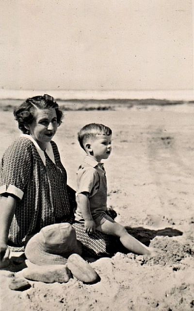
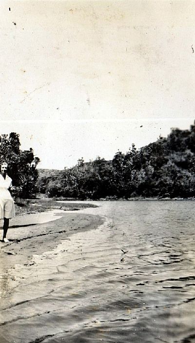
This is a picture of me and my mother. I don't know which beach although I can see rocks beyond. It may be the Orient Beach. As can be seen in a photo below, there were rocks alongside the main sandy beach. The paddling pools were on the rocks just out of sight.
The Orient & Quanza
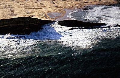
East London has two great beaches. The Eastern Beach is exposed, but had the woody retreat of Marina Glen just across the road. The Orient Beach was created by the accumulation of sand against the pier and was named after an early shipwreck there. Also see HARBOUR MEMORIES
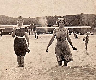
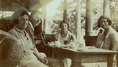
I am pretty sure that that is Granny Maud on the right, but do not know who the other woman is. Great swimming cossies. That is the old Orient Beach changing building with his & hers enstrance steps. Note how thick the vegetation is up on Signal Hill behind it.
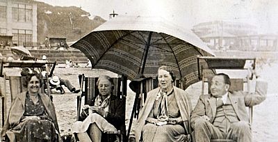
This photo is labelled "On Orient Beach May 1937. Aunt Norah, Mom, Aunt Nell, Uncle Frank. (The setting was unchanged when I was taken there as a small child in the 1950s).
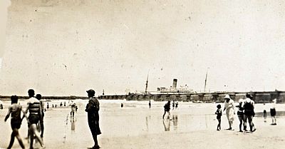
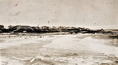
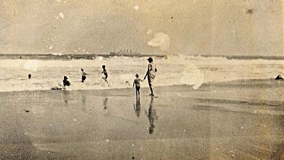
A ship is about to leave the port while bathers enjoy the beach close by.
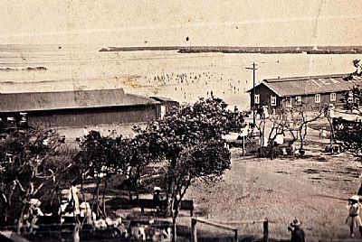
An undated photo of Orient Beach from above the wooden changing and other facilities. You can see some ladies in all their finery under the trees while the beach itself is teaming with bathers. Note the sign TEA ROOM on the roof to the right.
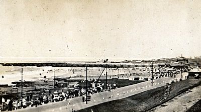
A similar view as the photo above.
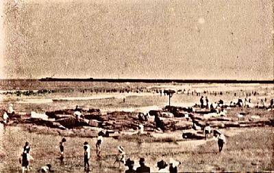
This photo was taken little to the left / east of the one above. The same bathers can be seen, but here there are rocks alongside the sand. Again we see some onlookers dressed up smart and a few children paddling, but fully clothed.
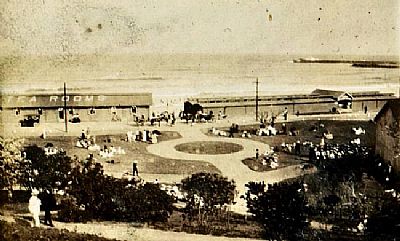
The Orient Beach was also the place for amusements. Here we see crazy-golf being played on a narrow course alongside the lower road.
Almost the opposite view to the one above. This was taken from the pier looking back towards the Esplanade with its hotels.
It is simply to be expected that a beach right alongside a harbour entrance with anglers casting off both the breakwater and pier would accumulate some debris. Much of the coast here suffers from oil spillage. It comes up onshire as black blobs that stick to the rocks and feet. The Orient Beach looks very pristine and is popular with bathers, locals and visitors. But I once took my goggles ... and was shocked what was beneath that surface. Fish heads discarded by the anglers, plastic cups, oil....
The Quanza Pool
This was a sea filled pool on the rocks adjoining the Orient Beach. It was rebuilt a little further over and a little larger. What you see now is a refurbished pool.
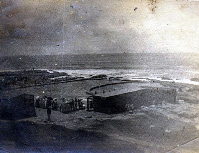
This is the forerunner of the Quanza Pool. It was built on the rocks close to the Orient Beach and filled with sea water. Swimming was segregated. We are not talking of separation of races. Men and women had to swim in their own sections. (Remains of the early pool can still be seen on the rocks next to the current one). If you think society was over prudish in these days, you may be surprised to learn that one of the concerns of the Council was the popularity of nude swimming in the sea.
The Esplanade
Linking Orient Beach and Eastern Beach is a stretch of road and pavement set well above the coastal rocks.promonade. "Esplanade" simply refers to a long level walkway. But it almost equates with "promenade" take a leisurely public walk, ride, or drive so as to meet or be seen by others. And East Londoners had the habit of promenading here. Some old pictures show people in their Sunday best walking along. Today promenading as such is no longer a done thing. It is more a place to dodge street vendors.
But the Esplanade also had some prominent hotels along it, some of which have been replaced, and the showgrounds, aquarium and other facilities.
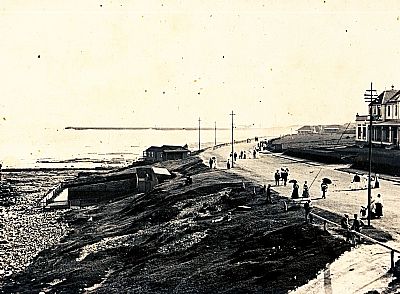
The old Beach Hotel is to the right. Across the road from it was its own outdoor tidal pool. Note how dressed up the people are walking along the road - no traffic then, so some are right in the road.
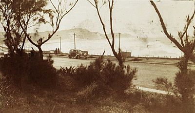
Here the Easplanade almost reaches Eastern Beach. There is that high dune. We see it through the windswept coastal trees that still grew within the grassed area across the road. That made way for hotels and open event space.
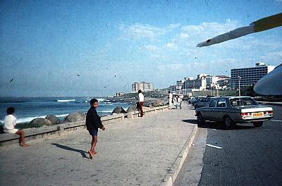
The Esplanade as seen from the Eastern Beach end in the mid-'80s. My windsurfer protrudes from the roof of my car.
Marina Glen and Eastern Beach
Marina Glen is almost synonymous with Eastern Beach so the two are discussed together here.
Eastern Beach was not as well protected as the Orient Beach. The surf was affected by backwash and cross currents leading to rip waves. The small brackish river separated it from the stretch of sand instespersed with rocks, before becoming the rocky area of Bat's Cave and beyond that rocky walks to Mermaids Pool and eventually Nahoon Point. That same little river also separated the races. People of other colours were not allowed on the main beach, but could bathe in amongst the rocks eastwards of it.
Overlooking all this was the very high wooded sand dune that appears in many old photos and works of art.
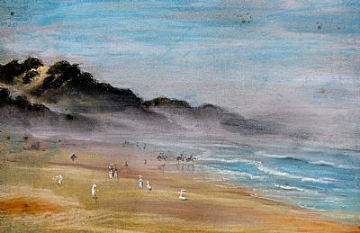
I don't know the artist of this pastel of Eastern Beach. It was in my father's collection. I managed to rid it of quite a lot of specks of mould and we then had it framed. If you look closely you will see several women in their Sunday best with wide hats on. Some horses with riders venture into the surf.
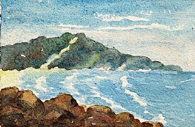
This is a tiny painting by Granny Maud Watson
With the removal of restrictions on the fall of apartheid, Eastern Beach became a mecca for those previously barred from it and on public holidays was mobbed by hundreds of thousands which overspilled into Marina Glen. Some even seemed to move in long term. Few of these people could swim and drownings have occurred. Hopefully over the generations, the population will become much more sea savvy.
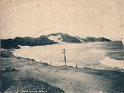
Eastern Beach with its magnificent sand dune. The label on this commercially taken photo notes it as "Nahoon Point, East London, SA", but that really only applies to the rocky outcrop to the extreme right. This is a natural beach, but erosion occurred up to the sands against the woody area to the left. The photo records the creation of a hard edge with infilled boulders to stabilise it. This eventually became the road we see today. I have left the circular pencil mark on applied by someone else. It seems to draw attention to the main dune. That signs is apparently about safety. It was to become replaced with signs about barring "non-whites" from the main sands.
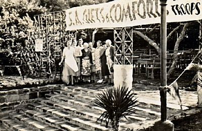
These are the steps leading straight up from the road along Eastern Beach into the Marina Glen tea garden. It was developed as a place to raise funds for charities. In this early photo it is aiming to raise funds to support the troops during WWII
If you walked through this area you came to extensive lawns encircled by coastal woods and an almost central section of woods. This was the area infilled when the small stagnant stream was straightened. That became the location of the "Smarties Train" run by the Round Table.
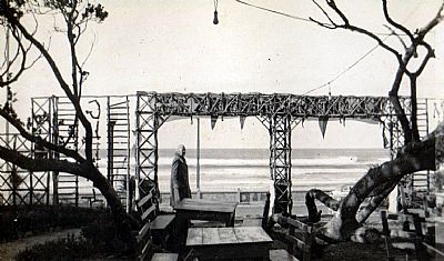
Looking back through the entrance with the beach beyond.
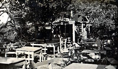
The tables, chairs and benches in amongst the coastal trees such as milkwood. Note the very large loudspeaker.
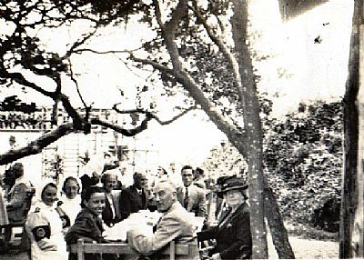
This looks like a specific fund raising event. Two nurses, with a military look about their armbands and epaulettes are joined by folk fairly formally dressed for a tea and a scone.
Bats Cave
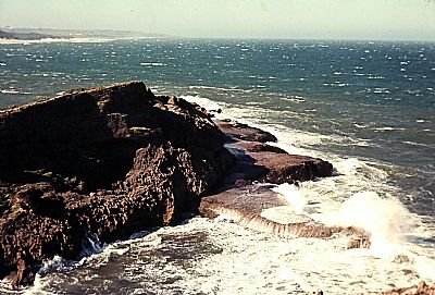
The stretch of coast from Eastern Beach towards Nahoon Point is very rocky. The basalt base layer is overlade with cliffs of crumbling sandstone. It is difficult to walk even with the worn and cut path, but it is rewarding. More so in rough weather when the waves come crashing in and throwing up great plumes of spray. But at low tide in calm weather one can clamber down into Bats Cave. I have only done so twice. The sea level has not always been suitable. I did not see any bats, but sand fleas abounded. If you went at certain tide and wave conditions you could watch the spray spouts as the waves rush in under the flat sandstone shelves which are eroded below and have some holes right through them.
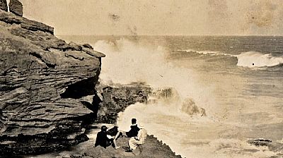
This picture was taken in 1934 and shows some family and friends just above Bats Cave watching the wave hit the rocks.
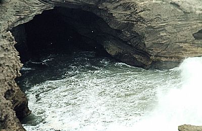
This is a photo of Bats Cave taken from roughly where the group are sitting in the photo above.
Nahoon Beach, Reef and Mermaids Pool
These are three different places, but directly entwined. Nahoon Beach is the best swimming beach and it stretches from Nahoon River down to where the rocks reach out to Nahoon Reef. Mermaids Pool is a tidal rocky area that forms a pool shaped area of water when the water is high, yet reverts to an expanse of round basalt boulders sitting over a sandstone base. An intriguing geological feature. You can snorkel here if the water is high enough.
Nahoon Reef is not a true reef, but the point of that same flat sandstone base layer where it reaches into the sea and inspires the rollers to rise up. The resultant swells create one of the world's best surfing locations.
I learnt to windsurf on the Nahoon River, but often came out to see from Nahoon Beach. There could be a breeze just perfect for good sailing out there, but towards evening it could drop to a beautiful stillness. Beautiful if you are NOT still out there windsurfing. I would sometimes get becalmed as the sunlight was fading and would have to swim the windsurfer back to shore through the swells, trying to avoid the sail, which would be underwater, drawing the mast in against the shallows and snapping. It was on such a becalming that I was very late getting home where I was to meet my girlfriend and found her distraught fearing some worse mishap. It was then that I knew that she really loved me. She is now my wife of over 4 decades.
I had learnt to paddle ski while still a student in Port Elizabeth and continued here. The reef produced really good surfing waves. Paddle skiiing is a sort of sitting down surfing with a paddle. I never really learnt to surf as such, but this suited me more as I did not need to lie on my asthmatic chest.
But if I wiped out I could not always get straight back on and could often find myself swimming after my ski which would be taken accross the boulders by the diminishing waves. By the time I retrieved it I would be scratched by barnacles and have the broken off spikes of urchins in my feet. I would spend ages that evening getting little bits of urchin spikes out of my feet.
This though was much less dramatic than the time I found myself within a relatively short swell with a really novice guy right in the way. This swell was shaped by a very large rock just below the surface. It created a good ride, but one that needed care. I could not avoid him and he did not appreciate the situation. I was then riding a very heavy locally made ski. Within seconds I had to try to avoid him, but all I could do was lift the nose of my ski. I hit him hard in the chest. We both wiped out. He was gone. I swam back to shore and recovered my ski, relieved to see that he had been pulled out and was being attended to. He looked bad so a friend and I had to drive around to the main beach to look for his wife. She drove a Beetle adapted with wooden blocks on the peddles because of a deformity. She took him to hospital.
I visited that night and found him unaware of my involvement at all or even quite what had happened to him. He had 4 broken ribs. But he was cheerful and introduced me to two other surfers who had injuries from the same beach on the same day. (He died a few years later from an unrelated ailment).
Mermaids Pool looking across to the main beach.
A similar view but from a higher vantage point. This was the Mermaids Pool carpark, before it was tarred. The main Nahoon Beach is beyond that rock outcrop. That has a carpark at each end, one just out of sight to the left and one near the river mouth.
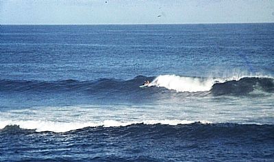
The surf on this day was not very big, but it was nicely formed and good for paddle skiiing. You can see how the swell drops in a hidden channel and rises again nearer the shore. That can lead to dumpers near the shore, which are not as nice to ride.
There is often a short but nice ride on a swell at this point which can rise steeply because of a large boulder just below the surface. This is the sort of swell that I hit a fellow paddle skiier on. It starts as something with little initial hint of its height or shape, but can develop into a crescent that encloses the unwary.
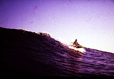
This is what it can look like out there. It may even involve hard paddling to get onto the steeper swell, but it can build up nicely.
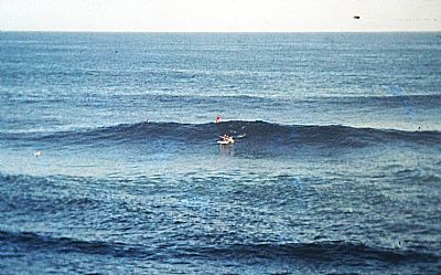
Look closely and you can make out a paddle skiier left behind the crest and one right in the foam as it breaks. Getting into the right spot to start a good ride is crucial.
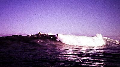
I am concentrating on paddle skiiers rather than surfers as that is what I did, but there would be lots of surfers out there too. Sometimes even an irritating Hobi-Cat or JetSki.
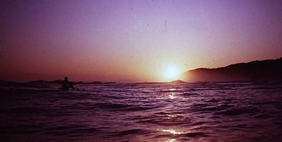
The feeling of being part of a liquid gold sunset is amazing. Here we see a paddle skiier waiting for that last wave before heading to shore. The sun sets through the light spray rising from the swells towards Bats Cave.
Although I had seen sharks while out paddle skiiing or windsurfing over these years, none of these sightings was at Nahoon. Sightings though of sharks was fairly common, but surfers (whose legs dangle in the water, unlike what I did) were nonchalant about it. Divers used to say they saw small sharks here regularly. However Nahoon has had its share of attacks. See https://sharkattacks.planetdeadly.com/attack-3629, an instance of a fatal attack here.
Nahoon River
As kids we had easy access to the river from our house in Pembroke Place where we had moved to from Baysville. (We moved to Selborne in 1964). We were sea scouts from about that period and set out in canoes from the scout hut above the river. My father made us a similar oiled and painted canvas canoe so we were able to trundle down there whenever we wished. As scouts we rescued families sometimes who had been caught by the cross wind in rented canoes and had been stuck on the other side. On one occassion this included a mother with a toddler when their canoe had sprung a leak.
Early canoeing outings would take us upstream past the Nahoon Bridge all the way to the weir at Abbotsford and even a bit beyond. We would pick prickly pears - a difficult thing to do. And then take them home for de-prickling - another difficult thing to do.
In later years I would drive down there to run the dogs on the sands. At low tide the sands were extensive and an easy place to park or launch a boat from. Sometimes we would see cars stranded out in the water as the tide came in. Then one day that happened to me. It is surprisingly easy to forget one's car when the weather is great and a walk around to the main beach has been a great distraction. The sand goes oozy when soaked again, but I managed to get my Beetle out reasonably easy without help even though the tide had risen to halfway up the wheels.
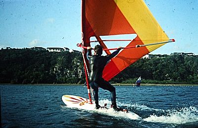
In later years I learnt to windsurf here. (Strictly speaking this is sailboarding - a Windsurfer is a trade name). It is easy safe water. The only problem being the odd gusts of wind as it channels down between the high ground on each side.
This is not me, but a photo I took of someone else. When I was a child, there was only one farm house up there on the ridge. Today Beacon Bay is a capacity developed suburb.
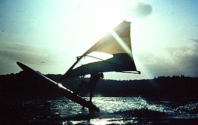
Another photo taken by me of a friend. Even on relatively flat water it is possible to become almost airborne if the wind is strong. This copy has lost its colours, but the original appeared in a windsurfing magazine.
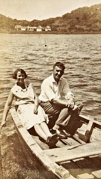
Bonza Bay Beach / Quenera River
The alternative spelling of Quinera is sometimes used.
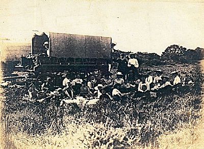
How is this for a family trip to the beach. It is labelled (by my father years later) "Quinera River - 1904". How many students can you stuff in a Mini was a popular fund raising stunt in the '70s. Here we have 26 family and friends out travelling to the mouth of the Quinera River. I think the shack was already there, but some of them would have camped. (Some old photos show a bell tent alongside the shack).
"Bonza" was inspired by the Australian slang for "brilliant". There is no bay here, but the two words ring well together. A village known as Bonza Bay grew up on the west bank, intitially almost all of beach cottages. The east bank remained comparatively wild. The family would make the trek by wagon to a cottage on the west side that was owned by o'Gorman who Alex R Watson had been in partnership with. See FAMILY HOMES OF ANCESTORS (I don't know if Alexander my paternal grandfather had shares in the cottage too). My father would refer to "the shack" and there seems to have been a smaller, perhaps older, building here too that our family used.
I have a lot of photos of the beach and the river. Someone in the family was keen on photography and enjoyed the opportunities of such leisure time.
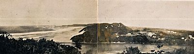
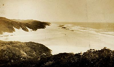
While the cottages were set on a flat grassy area on the east bank, the surrounding area was heavily wooded, mainly large ancient coastal dunes, inland of which stretched bushveld. This double photo was taken from a vantage point up one of those hills. The cottages on the east bank are just out of sight below. What is more prominent here is the large wooded dune on the west side of the Quinera River, behind which we can see cottages of the fledgling village of Bonza Bay.
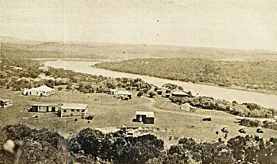
This photo was taken from the very high wooded dune on the west side of the Quinera River. In the foreground are the sparsely and casually distributed cottages that were to become the village of Bonza Bay. The river winds into the distance. There are reeded tidal mudflats at the first bend. Going upstream we then find the lower slopes of what was to become Beacon Bay (which was to subsume Bonza Bay). We built our own house just to the right of that bend.
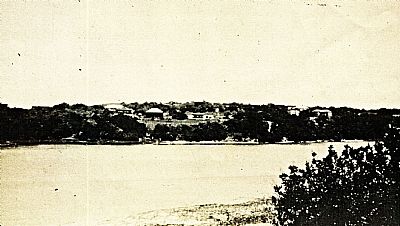
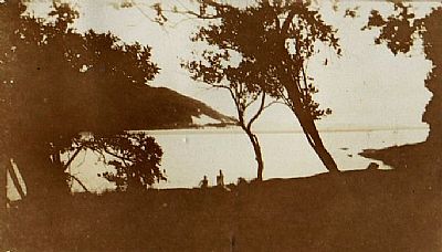
A view of "Bonza Bay" on the west side from the area of the shack on the east side.
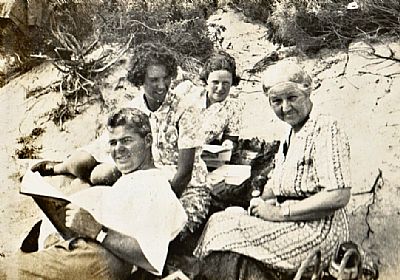
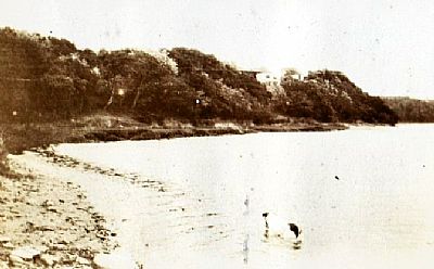
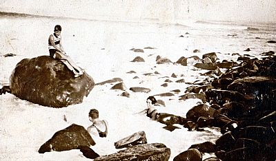
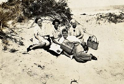 This appears to be the beach a short walk from the Quinera River mouth. The river is just out of sight. (Bonza Bay is across the river). That is granny Maud Watson with the thermos basket. I don't recognise the others.
This is the same place with the same group, but the photographer has moved.
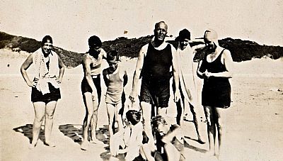
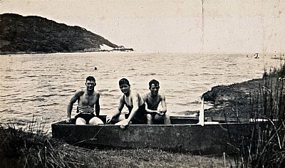
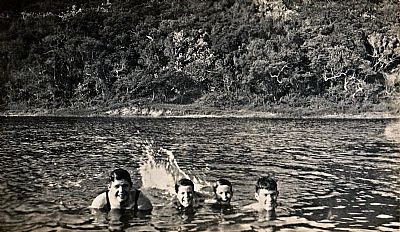
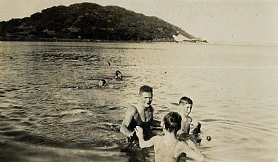
Two pics of family and friends who have walked from the Quenera beach cottage to swim in the sea.
This and the 3 pictures below are labelled "Quenera - Xmas 1930-"
A view back up the coast from the high dune on the Bonza Bay side. The river often closes over. Here we see it shallow at the mouth but open.
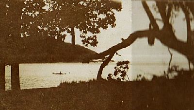
Here is the river mouth as seen through the trees. A small canoe has children playing around it.
A similar view to the one above.
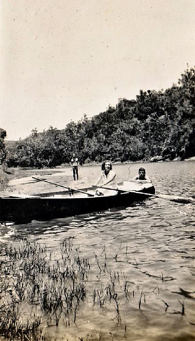
Boating in the estuary. The forested coastal dune stretch beyond. The Quenera is a shallow lazy river that only flows properly after good rains. This results in the mouth blocking up with sand. While it can be fun to watch it break through sometimes and play on the resulting collapsing banks, having it full like this offers great opportunities for swimming and boating. The downside though it that it can become a little stagnant.
Boating on the Quinera estuary. The cottages on the east bank are visible in the background. What began as a grander than normal cottage by this time has rondavels added to it. "Our" shack is somewhere there too. This is labelled "Joan & Mick". But where are the oars?
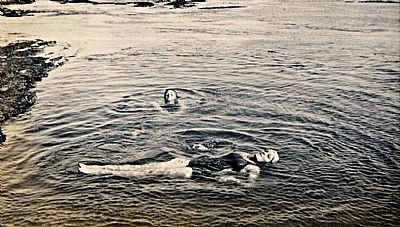
Swimming in the estuary. This appears to be looking towards the Bonza Bay side. This together with the photo above is labelled "A few Watsons".
This picture is labelled "Spottie" a fox terrier which you can see in the foreground. A few of the first house (on the prime sites) peer out from the coastal forest towards the river, hinting at the growing village of Bonza Bay behind them.
These two pictures were taken on the "upper reaches" of the river. This looks a little beyond the island. The water level looks lower than when some of the photos of the river mouth were taken. Mud and some rocks have been exposed. Across from this point the banks rise steeply in densely wooded cliffs. This scene is a little upstream from where we built our house. HOME ENVIRONMENT BEACON BAY / HOME IN BEACON BAY. This picture is labelled "Aunt Rose in the REACHES of the QUINERA RIVER". I think this was Rose Newman, my father's aunt (nee Mockford).
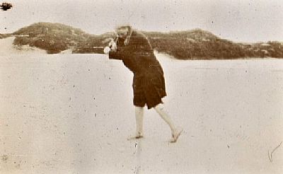
One of the family practices her golf swing on the beach.
While others cavort in the surf. This and the photo above are labelled "Quinera - Xmas 1930".
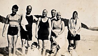
These two photos are labelled " Graham, Hinds, Quentin B-Smith".
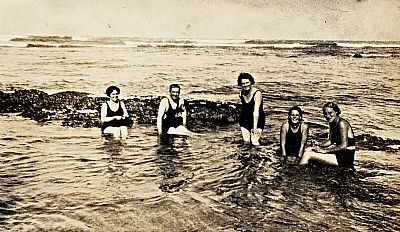
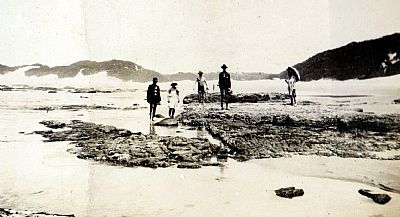
I think this is another picture of the beach at Quinera along from the river and further up from what we call Bonza Bay. The main swimming is in the surf on the west side, but they have simply enjoyed this opportunity. Tidal pools like this only become suitable for wallowing if the tide is just right. This photo is labelled " Aunt 'K', Uncle George, Aunt Clarissa, Lynette and Bobby".
Aunt Clarissa is NEWMAN, CLARISSA MARY KIDGER, Lynette is probably Lynette Daphne Blue, my great uncle's step-daughter.
This picture is labelled "Brian & Lynette". Brian was my father while still a teenager. Lynette as noted above.
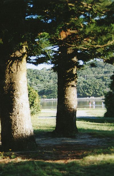
The cottages of that era are long gone, but the Norfolk Pines planted back then have matured and create a good reference point.
Gonubie
The next beach up the coast eastwards is Gonubie. This, then independent, town stretches along a rocky coast to the Gonubie River. A great beach sits below high dunes, somewhat constricted by them at high tide. A tidal pool offered an alternative and a boardwalk enables access from the carpark to the sand.
I windsurfed in the bay sometimes, but it could be awkard sailing. This was where I had one of my shark sightings.
I remember as a child seeing fishermen use kites to get their lines way out into the bay, the intent being to catch sharks.
My girlfriend / wife to be lived for a while in premises overlooking the river. We were to later rent a house in the sprawling suburbs just a short stroll from the rocky shore.
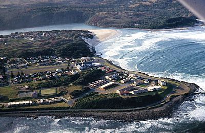
I took this picture from a light aircraft. It shows the rocky promontory with the river beyond. You can see how tight the beach is below the wooded dunes.
Kwelegha Beach
Kwelera, or Kwelegha (the ‘r' is pronoucned as a ‘gh' as in loch), comes from the Khoi language and means place of aloes (the Eastern Cape's emblem).
Under MILLER JOSEPH we find a reference to Joseph Miller being granted land “beyond the Fish River" and also to Kwelegha. I suspect that these are the same place even though Kwelegha is south of the Fish River. I certainly know that the family enjoyed trips up that way in the days of mule or ox drawn wagons.
There are sandy beaches at Kwelegha, but the sea tends to overrun them at high tide. Here we sea some of the family swimming in amongst the boulders. Its a bit rough and they were presumably being bumped about. Still worthwhile on a very hot day.
I once went paddle skiiing there. The drive takes some time to get there. The road reaches the east bank of the river, a suitable place if you are a fisherman as this is rocky. But I wanted to get some waves across the river. First I swam the two dogs, Flotsam (Flossie) and Jetsam (Jet) across and had some fun. I then took them back to the car and took my ski across. The suitable waves were out beyond the rocks much like in the photo above. This was a heavy locally made ski (before Kola produced his superior ski). I had attached a VW seatbelt as the buckles don't rust. Well they do corrode. After a few successful waves I found myself upside down in shallow water and not able to release the buckle.
I eventually wriggled out and then had to get to my ski which had washed further up towards the sands.
I was injured by the barnacle encusted rocks just below my left knee. I put my hand down to feel the wound and my finger went in a bit. I called an old angler on the shore for help, but he could not carry my ski. So I dragged it back to the river, paddled accross, got it onto the roof rack, and drove all the way home to Selborne. I got the dogs insid and went to A&E. After nearly an hour I was attended to by a Dr Castro. I had a dramatic bandage for a while and a story to tell my fellow paddle skiiers when I eventualy got back to Nahoon Reef.
Morgan Bay
Stretching up the coast roughly north-eastwards are qutie a few other great beaches. The Kei River delineates for us here a point to limit our discussion here. One of our favourites was Morgan Bay.
Morgan Bay takes its name from A.F. Morgan who was Master, of the Royal Naval ship:' Barracouta'. This ship was used in the survey of this Coast of South East Africa in 1822, under the command of Captain W.F. Owen. Then on the 26 August,2022 it was announced: “There was a need for the name changes as this is part of a government programme to transform South Africa’s heritage landscape. The names of places we live in reflect the identity and cultural heritage of the people of South Africa,” said minister Nathi Mthetwa. [SA History website]
We visited quite a few times; once even camping - with a Corgi!. (My parents adopted dog). The estuary and beach are wide. The coastline rises dramatically nearby into high cliffs.
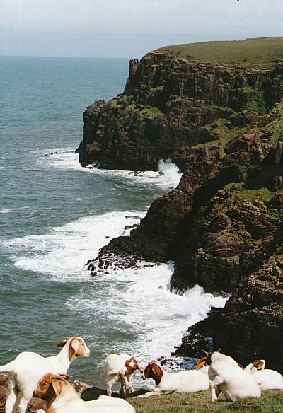
Goats enjoy the view too. Fresh sea breezes.
West Bank
Unlike the coast stretching eastwards, the coast in this direction is very rocky for quite some distance. Our family would take drives out there on weekends for something to do. If we chose this over the other beaches it was probably bad weather so my memories are of it being a little severe.
We would still clamber over the rocks or try to catch muddies rockpools. On one occassion I standing on a flat rock when I wave grabbed me. I hung onto a vertical rock next to me with my fingertips and was drawn backwards horizontally, but then released, soaked. I had learnt a lesson. My parents didn't blink.
The surf can look more drammatic than it really is. As a wave rushes up and hits a vertical surface it compresses. Some splashes up, but the force is dissicpated.
There are other nice beaches westwards of here.
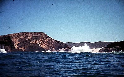
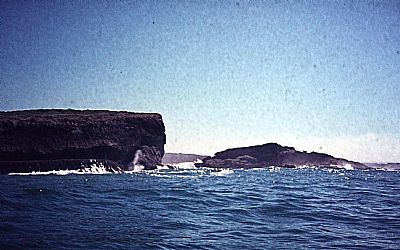
Cove Rock
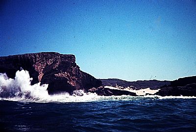
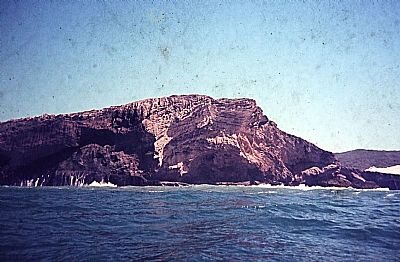
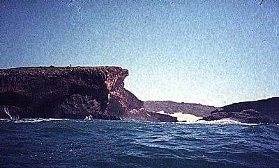
Cove Rock is an extraordinary sandstone outcrop anchored in the sandy shore, but penetrating into the surf. It roars as the sea rushes into the cavenous lower part pushing up plumes of spray. It is unsurprising that it was held in awe by the local indigenous population who believed in it being inhabited by ancestors and water spirits. It was also imbued with the power to rid the country of the white invaders.
To the family, it was a place to walk to and explore.
I once managed to persuade the owner of a small plane to take me up so that I could take photos for a project I was doing for the Wildlife and Environment Society. This is such a view of Cove Rock.
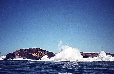
I took this picture one windy day from one of the summits looking back towards the other. The West Bank of East London is in the hazy distance.
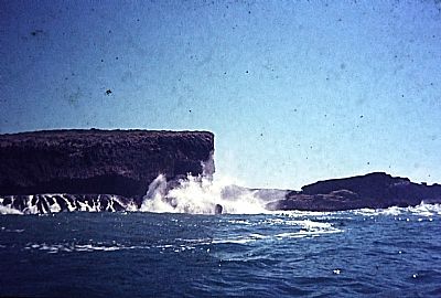
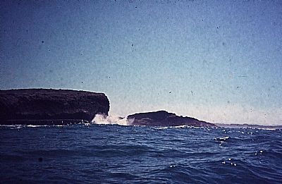
I used to have a waterproof camera and a paddle ski. It is essential to have calmer weather to visit Cove Rock from the sea, but it is rewarding. The following photos were taken with slide film. They have gone mouldy over the years, but were copied to digital and cleaned up a bit.
Gulu
Gulu is further down the coast. A nice estuary and a beach. I once rode my bicycle down there and stayed over with my Wells cousins who had their caravan with them. We borrowed a rowing boat from the campsite and I endevoured to row us teenagers up to the far end of the navigable part. In spite of having rowed with the school rowing club, I found the fixed seat and basic oar arrangement difficult against the breeze and lightly choppy water.
I do not know who these people are, but I have included this picture as it shows a lifestyle. Beach cottages could be quite substantial and most had verandahs. Getting to such places was not as easy then as it is now due to the gravel roads. Friends would invite friends to visit.
SOUTH AFRICAN HISTORY ONLINE : https://sahistory.org.za/place/morgan-bay-gxarha
