
Terrae Incognitae Imagined
For a long time much of the world's landmass remained unknown to Europeans.
So they picked up clues from their experience of the natural world and traveller’s tales and combined them to imagine what other lands might be like.
The Daily Migration of the Sun
The sun's apparent daily journey across the sky from East to West has always fascinated our imaginations and produced endless myths.
The Golden West : The Occident: El Dorado
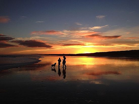
Photo: Iain C. Stewart
It is not really suprising that people on the Atlantic seaboard of Europe dream of far off places beyond the setting sun with wealth beyond their imaginations; a place of unfettered autonomy and, more altruistically, of a better life for their children.
The Mysterious Wealth and Power of the Orient
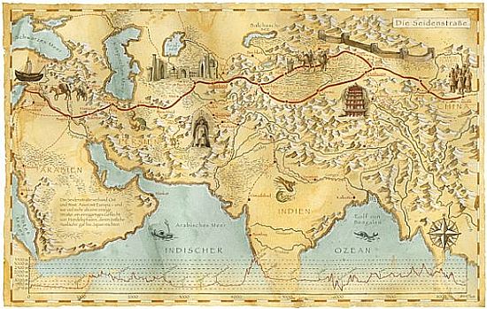 Ferdinand von Richthofen's map of the Silk Road 1877. Goods would be traded from the Levant coast right across Europe.
The lands of the rising sun - the Orient - were more of a challenge because their ancient and established civilisations were already quite well known and powerful.
Valuable products of the East had been carried by trade caravans across Asia into Europe for many years creating an image of a territory that was challenging, intricately mysterious and exotic which became the staple European view of the East.
The costly perfume that was poured out lavishly to anoint the feet of Jesus is believed by some commentators to have been imported from Nepal for example. Beautiful silks and brightly coloured textiles began to adorn Europe’s aristocracy. Most of all, Eastern spices which were food preservatives delayed the deterioration of food so were in demand to complement the use of salt.
It was also in the East that European governments and merchants first fought one another to the death for this valuable wealth that was attainable by both land and sea routes.
Are there indicators of Strathspey’s involvement in this early medieval trade that someone has already investigated? There are certainly many later ones.
The momentum of the Winds of the North and South and a Frozen Wilderness
Our perceptions of the North and the South, Boreal and Austral regions, reflect travellers’ tales about the powerful winds in these regions and also of a frozen wilderness totally inhospitable to humanity.
Because winds in the South Atlantic, literally circumnavigate the globe with nothing to modify their force it is not surprising that square-rigged sailing ships from Europe did not venture there.
As a result Australia, Tasmania and New Zealand came to European notice so much later than the rest of the world.
They are totally missing even from some 17th century maps and left as “Terra Incognita”.
No wonder some people imagined that there were down-under lands where people walked with their feet in the air or perhaps backwards - the Antipodes.
Yet some folk had obviously travelled and settled there from the great belt of islands in the Pacific long before Britain turned Australia into a conveniently distant penal colony.
Early European short-term sojourners were much less likely to make the very long journey there until gold was discovered.
Indeed, Scottish free settlement only began seriously in the 19th century largely because of the distance and the dangers that the very long journey involved.
The bravery of the pioneers who did travel there from this part of Scotland is astonishing. New Zealand and Australia soon became a favourite home from home for many Scots from this area.
The South Seas
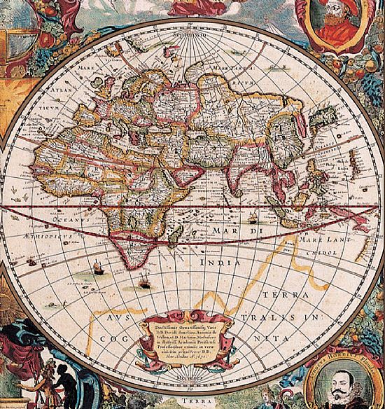
As a result of such lack of knowledge, what was called the “South Seas” territory originally referred only to the Atlantic coast of South America where colonies might be set up, though the ocean is confusingly referred to as the North Sea on the Bleau map below of 1632.
It was to be some settlement proposals in South America that were to be the cause of the major share-trading fiasco known as “The South Sea Bubble”.
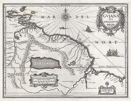
There are some accounts already published (which will be referred to in the mini-biographies) of people from Strathspey and around in Guyana and as far south as Patagonia but there is a great deal more shared history to be uncovered I am sure.
Darkest Africa
The huge landmass of the African Continent has evoked multiple sterotyped images of peoples and places.
Much of the coast was accessible from Europe quite early. Indeed mighty North African intellectuals, like St Augustine of Hippo, partly created that same “enlightened culture" that we have exported round the world as “European civilisation”.
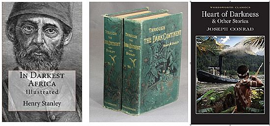
Perhaps our strongest popular preconception of central and southern Africa can be attributed to the works of David Livingstone, Henry Stanley and Joseph Conrad.
or Africa - Land of the Sun and prolific "Big Game"....
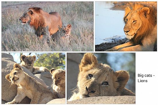
African lions soaking up the sunshine. Photo Fiona M. Stewart
What has been called the “scramble for Africa” by European powers in the late nineteenth and early twentieth century also created a legacy of confusing identifications derived from our dreams of imperialism, gold, diamonds and prolific wildlife.
Scots from hereabouts are certainly part of all those perceptions in action.
Suggested further reading:
If you wish to explore these topics of the way we mentally shape the unknown you might like to search on the internet for terms like “mental mapping” and “mapping national stereotypes”. You will find some very clever and some very amusing approaches as well as some serious political and psychological ones.
Denis Cosgrove: Apollo’s Eye: A cartographic Genealogy of the Earth in the Western Imagination John Hopkins University Press, Baltimore 2003.
An essay on ibraaz.org. written in 2014 by Walter D. Mignolo: "The North of the South and the West of the East : A Provocation to Question". We cannot escape the political aspects of migration which have always been an integral part of the story but our entry into both debate and action surely needs great caution.
Alessandro Scafi: Maps of Paradise University of Chicago Press 2013 is a delightfully illustrated analysis of the way people have tried to map their imagined “perfect homeland”.
