
HARBOUR MEMORIES
Early days
The harbour began as simply a safe landing for tenders from ships moored off the river mouth or for only the small craft to enter. It was sandy, as most east coast rivers are, and the tides had a great impact on access. Gradually, excavations and dredging enabled ever larger ships to enter.
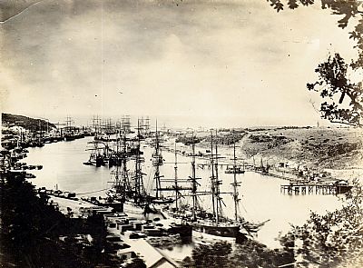
A busy time on the river port with several sailing ships. Some downstream may have the dual benefit if coal and sail. Quayside facilities were still limited and a few are moored together in the middle. The use of the quayside and the jetties would have incurred further port charges so would have been kept to a minimum. That is the sea in the distance.
I have never quite got my head around the processes of getting sailing ships into such constricted ports. They would not have been able to remain under full sail all the way and would have depended on the tidal flow to some extent. As steam power developed, some would have had used it as well as sail and used it here. Steam would also have allowed the use of early tug boats. Only very small sailing ships could have had the extra use of manual oar manipulation. And on leaving the ships would have needed to have been turned around.
Family connections
A significant family link to East London Harbour on the Buffalo River can be found under the family story of Alexander Watson, my paternal grandfather. He had bought the hulk of a cargo ship using it to transport coal from Natal to East London. WATSON, ALEXANDER RICHARDS While it does seem to have been able to raise some steam, (it was carrying coal afterall), it was otherwise unable to progress on its own and required the assitance of a tug. Anyway this gives me a feeling of a connection to this harbour.

That is it to the right, a permanent list to starboard and a tug to pull it.

Even when docked, the list is evident. Was this to do with the mechanics or a badly loaded cargo?
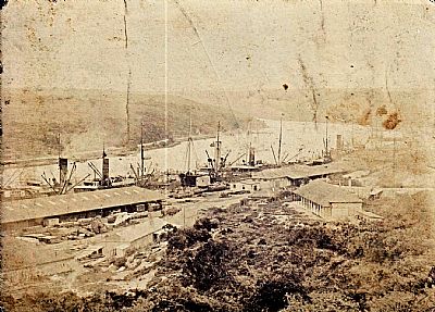
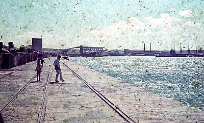
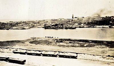
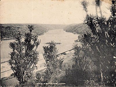
I can't find the date of this photo, but it is of great interest. It is from Signal Hill looking upstream. You can see how narrow the harbour was. There are no bridges across the river, but you can just make out the pont.
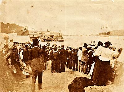
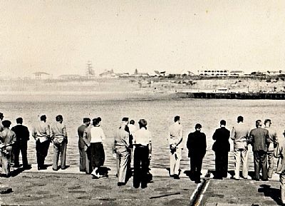
I don't know the event here, but think has something to do with dignatories being disembarked from thr larger ship via ferry. There is a Royal Navy Flag flying. Note how dressed up everyone appears. There are some black folk in the crowd. Nothing unusual in that today. The one in the foreground is smartly dressed and has a bowler hat.
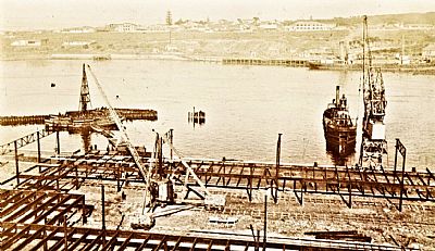
Looking across from Signal Hill towards the West Bank. There is already a small indent into the west side to facilitate turning of ships, but the turning basin as such is only just getting under way.
Ship wrecks
Ship wrecks were not that uncommon along this coast, but to have a ship beached right there on the Orient Beach would have been quite a sight. This beach was named after a previous ship aground here.
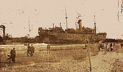
This photo comes from a postcard (commercially produced photos were often made into postcards). It is a bit damaged so I have cleaned it up. It shows the Galway Castle stuck on the Orient Beach. She was beached here in 1917. She was painted a war-time grey and had anti-submarine guns emplaced on her poop deck.
GALWAY CASTLE was built in 1911 by Harland & Wolff at Belfast with a tonnage of 7988grt, a length of 452ft 4in, a beam of 54ft 4in and a service speed of 13 knots.
Similar to the Grantully Castle she was the last ship to be delivered before the company was taken over by Royal Mail. In August 1914 she was requisitioned as a troop ship for deployment in the German West Africa campaign against Windhoek.
After the German colony was taken over by General Botha in 1915 she reverted to commercial service as the only remaining Union-Castle vessel. On 3rd August 1916 she was attacked by a German bomber near the Gull lightship but the bomb, although scoring a direct hit, failed to explode.
She went aground on the Orient Bank at East London on 12th October 1917 but was refloated five days later without any damage. .[Bandstaff Register]
East London has seen several wrecks along her coast including some just off the Esplanade.
Ship watching
Watching the comings and goings of ships is a popular pastime in East London, more so here than in many ports as the Esplanade offers such as good view. The breakwater was built as a ulitilarian protection against the Indian Ocean; the Pier by contrast was very much a public facility with projecting seat enclaves for views. An extension of the promenade of the Esplanade. Both breakwater and pier work together to guide the natural flow of the Buffalo River to aid in flushing the silt clear and reduce the need for dredging.
You will find more about 4 Seaview Terrace which overlooks the sea from a good high vantage point under FAMILY HOMES OF ANCESTORS There are some photos of ships from there too.
The local newspapers would give schedules of ship time-tables. There was even a record of passengers at one time and you can find these useful resources for tracing ancestors as I have done with some. The newspapers would naturally highlight any ships of particular interest.
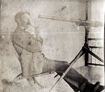
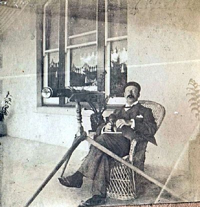
These two pictures show someone watching the ships from 4 Seaview Terrace. I understand that this is "Uncle Put". In other words, Angus Miller Newman, my father's Uncle's cousin's husband, husband of Clarissa Newman.
A mailship leaves port. To the bottom right and centre foreground are guys looking for bait or food on the rocks. Look even closer and you will notice 3 white robed figures on the rocks nearer the sea. These are like to have been a black religious group undertaking a baptism. Their choice of the rock pools is curious. I have seen a few of these ceremonies, but on beaches. Participants are dumped under the breakers amidst prayers and singing.
I don't know who took this picture, but it is an interesting ship seen off East London.
Another two-funnel ship. This time a mail ship. That is the Beach Hotel to the left with Cadwallan Road running down at an angle between it and 4 Seaview Terrace.
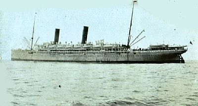
Mail ships
As the name suggests these carried the mail around the world. Note the reference to the Royal Mail in the description of the Galway Castle above/ They served Royal Mail within and between the British Empire. Those that served South Africa were run by the Union Castle Line and all their ships were named after castles. They soon took on other roles too becoming a popular passenger service as well as carrying some cargo.
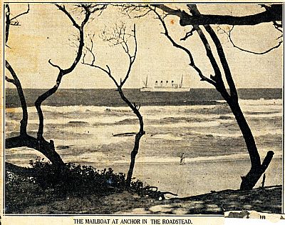
Unfortunately there is no date on this cutting from a Daily Dispatch. It simply notes "The Mailboat at anchor in the Roadstead". An interesting one with four funnels. Judging from the trees it appears to have been taken from Marina Glen. Ships would need to wait in the "roadstead" if too large to enter the riverport, or the weather was bad, or they wanted to save on some of the port duties. (This is still done). Before the port was made more readily accessible to ships, passengers would be fetched by a lighter. Transfering from one to the other would have been with a large basket on a winch.
[The other side of this cutting has short pieces on various fashion subjects : "Curious Evening Wraps There are many evenings in South Africa when a light fur wrap is a welcome adjunct to the evening toilette....." / New Frocks in Cochran Show "Anything Goes".... / ...So much for London ideas. In New York the have other ones. The have just held there a convention of the National Hairdressers and Cosmetologists' Association, and it seem that the American experts have decreed elaborate coiffures "with as many parts as possible forming triangles and other geometric figures" / "CHARS DRESS BETTER....].
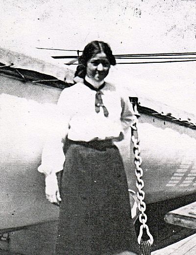
A young Ella Maud Newman, my father's mother, poses next to a lifeboat aboard the Walmer Castle in 1900. (She was to marry to Alexander Watson eleven years later).
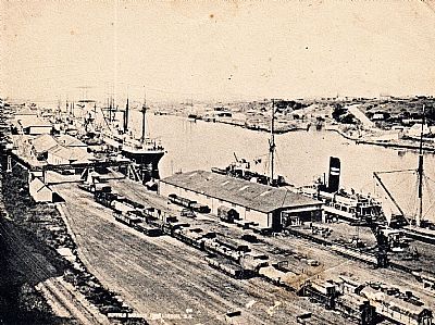
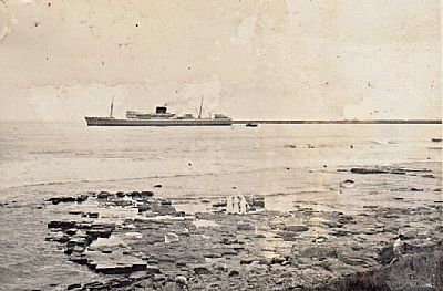
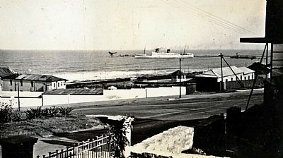
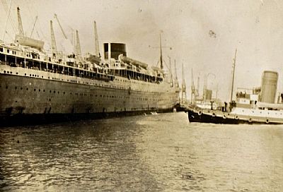
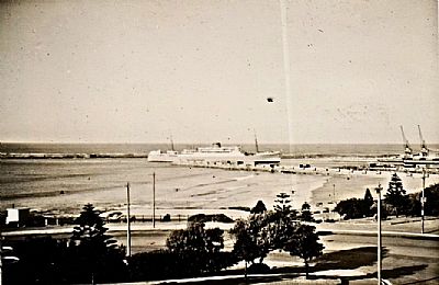 A typical scene with a mailship arriving in port. The Orient Beach is this side of the pier.
My maternal grandparents Nana and Da did a trip by mail boat. Possibly just to Durban to see the Wells family. Later Nana did some trips to Europe with her friend Madeleine whose daughter had married a Dutchman. Some of our possessions date from this time.

Travel to and from England was always by ship. South Africa was well served by the Union Castle mail ships which combined some cargo with passengers. I do not know the ocassion, (it may have been a local trip up the coast), but my mother and I have come to see them off. And of course my nanny came too. She was known as Tiny. I spent much of my early youth tied in a blanket to her back.
The Union Castle Line mail ships were considered passenger ships, but as the name suggests were also cargo ships, a role which included the mail. These were to be supplemented by Safmarine in partnership with them. These were not actually cruise ships as they did not primarily serve the holiday market. We used to see Nana off each time and wander onboard to do this with minimal security. And in about 1969 my parents and I did a trip to Cape Town (My brother P was involved elsewhere). The trip down was on the Pendennis and the return on the SAS Vaal. On the trip down I was put in an inside cabin with an intoxicated man, but we had dinner with the captain. Evening entertainment was a film running in the corner of the lounge area.
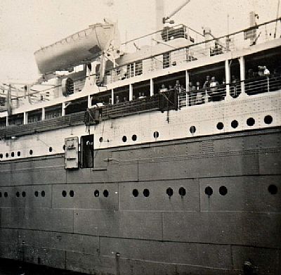
The family of the past and then when I was young would enjoy watching the ships come in and out. It was particularly entertaining to see the pilot boat drop off or collect the harbour pilot whose local expertise ensured the safe procedure of each vessel. (To the landlubbers of you readining this, this is a standard requirement in every port world wide.). Here we see a door open with the rope ladder about to be lowered to collect the pilot. This is a mail ship (as noted by the grey sides (actually a mauve-grey). Note the heavy lines of the metal ship construction.
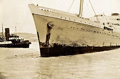
Two views of a grubby looking Cape Town Castle being escorted from East London harbour by tugs.
Tugs were so much more integral with the workings of harbours than they are these days. Most modern ships now have side thrust capabilities and hardly need them other than as a safety precautions in difficult weather or constricted ports. But back then tugs were essential to turn ships and to get them into the quayside. East London had its own set of powerful tugs. When we sailed on small yachts out from the East London Yacht Club based at the mouth of the Buffalo River we would sometimes intentially sail across the wake of tugs for the shear fun of the sudden side movement.
It was also amazing to see ships from down at water level. The bows look so amazingly narrow; sharp, exaggerated by the looming shape above you.
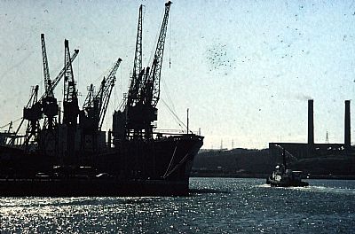
The docks
We would often visit the docks and simply drove in. Security back then was minimal and customs or harbour police usually only coming on duty if particular ships were loading or unloading. I have a memory of watching the maize bags being hoisted overhead on large nets. Even a car. My brother P caught my eye. He was also peering above while walking close to the quayside edge not watching where he was heading, but I stopped calamity in time. Public health and safety was hardly considered then. Alls sorts of products were lifted above us in nets or on pallets by cranes that were prone to move with just a brief cautionary hooter blast. We were dwarfed by the cranes operating above us and needed to watch out if they moved. This was still long before RO-RO and containerisation.
An interesting feature to visit was the grain elevator, a very tall cluster of linked concrete towers. Great views from the top. Many, many stairs up. That is now defunct.
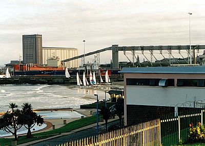
In this picture you can see the Orient Beach named after a ship that grounded there a long time ago. In the foreground is part of the beach complex designed by my father. The beach itself was created by the sand collected on the leaside of the pier. Unusually there are some Hobi-Cat yachts on the sand, but just beyond them you can see the tops of sails of other small boats where the main yacht club is. Looking beyond that is the grain elevator with its raised conveyor system and silos. A large cargo ship is berthed alongside that. The open sea is to the left.
Beyond that the main breakwater curved out into the sea to protect the harbour mouth. This worked very well, but a sandbar formed out from its extremities, in turn exacerbating the incoming waves at this point. That makes for an awkward approach by ships of all sizes, particularly in rough weather - the treacherous on “bar”.
A popular spectacle was to watch the ships leave port. It has caught many a ship, as has the swell outside of the wall. The remnants of a dredger remain there. Anyway it makes watching the pilots jump from pilot boat to the ladder and back something rather exciting. My Watson predecessors had done so before me from their house on Seaview Terrace. And Granny, Maud Watson, had not only used the early hoisted basket for passengers between ship and tender, but had crossed the river mouth on sand at low tide before it was properly dredged. The dredging became necessary as larger ships could not come in.
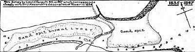
I wondered how on earth Granny could have crossed the river by wagon, but here is the answer. This is a map from SA Railways and Harbours Magazine of 1914 made available through the Soul of Railway article (link below). That squiggly double dashed line between the sandbars is a "wagon track". It actually passed through shallow water. Other maps show that wider sandbar covered with vegetation at low tide so it would have been relatively stable.
The smaller breakwater or pier on the leeside was built to control the natural river flow so keeping a reasonable water depth in combination with the main breakwater. It also served as a public facility complete with lookout points and seating. Gun emplacements were installed during WWII and the bases can stilll be seen. It is popular with anglers and those waving to ships entering and leaving. This pier created the Orient Beach as sand accumulated. It has had its own share of shipwrecks, but is a popular beach.
The exact locating of such a pier was influenced on an understanding of the tides, onslaught of breaker and weather and the river flow. If you look at the rocks below the Esplanade you will see beacons that are used for guidance of ships including the dredgers. You may also notice what appear to be abandoned bits of concrete works. These were evidently trial positions for the pier. My mother used to proudly tell us of her Wells father saying the experts had got it wrong, but that he ad advise them (presumably in the press or letter) as to where the pier should be located. Of my ancestors, he was the probably the least likely to undertand the technical requirements, being an electrical engineer and not having had the closer experiences with the sea as my Watson family did.
A much transformed harbour as seen from the top of the grain elevator.
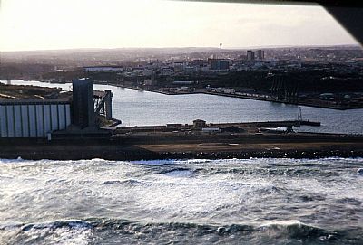
I took this from a light plane in the mid-'80s.
Containerisation completely changed the naure of cargo handling and therefore also the cranes. And Ro-Ro changed the need for them for some cargo types.
The breakwater
The breakwater was extended at one point to increase the protection from the rollers coming in from the Indian Ocean. When walking along it one appreciated the force of the sea very closely. The waves could break right over it onto us. The wreck of one of the dredgers lay alongside, constantly poundered against the wall. The wall itself was built of very large concrete blocks set on rocks dumped into the sea. As each roller came in the water would rush bewteen the them and up through the holes left for setting them in place.
One of my mouldy old slides. This one shows families wandering down the breakwater on a Sunday afternoon. The rails are for the permanently stationed crane.
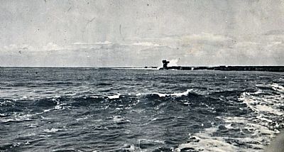
Sometimes the sea at the harbour mouth looks treacherous and sometimes as in this picture it is deceivingly flat with just a small ripple up to the shore. It depends on catching a gap between rollers. The photographer on this occassion was instead trying to catch the waves on the bar at the end of the breakwater. You can see the enormous Titan Crane used for building and repair of the wall engulfed by an enormous wave. Ships coming and going would need to go around the worst of the swells across the bar.
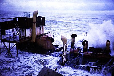
This picture was taken on a walk along the breakwater. The large dredger is stuck against it, ironically right at a beacon. We were to see this same ship in reduced scale as it slowly succumbed to the forces of the sea until only that mast stuck out from between the dolosses.
Not much left'
A story probably more legend than reality, but believed by many locals is that of an angler who got swept off the wall to seaward, yet found himself on the lea side having been sucked through one of the larger gaps by the force of the water.
The turning basin
There being no other sheltered mooring around, the Buffalo River was opened up. The aforementioned breakwater and pier guided the natural flow of the river to ensure a reasonable gouging out and suitable draft, but regular dredging was still required to keep the accumulating sand out. As the harbour grew in importance and use, it needed to be dramatically widened and a turning basin was formed. We were taken out of primary school that day to witness the remaining rock being blasted from the basin. The dockside facilities have subsequently been dramatically added to by Mercedes – Benz's facilities for export.
The turning basin took years to create. Here we see a dredger working close to the west bank. The river has already been widened a bit, but there is a lot still to do. The east side was still being widened too. Railway trucks have been filled with rubble and await being moved away.
Here we see the turning basin on the east side more developed. One of the harbour cranes for the quayside is already in place and is assisting in the construction. There is a works crame to the centre left as well. The structural skeleton of the dockside warehousing is seen in the foreground. A dredger is at work and a small tender can be seen off the remaining earlier jetty to the left. That jetty has two barge type boats tied up with some sort of link of small pontoons too - all facilitating the works. A cargo boat is tied up on the west side.
In both this and the picture above we can see the suburb of West Bank. A prominent feature is the imposing Norfolk Fine.
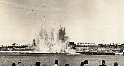
A large area had been excavated between the water and the suburb of West Bank. That in turn had been dug down to the required level of the intended harbour turning basin suitable for large ships. A narrow band of rock remained and then on the allotted day, that was blasted which you can see in my father's photograph. It was then up to dredgers to remove the resulting debris. This photo is labelled "The Big Bang Buffalo Harbour 12/5/60".
Seconds later and the blast wave crosses the harbour; dust, smoke and spray rise above it.
The Grain Elevator
Enormous concrete silos were built on the ground gained by the infilling at the base of the breakwater. Grain was transferred to and from these using a large system of chutes and conveyor belts.
What better place for a view than at the top of the silos. Below is a ship being served by the conveyor belt / chute system. The turing basin is immediately adjacent to this.
The dolos
We used to employ an excellent draughtsman called Aubrey Kruger. He would tell us of his earlier job with the harbour drawing office under Harbour Engineer Eric Merrifield. Besides dealing with the changing needs of the ships and smaller craft coming in, was a constant monitoring of the wear and tear on the harbour structure. The giant concrete blocks that formed the breakwater would actually shift slightly in heavy weather. A solution was required. Other countries had tried concrete shapes that broke up the force of the waves rather than resisted them head on. The design team included others, but Aubrey would claim this specific concept was his.
He would play a simple game with his children that was popular at the time. This was "jacks" in which you tossed a handful of small 6 pointed stars onto the floor and bounced a small ball. Throw the ball straight up, giving it enough height to give you time to pick up your jacks but not so high that it veers off beyond your reach. ... Place the jacks in your two cupped hands, throw them into the air, and then catch as many as you can on the backs of your two hands, linked together with your thumbs. Toss them back in the air, and then catch as many as you can again, this time with your palms cupped again. The player who catches the most jacks goes first. [Wiki How].
A more traditional form of the game was played by early settlers using animal knuckle bones. The bones of an ox, in Afrikaans, "os" was used. "dol" refers to dum. Hence dolos.
The 6 pointed stars cluster together readily if held together. And so Aubrey realised that such a structure in concrete was superior to all the other shapes being used elsewhere in the world. His boss, Eric Merrifield did not exactly claim the invention for himself, but being the leader of the design team tended to get all the credit leaving Aubrey rather peeved. As this team was a government department, it was decided not to patent it and all financial reward was waived.
The design though, in this form and some variants, can be seen world-wide. The Wiki link below is to that of Eric, his boss, but there is another link from that to Aubrey too.
>>> There is a spin-off from this subject. As the future of education in SA was beginning to be doubted, there was an intiative to start a private school. We had already been interested in this through our girls going to Pooh's Corner Montesorri nursery school where it was envisaged that it eventually develop at least into a Montesorri primary school. Another alternative school sounded the next best thing. Private school fees were exhorbitant, but at least it would not be a boarding school in another town if our girls went there so we showed interest and I joined a committee that soon evolved into a board.
Well, as the discussion developed I realised that we would not afford the fees here either, but there was a whiff of a possible architectural commission so I hung in there. As it turned out the group bought a farm near Beacon Bay and I did some of the preemptive alterations to existing buildings to get them started. Another practice was to take over, one with an architect whose wife was to become a teacher there.
This whole story here relates to the previous one about dolosse though. We all pondered the most appropriate name for it. "Mandela" obviously came up, but something inspirational, yet less politically associated was required. Then I thought of "Merrifield". Someone would have thought of it in due course, but I can claim having thought of it first.
And so today we have Merrifield School which incorporates a pre-primary, preparatory and college. As a name Merrifield sounds great for a school. While they pupils are reminded of its inspiration, most will probably think of it as having pleasant grounds. We even chose the first uniform, a cheerful tartan inspired design. This was at the suggestion of one of the board members, Terry Briceland of the Daily Dispatch.
Currents
I got to know the ways of the sea a lot more when I started to paddle ski and windsurf. The main current goes down the coast, the Mozambique Current, yet when it hits any promintory, it forms an eddy and appears to flow up the coast. My mother had a story of her father Cuthbert Wells, swimming our beyond the breakers off the Natal South Coast. He got into the outer current and found himself unable to get abck to the beach he had left. He had the presence of mind not to panic and eventually got to shore about 2 miles further down.
My paternal grandmother Maud had an experience off the East Cape coast once when on a mail ship. It hit a trough of water and the ship lurched, creating fears amongst the passengers. A container on board was dislodged. It would have been the early days of containers and ordinary ships carried some, most likely not as well secured as they were to become.
The sea and wind here was known for its ferocity. We lost friends on a yacht that sank off the coast during a long distance race. It was from East London that the ill fated passenger ship the Oceanos had left before sinking further up the coast. Fortunately on that occassion, noone was lost.
Dry docks
To be precise these are the Princess Elizabeth Graving docks opened by her on her trip to South Africa before becoming queen. They operate by filling with sea water alowing a ship to sail in. The caisson gate then floats in place and the docks are emptied to allow access to the bottom of the ship for maintenance and repairs.
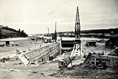
This picture shows them under construction.
We used to walk freely around the docks and even over the caisson. One year the class of one of my daughters asked me to lead them on a tour of the historic features of the West Bank. We saw the remains of the Fort Glamorgan Prison that had been a powder store. And as an extra I suggested a visit here. We were travelling around on a large bus, but the person security duty let us in. While we had to be very careful of the edges, which were fenced off anyway, we could see down to its depths. And the captain of the cargo ship in at the time let us walk around the deck.
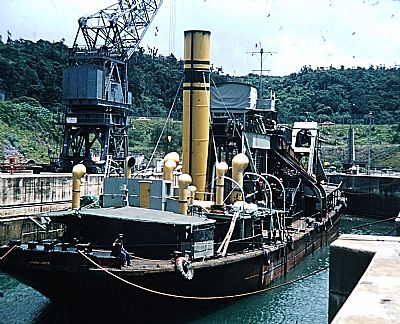
An antiquated looking dredger in the dry dock.
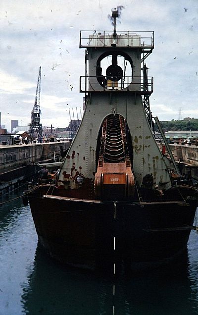
The grand old lady from the bow.
Friends living in the harbour
My parents knew the Blackler family from church. They had come down from Rhodesia and had bought the pleasure boat the Lady Eileen. They lived on board and made a living taking people on short sea trips. East London's harbour was interesting to see from the deck of a small boat, but the sea was not suitable. It was rare for it to be calm enough to be able to venture far out and the trip was usually limited to within the protection of the breakwater. (Anglers with even smaller boats could actually manage much better).
Then they bought a house, but it burnt down.
Cross winds
East London vies with other coastal cities as The Windy City. It is also a river based port. In spite of the turning basin adding to the facilities greatly in width, it still provided problems in high winds. I remember a ship being caught by a cross wind and side swiping the small tug being used in conjunction with the pilot boat. That little boat made it back to its dock, but then sank. Fortunately it was shallower further upstream near the bridge and the superstructure remained sticking our of the water. It was refloated by installing and inflating a large airbag inside it.
An unusual pub crawl
I was on a chamber of commerce committee and attended several events. One was a "pub crawl". Well, being a non drinker that was hardly me. But this one was different. It was around the harbour. Drink stops were located in a customs room, the West bank Lighthouse and on board a tug which took us out to sea. My wife came too.
The fishing industry and the Coelacanth make East London famous
Irving and Johnson (I&J) used to have a small, but fairly thriving fishing industry operating from this harbour. They had a dedicated small timber quayside up towards the bridges and just beyond the dry dock.
Private boats used to use this too and some still do, but not as much as they used to. When we went for Sunday drives down the coast we would watch for fish being offered for sale along the road near the zoo. We sometimes stopped for one, but my mother was never one for gutting and cleaning fresh fish so this wasn't often.
My paternal grandfather was on the board of the local museum and so started our tenusou family link to a living fossil. A fishing boat captain contacted the museum about something unusual. Down went museum curator Marjorie Courtenay-Latimer, as she often did to get museum exhibit material. Her name was to be linked with this fish forever and gain some fame for the town. She is credited with having discovered the fish among the catch of a local fisherman. Courtenay-Latimer contacted a Rhodes University ichthyologist, J.L.B Smith, sending him drawings of the fish, and he confirmed the fish's importance with a famous cable and the rest is history. The genus name Latimeria commemorates her. It was then thought to have been extinct for over 65 million years.
I got to know Marge and liked her, but there were many who were irritated by the degree of credit she gleaned from this fish. Was it really her who discovered it? or the captain of the trawler? Or should Prof Smith have been given more credit having identified it and named it? He worked closely alongside his wife Margaret. I met them both. She wore coelacanth earings.
Anyway, my father and his mother kept up a long friendship with Marge Courtney Latimer.
Many an East Londoner will feel oversaturated with pictures of coelacanths, but here is one that I drew. It appears on the back cover of my Urban Trail book. See URBAN TRAIL An acknowledgement of the significance of that fish known as "old Four Legs" due to its prehistoric form of leg-like lower fins. An appropriate symbol for a walking trail. (This is based on the City's then official emblem by cartoonist Basil Kenyon).
Latimer's Landing
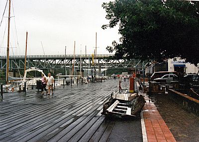
The timber quayside continued to be used by visiting yachts, but the fishing industry declined altogether. Then someone had the initiative to resuscitate it with restaurants. It was renamed Latimer's Landing and proved popular. That too has seen better days, but you can still visit it.
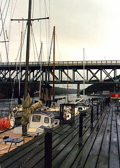
Visiting yachts moored at Latimer's Landing.
Pity about the bits of dinghy. The old two level bridge is seen beyond. This replaced an even older one and had road above rail.
The bridges
My paternal grandmother Maud would tell us of her crossing the river by wagon when the tide was out. It was that silted. But this was before the river was properly scoured by the flow guided by the breakwater and pier and before the dredgers really got going. The first bridge to replace the ferry was made of timber. This was replaced by a more substantial road bridge.
We should note that the first bridge was itself preceded by a pontoon. Fares were set for foot passengers, wheel barrows, hand trucks, wagons and the like. Even ostriches.
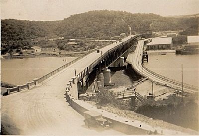
The two bridges can be seen side by side here. The newer one was at two levels; road above rail. The fish wharf is to the right.
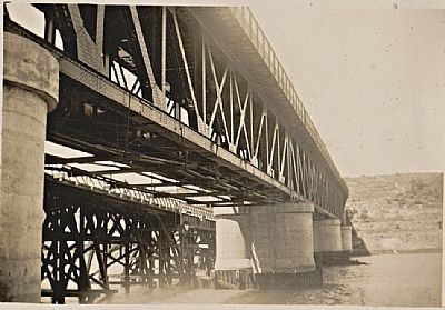
The two levels are more clearly seen here.
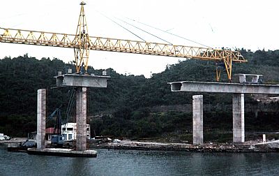
It was fascinating to see the new road bridge being "glued" together.
Beyond the bridges
The natural form of the river limited access for larger craft beyond the bridges. It became suddenly narrower with higher banks. I had at one time canoed it with a friend all the way up to Buffalo Pass. Well we went from rock pool to rock pool over boulders. We saw many birds, some monkeys and a small leguaan.
The first section of river up here though was almost straight, up until Green Point. It was very suitable for recreational boating,
This is an old photo taken roughly above the old Buffalo Bridge before the newer current one was built. You can see some harbour railway buildings in the foreground. The gravel washout from the small river to the right indicates about where access along the shore stopped. Our first rowing club was about where the buildings in the foreground were before they were cleared away. In the distance it is just wild forest on steep embankments.
Rowing
There had been rowing clubs and social boating on the Buffalo River from early on. I rowed with the Selborne College crews using the double storey boathouse on the east side of the river. It had a practice rowing tank on the roof. If the building had not been unlocked I would climb up the 3 levels of external plumbing and unlock it from the inside.
As a teenager we boys were fascinated by the toilets being signed as cox and coxless. Get it?
By the time our girls did rowing a new clubhouse had been built on the other side.
That takes me up to 1999 when we emigrated and had to start afresh. Our belongings took ages intransit within a container on a ship. And then when our SA house was eventually sold, we did that again.
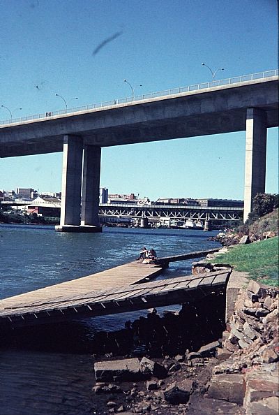
The new bridge overlooking the newer rowing clubhouse. Here we see the jetty at low tide.
I had learnt to row for Selborne College which used the earlier clubhouse on the opposite bank. I did not very well, being asthmatic, both of our daughters learnt to row here and then pefected their skills in Scotland. Perhaps there was something in the genes after all.
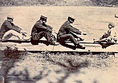
I understand that some of the wider family rowed back in the day and I suspect that some of these in the picture are of at least one of them. But look closely. They are all dressed a little dapper. Look even closer. None of them actually have oars. In fact none of them even has a boat. This is a mock-up for the photographer.
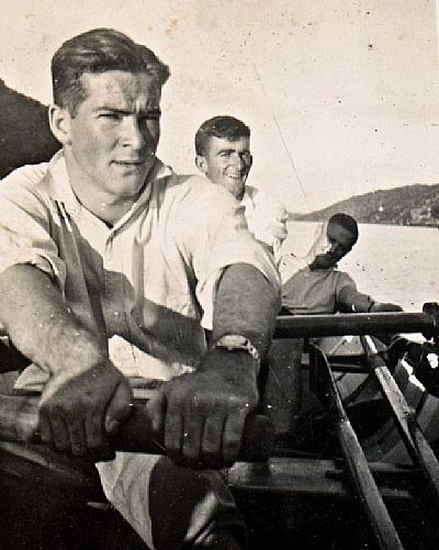
My father with friends rowing on the upper Buffalo River. This appears to be a fixed seat clinker boat, tiring to row, but good training
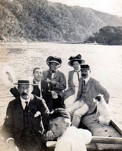
This though is proper rowing, not a racing boat, but socially on the upper Buffalo River. We have several members of the extended family with Granny Maud to the back right. And a dog.
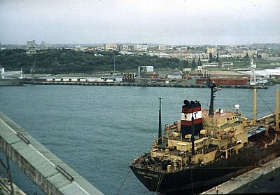
The harbour today
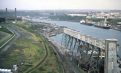
We witnessed a dramatic change in the harbour over the years. This picture was taken after we left. Containisation has completely taken over the east bank. On the west bank CDA ie Chrysler-Daimler-Assembly who make Mercedes Benz and other vehicles dominates the harbourside, not just the industrial area above.
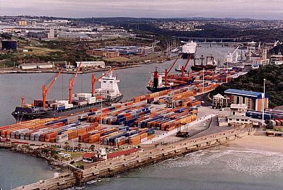
The pier is in the foreground. To the right is the Orient Beach Pavilion. In the distance are the older double level bridge and the newer road bridge. Containers dominate the east bank and CDA's car export centre the west bank. You can see a Ro-Ro ship in to upload vehicles.
Air views
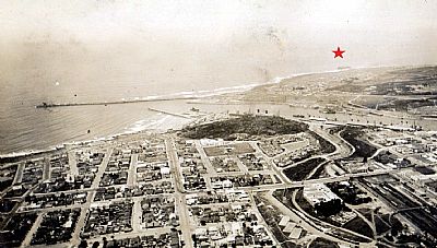
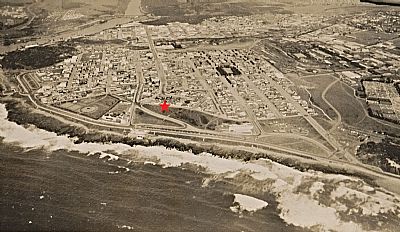
These views were taken a very long time before Google Maps and similar views. They were unusual. I don't know who took them, but they look like personal snaps and not commercially taken photos. They are dated "Aerial Views of East London. January, 1935".
This one has a label with "Note Stuart Star". This was a refrigerated cargo ship launched in 1926 which ran aground off Hood Point whilst on a voyage from the River Clyde and Liverpool to Lourenco Marques, Portuguese East Africa and Melbourne, Australia with general cargo. [Blue Star Line website]. I have marked the spot with a red star.
This one is labelled "Seaview Terrace". I have marked that with a red star.
Another wreck
The coastline around East London has seen several ship wrecks. Here is another. Hundreds of city residents lined the shore to watch as the freighter SA Oranjeland carrying 38 people drifted onto the rocks of the Esplanade in 1974.. It remained a popular sight for years.
I don't know the precise circumstances, but there is something about the swells rolling in from the Indian Ocean as they get past the breakwater. Ships then did not all have side thrusters and were at the mercy of wind and sea until the tugs could get complete control of them.
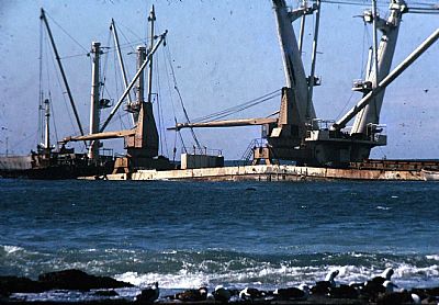
SA Oranjeland in the mid-'80s.
BANDSTAFF REGISTER : https://bandcstaffregister.com/page38.html
BLUE STAR LINE : https://www.bluestarline.org/stuart.html
MERRIFIELD school website : East London Harbour Compiled by Les Pivnic with major assistance from Trevor Jones, Fr Andrew Scott Davidson, C.Ss.R., Johannes Haarhoff – DRISA Website and Roger Darsley : https://mpsc.co.za/
SOUL OF RAILWAY : https://sites.google.com/view/eastlondonh
WIKIHOW :Jacks: https://www.wikihow.com/Play-Jacks#:~:text=Jacks%20is%20a%20great,%20%EE%80%80easy-to-learn%EE%80%81%20game%20that
WIKIPEDIA : Dolos : https://en.wikipedia.org/wiki/Dolos
