
TURKEY RED : 6 - DALMONACH PRINT WORKS
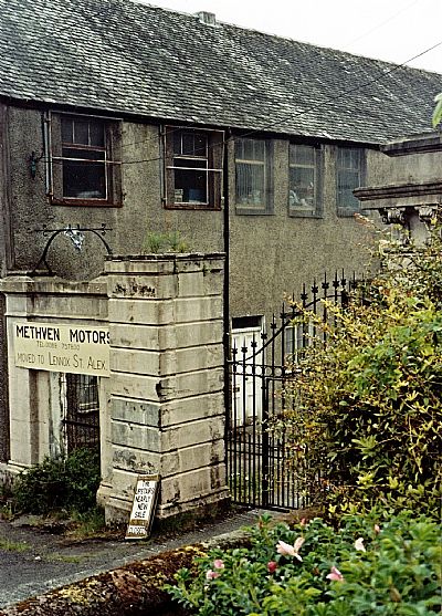
ACCESS : The works site is now modern housing. The Dalmonach School can be seen from outside and from across the river.
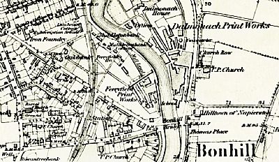
///classmate.array.book This marks the location of the works gates. The school building alongside it was part of the works, but is described separately.
The name Dalmonach refers to the field of the monks, This is because these lands and the fishing rights at this part of the River Leven had been granted by the Earls of Lennox in 1330 to the monks of Paisley.
Also see TURKEY RED : 6 - DALMONACH PRINT WORKS
This works was next to what is now the Bow Bridge on the east side of the Leven where the road heads for Balloch. The schoolhouse remains. The rest of the site is now occupied by Willowbank Gardens.
NLS ©
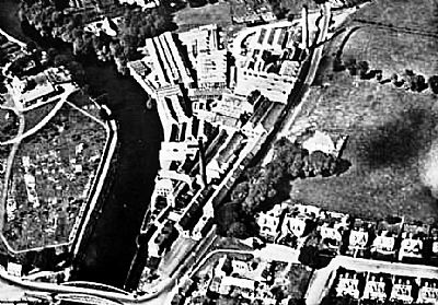
An aerial view showing the works in its heyday. Bonhill Bridge (the previous one) is visible below. You can make out the main gate from the road access near the bridge. Immediately to the left of that and outwith the actual premises is the small school.
Taken from Vale of Leven Project website. Original source unknown.
-
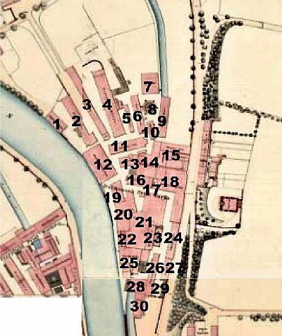
COPPER BOILER HOUSE
-
STENTER HOUSE
-
STENTER HOUSE
-
FINISHING HOUSE with boiler & timber store
-
PADDING STORE
-
MILLWRIGHTS SHOP
-
GRAY WAREHOUSE
-
GASOMETER
-
SINGEING HOUSE
-
MILLWRIGHTS SHOP
-
ENGRAVING SHED
-
MACHINE PRINTING SHOP
-
STEAM BOILERS
-
BLEACHING HOUSE
-
HANGING SHED, STORE HOUSE, BOILER HOUSE
-
WAREHOUSE,
-
WHEEL AND PUMP HOUSE
-
MACHINE PRINTING SHOP
-
PREPARING SHOP
-
COLOUR SHOP
-
DYE HOUSE
-
BOILER AND ENGINE ROOM
-
MADDER STORE / STEAM BOILERS
-
AGEING HOUSE
-
FANCY DYE HOUSE / CISTERNS
-
STORE HOUSE
-
STORE HOUSE
-
GARANCINE HOUSE
-
WEIGHING MACHINE / main gates
-
SCHOOL / house
Composite map from 1859 as ref below ©
The Dalmonach Schoolhouse still remains. Just up from the Bow Bridge and on the Bonhill side of the river. See DALMONOCH WORKS SCHOOLHOUSE index.asp?pageid=716415 . There is one other building that remains, albeit much altered. That is the works lodge house that is located in Main Street where the road heads towards Jamestown. Rescued from a ruined state, it is now a comfortable modern home. What is still of interest is the original stone boundary wall, now painted white, which curves in towards the gates and has cast iron railings on it. (Listed C based on its historic context). ///carpentry.indicated.lotteries
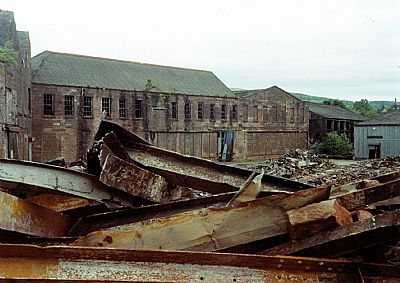
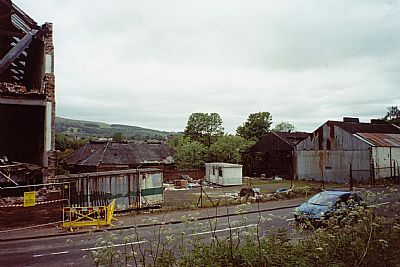
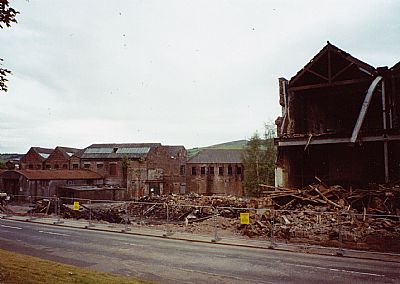
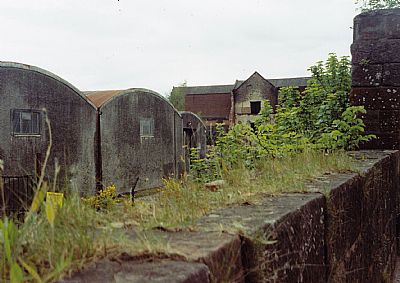
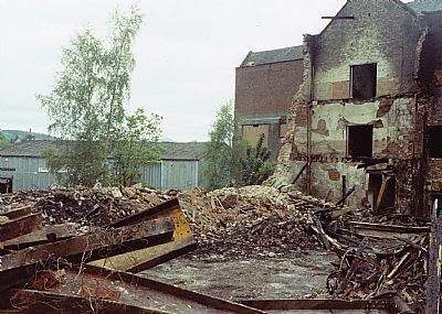
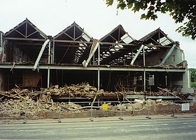
Right next to the surviving Dalmonach Works School building were these gates. This and the following photos were taken about 2 decades ago. They show the extensive worshops being demolished. Most of the site is now new housing.
The main gates.
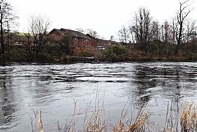
The lade inflow is hardly recognisable behind a gabion of stones to block its flow and stabilise the bank.
A closer view.
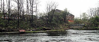
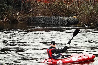
When the water level is much lower you can more clearly see the wall that diverted water into the lade. That wall was breached either from natural collapse or when the lade was blocked. The boat had drifted down during heavy rains and got stranded.
CANMORE : https://canmore.org.uk/site/128245/alexandria-dalmonach-print-works
COLOURING THE NATION - Wordpress - Project run by the University of Edinburgh and the National Museums Scotland : https://colouringthenation.wordpress.com/turkey-red-in-scotland/
GEOGRAPH.ORG : https://www.geograph.org.uk/photo/429940
MACPHAIL, I.M.M : A Short History of Dumbartonshire. The Lennox Herald. 1963.
NATIONAL LIBRARY OF SCOTLAND (NLS) : The maps here are reproduced with the permission of the National Library of Scotland.
Composite maps overmarked. Alexandria - Sheets XVIII.9.15. / XVIII.9.11 / XVIII.9.16 Surveyed: [1859], https://maps.nls.uk/townplans/alexandria.html
1860 : Archive title : " Dumbartonshire, Sheet XVIII (includes: Bonhill; Dumbarton; Kilmar... Survey date: 1860 , Publication date: 1864". https://maps.nls.uk/view/74426619
1914 : Archive title : "Dumbartonshire Sheet nXVIII (includes: Bonhill; Cardross; Dumbart. Date revised: 1914, Publication date: 1923" : https://maps.nls.uk/view/75827346
NATIONAL MUSEUMS SCOLAND : https://blog.nms.ac.uk/2012/06/22/turkey-red-a-study-in-scarlet/
VALE OF LEVEN PROJECT website : http://www.valeofleven.org.uk/levenbridges.html
and http://www.valeofleven.org.uk/valeindustry3.html
WEST DUNBARTONSHIRE COUNCIL : Textile Industry in the Vale of Leven. https://www.west-dunbarton.gov.uk/leisure-parks-events/museums-and-galleries/collections/industry/textiles-and-mills/ and The River Leven Heritage Trail : https://www.west-dunbarton.gov.uk/media/2619077/vale_of_leven.pdf
WIKIPEDIA : https://en.wikipedia.org/wiki/Turkey_red
