Login
Instagram
Get your free website from Spanglefish

CORDALE

Cordale today comprises modern housing between Renton Main Road and the River Leven. It remembers its past through many of its road names which refer to its heyday as a major textile works. There still some remnants of that although most of them are hidden within the vegetation covering the large curve of the river.TroveFor more on that see TURKEY RED : 11 - CORDALE PRINT WORKS

Also see RENTON

Cordale House

https://w3w.co/wreck.shampoos.thighs Approx.

Cordale House was built by William Stirling in 1770 adjacent to the printworks that he established at the same time. 

You can see where it was in the map below. Trove (HES) and PastMap both identify this site as midway between the modern day Hannah Place and Cordale Avenue in Renton.

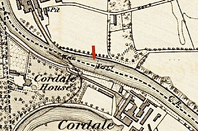
In this map from the 1860's you can see where Cordale House was and the location of the ferry. © NLS

This photo comes from an old postcard. 

A post on FB by CC in 2021 notes "My, mother told me that when she was young the local Sunday Schools were invited to Cordale House grounds for their annual outing. They were given rhubarb and apple tarts as part of their picnic".

A similar event is recorded in a newspaper in 1890 : On Saturday last the children attending the Renton Parish Church nts and Sabbath School, aloug with their friends, numbering in all about unds. The , had their annual outing to Cordale House Renton .[Newspaper Archive as below]

Notable occupants of Cordale House were the Wylie family, Alexander Wylie of Cordale being the most prominent. You can find his burial site in the grounds of RENTON TRINITY PARISH CHURCH

The Vale of Leven History Project dsicusses some of the streets named after him. https://www.valeofleven.org.uk/scottishplacenames/Wvale_names.html


BRITISH NEWSPAPER ARCHIVE : https://www.britishnewspaperarchive.co.uk/Search/Results?BasicSearch=cordale%20house%20renton&ExactSearch=False&RetrieveCountryCounts=False&msockid=21bdc2bcd41167253d3bd4a0d55566c2

LAIRICH RIG on Geograph : https://www.geograph.org.uk/photo/5115777

NATIONAL LIBRARY OF SCOTLAND - Maps : Dumbartonshire, Sheet XVIII Survey date: 1860,  Publication date: 1864. https://maps.nls.uk/view/228777145

VALE OF LEVEN HISTORY PROJECT : https://www.valeofleven.org.uk/scottishplacenames/Wvale_names.html


Click for Map
sitemap | cookie policy | privacy policy | accessibility statement