Walks Around Cold Ashby

Cold Ashby is a small rural community in the Northamptonshire Uplands.
It is not within the boundaries of a National Park, nor is it an accepted tourist area like its neighbours in the Cotswolds, though there is a choice of holiday accommodation now available in the area.
It is situated in an area of beautiful undulating farmland which, for me, encapsulates the appeal of the English countryside.
There are some delightful walks in close proximity which, as former Parish Path Warden, I would like to share with you as a visitor to this site.
{The Rambler strives to give accurate descriptions of the walks on this site but is aware that any text is always open to a variety of readings and possible (mis)interpretations.
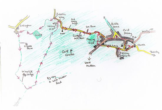
He therefore strongly recommends that walkers are equipped with a relevant O.S. map (Explorer 222, 223) and decent compass which should enable them to regain the intended route should they be unintentionally misled - please do not rely only on his meagre attempts at sketch maps!
Constructive comments and/or criticisms are always welcome here.}
For a Google map of Cold Ashby and a link to NCC's interactive map of this area (useful if you wish to report a problem with a Right of Way) please click here.
**For more local walks try my More Walks Around Cold Ashby Page.
** Click on the link for a longer circular walk including Honey Hill, Hemplow Hills and Crack's Hill
**For walks within easy driving or cycling distance of Cold Ashby have a look at Cold Ashby's Rambling Explorer, Rambling Explorer Continued and More Rambling Explorer.
**For details of Long Distance Paths in this area click here.
** For an exploration of local Permissive Access Areas click here.
Quick Links to Walks on This Page:
[1] The Cold Ashby 'Family Walk'
[2] Cold Ashby Rambler’s (Revised) Favourite Local Walk
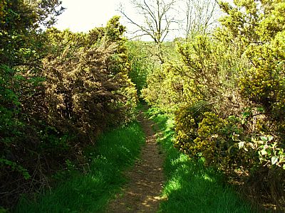
[3] Bridle Lane
[4] Yelvertoft Wharf – Cracks Hill – Crick Jubilee and Millennium Woods Trail - Yelvertoft
[5] Cold Ashby to Winwick, passing Thornby Grange and returning to Cold Ashby via Honey Hill.
[1] The Cold Ashby 'Family Walk'
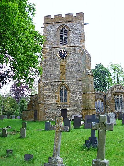
Starts at: St Denys Church, Cold Ashby
Distance: about 3 miles
Difficulty: easy stroll, some inclines, tarmac surface ( except for optional extensions) - watch out for spasmodic traffic !
This walk, as its local name suggests, is suitable for most people in most weathers.
The main route is on the largely single-width lanes which connect Cold Ashby, Thornby and Guilsborough and is therefore very easy to follow.
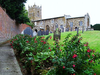
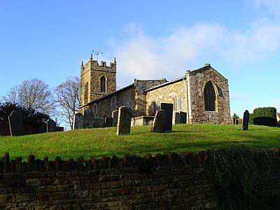
The Church of St.Denys, usually open to visitors, is a good place to start. Built in a simple Early English style, it is well worth your attention - as is the contrasting late Victorian Lych Gate.
At the eastern end of the south-facing wall is a new bench commemorating the centenary of the ending of hostilities in the First World War.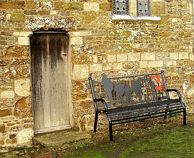
Go to http://www.parish-council.com/coldashby/ for an excellent brief history of the church.
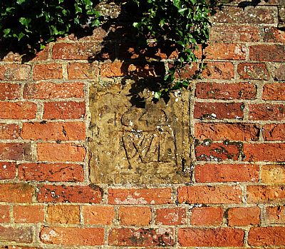
From the church, take the Thornby Road, noticing in the old brick wall on your left the stone inscribed 1642 WLwhich marks the bricked up doorway of the long demolished cottage, The Cedars, in which Oliver Cromwell is alleged to have stayed before the Battle of Naseby.
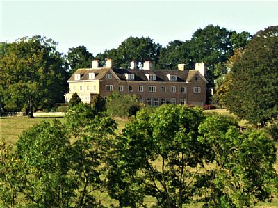
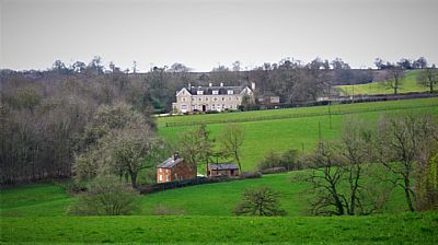
Continue towards Thornby until you reach the junction of the Guilsborough road and follow this (right) towards Guilsborough. Do try to ignore the intrusive wind turbines and enjoy the views to your right and the setting of Thornby Grange.
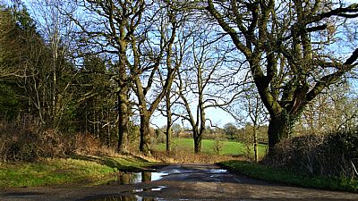
You soon come to a crossroads where you take the Thornby direction (left) to continue the walk proper but may wish to walk along the byway to West Haddon (right) as far as Thornby Grange or beyond this to view the old mill (see Walk 5 below) returning to the crossroads - the views are well worth this small detour.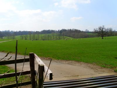
From the crossroads the winding, undulating lane gives you pleasant views of pasture, the outlying former stables at Thornby and the church tower.
The moderate 'climb' to the crossroads at Thornby gives you a view of Hollowell reservoir on your right.
Turn left at the crossroads towards Cold Ashby, noting the red brick stables and estate cottages on your left and St. Helens Church on your right.
(You might like to make another small detour here by negotiating the kissing-gate, crossing the field to the church ( the path is obvious) and continuing through the churchyard to emerge with the small village hall on your left and The Red Lion on the other side of the A 5199).
Suitably refreshed you can then follow the Cold Ashby road as it first descends and then rises back to your starting point at the Church.
........................................................................
[2] Cold Ashby Rambler’s (Revised) Favourite Local Walk
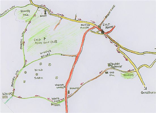
Cold Ashby – Honey Hill – Elkington – Winwick Lodge – Honey Hill Farm – Cold Ashby
Starts at: St Denys Church, Cold Ashby
Distance: about 5-6 miles
Difficulty: Proper ramble with both hard and soft surfaces, good views.
(This walk replaces the former 'Favourite Walk' which, in the Rambler's view, has recently become too dangerous as it used a section of the West Haddon Road which, though technically a local rural route between villages, is now treated as a virtual trunk road owing to the errors made when planning the Catthorpe Interchange. See this link for more details.)
From St. Denys Church (usually open to visitors – see Walk One above) set off (West) along Church Lane passing the junction with Crabtree Lane and the Long Well on your right and Park Spinney Close and on your left, noting the ancient sweet chestnut tree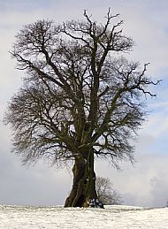 in the adjacent field, until you reach the West Haddon Road.
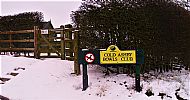 Cross the road with care (as traffic here rarely observes the speed limit) to Cold Ashby Bowls Club where you will find a small gate up some steps to the right of the main entrance. (Please note that dogs are not allowed on the playing field - if your canine 'best friend' is with you then turn right instead and then left up Stanford Road to regain the route.)
Go through this gate. Then walk past the well-tended bowling green on your left in the direction of the splendid children's playground and continuing through the Playing Field to the gates on the Stanford Road.
Turn left on to the Stanford Road and continue (West) towards Honey Hill. You pass Coe Farm on your right, Bunkers Hill Farm, its excellent Caravan site and the entrance to the Golf Club on your left.
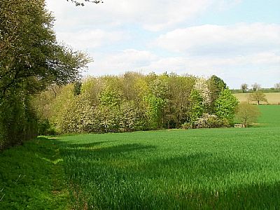
Continue past the historically significant, though officially inaccessible, trig point in a field to your left, then pass the somewhat ugly communications mast by the reservoir until you see the first sign for the Jurassic Way. This is where you will emerge on your return journey.
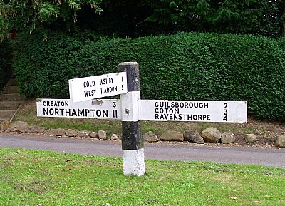
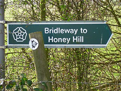
Continue to the next sign (pictured left)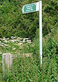 which directs you to Elkington via Honey Hill, a fine viewpoint from which, it is rumoured several counties can be seen (exactly how many is still in dispute!). Unfortunately, your view is now disrupted by 39 (at the last count) wind turbines. The Jurassic Way officially skirts the summit, where you will see the stone (pictured) which commemorates the opening of this useful long distance route.
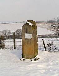 If you are fit enough, however, you will want to make the short climb to the summit from where the views can be fully appreciated. This year (2023) you will need to follow a path round the edge of the bean field which has been created on the south western slope to reach the best viewpoint before returning to the Jurassic Way proper towards Elkington.
Immediately beyond Elkington Covert you bear right and walk down a small ‘ravine’ to emerge at Portly Banks on Manor Lane.
Here you turn immediately left and walk (South) along the Bridle Lane/Byway towards Winwick, passing the drive for Creeds Farm on your left and continue for just over a mile, passing Winwick Lodge, also on your left, to regain the Jurassic Way.
You now head North on the Way, ignoring the byway which leaves for the West Haddon Road on your right and following the distinctive signage towards Honey Hill Farm. You will see the Golf Course on your right and what used to be part of the course in front of you. You cross this, continue across the next field and then climb up past Honey Hill Farm on a concrete track, pass a bungalow on your right and regain Stanford Road at the sign you passed on the way out.
Here you turn right and continue down Stanford Road to Cold Ashby where you cross (again with care) into Main Street, pass Bridle Lane (see below) on your left then turn right into Crabtree Lane where you can find a short connecting path between houses on your left between Crabtree Lane and Church Lane which returns you to your starting point at the Church.
..............................................................................
Starts at: 'The Green'
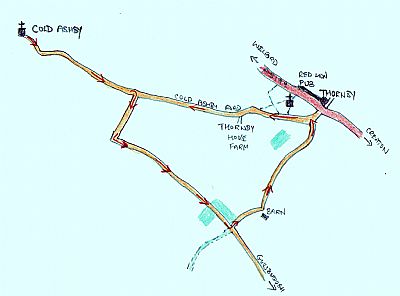
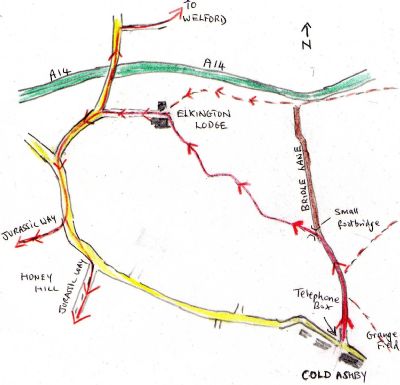
Distance: Bridle Lane is only just over 1 mile long but as the above map shows provides useful links with many other walks - notably the Jurassic Way. It also provides access to Grange Field via the first footpath on your right.
Difficulty : None really ... but bear in mind that this is a very popular dog-walking route and some owners are less conscientious about clearing up faeces than others.
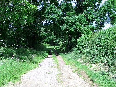
This ancient green lane begins at the red K6 telephone box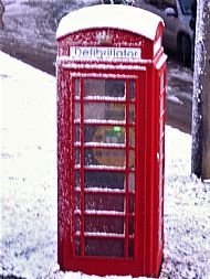 (which now houses a defibrillator but no phone !) at 'The Green' on Main Street. As its name suggests , it is now a bridleway, although the first section is now, technically, a road.
It is used as a linear walk by villagers, many with their dogs and also by local horse-riders.
As I indicate on the History page, it still provides a link with Welford though this is no longer as direct as it was before the construction of the A14.
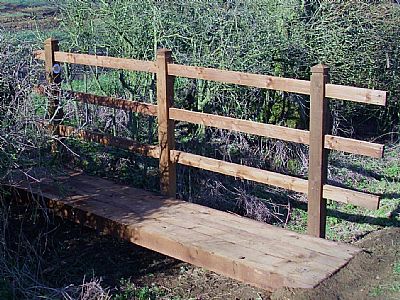
To reach Welford by this route it is necessary to take either the first footpath on your left to Elkington Lodge (via the sturdy reconstructed footbridge pictured) or, if you reach the A14 and the end of the lane, to turn left on the bridleway at this point, also eventually reaching Elkington Lodge.
The former route is recommended as the views are better and the noise and pollution from the A14 less intrusive.
From Elkington lodge follow the signs to the Welford Road.
For Welford, turn right on the road and continue, crossing the A14 by the road bridge, until you reach the new continuation of the bridleway on your right.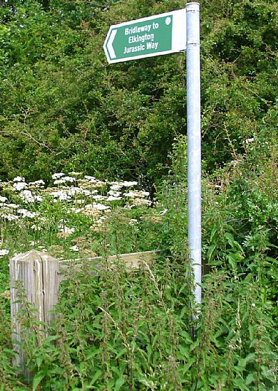
For Honey Hill and The Jurassic Way (or connection with the Rambler’s Favourite Walk etc.) turn left on the road for Yelvertoft, Stanford and Cold Ashby as far as the T junction, where you follow the Cold Ashby direction to the left continue on the road uphill and eventually reach the Jurassic Way sign for Elkington(via Honey Hill).
...............................................................
[4] Yelvertoft Wharf – Cracks Hill – Crick Jubilee and Millennium Woods Trail - Yelvertoft.
(Click on the highlighted link for an excellent detailed, illustrated map and further information about this area).
Starts and ends at: Yelvertoft Wharf (adjacent to Bridge 19).
Distance: about 4 -5 miles.
Difficulty: mostly easy walking on a level tow path and well-maintained bridleway. The ‘ascent’ of Cracks Hill does, naturally, require some effort but is not essential to the enjoyment of this walk.
Parking: room for several cars at the Wharf on the Yelvertoft side of the bridge, opposite Skew Bridge Cottage.
From Skew Bridge (19) take the tow path South in the direction of Crick, passing holidaymakers at the recently developed Yelvertoft Marina on your left, passing under Bridge 18 and climbing up from the tow path on to Bridge 17 to walk the bridleway towards Crick.
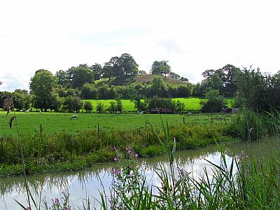
Continue South on this bridleway until you see the obvious mound of Cracks Hill.
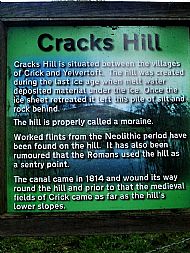 The hill and surrounding area are open to the public and the Rambler recommends climbing the hill to appreciate the views from the top before descending to Bridge 14, which is a restored footbridge.
Cross this bridge and you will see the sign for the Jubilee Wood and the trail which includes the Millennium Wood.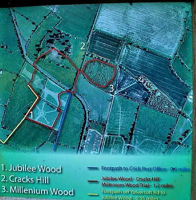
(Should you wish to avoid the climb you could enter the Millennium Wood on your left and thus join the trail early.)
Having sufficiently explored the trail and taken advantage of the many seats and viewpoints on offer, you can now rejoin the canal tow path and set off on your return to Bridge 17. The canal curves attractively round to the west of Cracks Hill, allowing a full appreciation of this unusual landscape feature.
On reaching Bridge 17, climb up again to join the Bridleway you used on the way out but, obviously, now in the opposite direction (North) towards Yelvertoft.
At the end of the Bridleway, cross Yelvertoft High Street, turn right and walk along towards your starting point at the wharf.
If you have time, All Saints Church is normally open and well worth a visit.
*Yelvertoft can be reached from Cold Ashby via Honey Hill, Elkington and the Grand Union Canal towpath or by a more direct field path - see More Rambling Explorer for a sketch map.
.................................................................................
Starts at: St Denys Church, Cold Ashby (which should be open to visitors from 9.00am to 5.00pm each day).
Distance: About 8 miles
Difficulty: Some ups and downs (Honey Hill is 690ft).
Well marked route over byways and footpaths.
(For further details, excellent photos and kind comments on this walk click HERE.)
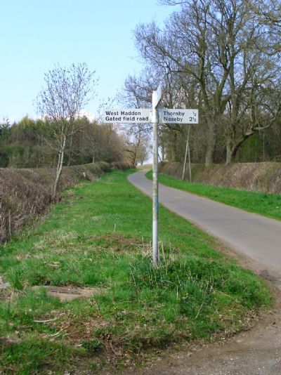
The first section of this walk follows the same route as the ‘Family Walk’ (see above) but, on reaching the crossroads on the Guilsborough Road you turn right towards Thornby Grange on ‘The West Haddon Gated Field Road ’ [NB : the arm of the sign post (pictured right) which displayed this legend has now mysteriously disappeared!]and continue along the track, passing the drive for Thornby Grange and then Grange Farm on your right and Rabbit and Mill Spinneys on your left.
(When I last did this one, a fox crossed the track boldly from right to left, disappearing rapidly into Mill Spinney when it realised I was approaching!)
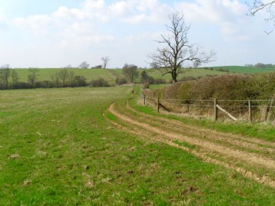
Pass the ‘unsafe’ buildings on your left (these are the remains of Thornby Mill and, possibly, also the site of the 'lost' hamlet of Chilcote) continuing on the byway towards the West Haddon Road.
You will know when this is imminent by the barking of the dogs in the kennels on your right.
On reaching West Haddon Road, cross with great care (traffic is too fast on this stretch) and climb the double stile arrangement immediately opposite.
This is the only section where the path is not always clearly defined so head diagonally across the pasture to the left corner where you pass through a small red gate, then over a stile to join the byway to Winwick. Here you turn right, past White House Farm on your right and head West along this clear track to the outskirts of Winwick.
The views on this stretch, which were once excellent, are now irritatingly interrupted by the Winwick Wind Farm of six huge (and not particularly useful) turbines.
Just before the gates to Winwick Hall you turn right joining the Jurassic Way Northwards to Honey Hill.
A sign soon declares that there is ‘No Through Road ’ and seems to suggest that the track is for access to the farms on your left only. In fact, this only applies to motor vehicles as you are, self-evidently, on a designated long distance path!
From this point onwards the Jurassic way clearly takes you up Honey Hill from which you can return to Cold Ashby on the Stanford Road.