|
Nepal 2009
Introduction
On the 13th October 2009 we flew to Nepal at the start of an exciting 6-month trip to the Indian sub-continent. We spent about 6 weeks in Nepal trekking, followed by 3 months touring and cycling in India, followed by another 6 weeks trekking in Nepal in the spring of 2010. This section talks about our 2 treks in Nepal in the autumn of 2009.

1. Everest Base Camp
2. Annapurna Circuit and Base camp
1. Everest Base Camp

Our flight from London was very smooth. We changed planes in Delhi and got the short connection to Kathmandu. Quite soon after we took off from Delhi we started to see the huge, snowy Himalaya mountain range stretching across the horizon. An exciting prospect for us! The plane started to descend amongst terraced green hills into the Kathmandu valley. Soon we were bumping along the runway and our first trip to Asia had begun! We emerged at Kathmandu airport to see Maila (our mountain guide) holding a big sign with Martin and Tilly written on it. We recognised him anyway since our New Zealand friend Jon, who had recommended Maila, had shown us a photo. Maila gave us both marigold garlands to welcome us.

Martin wearing his marigold garland.
Kathmandu is completely mad with totally lunatic traffic. What is more the roads disintegrate without warning into completely unmade, potholed cart tracks. The poverty of some of the people is pretty extreme with children and adults often scavenging through heaps of rubbish on the roadside. The street wiring is something else – we had never seen anything like it!

Street wiring in Kathmandu.
Maila delivered us to our hotel which was really nice – a big room with an ensuite bathroom! After this we went with him to his trekking agency to sort out details of the trek and pay over the money. We had a day sight seeing in Kathmandu before leaving on the bus for Shivalaya and the start of the trek.

The International Guest House, our hotel in Kathmandu.

General street scene in Kathmandu.

The famous Boudhanath stupa, Kathmandu.
The bus journey was something else. Our driver kept his finger on the horn and overtook (or undertook!) anything and everything in his path. It took 9 hours to reach Shivalaya and the last 2 hours were on completely unmade roads where the bus often got stuck in the mud or almost toppled over the edge of the track. We seriously thought that we were not going to survive - it was that terrifying.
Still we finally arrived at Shivalaya and picked our way through the mud to our teahouse. This was our first introduction to the realities of rural Nepal - in particular to Nepali toilets - which if you are lucky are a small sized version of a squat toilet which you flush by using a bucket of water. Another thing was the almost complete lack of any washing facilities - this lodge did not even have an external water tap to wash at.

A typical Nepali toilet.
The following day we started walking. The track started vertically up a hillside and continued like that for some hours until we reached a pass - after which we descended. Everywhere on the track there were Nepalis often carrying huge loads. There were not many tourists since most people now fly to Lukla and avoid this part of the trek.

Our lodge on the second night.
The countryside we passed through was amazing - very steep hillsides, completely terraced and very green. The paths we used were the highways used by the local Nepalis. We walked like this for 8 days until we reached Namche. By this time we had met Pat, a 40 something Frenchwoman from Toulouse who was travelling alone with a porter. She had visited Nepal a number of times before and was really nice. We kept seeing each other and finally teamed up and walked together. We had our guide, Maila who is completely brilliant - always smiling, very considerate and thoughtful and our porter Kanchha who is Maila's youngest brother.

Maila, our guide, with a local.

Kanchha, our porter.

On the trail.

Looking up the valley towards Namche Bazaar.

Our first view of the high mountains.
From Namche we walked up into the high mountains gradually trying to acclimatise. The paths were now very busy with lots of tourists. The walking was not particularly hard but got more difficult as the effects of altitude became more pronounced. Our bodies found the whole experience rather a challenge. Martin almost developed a urinary infection through not drinking enough on the first couple of days. Tilly felt very odd crossing our first 3,500 meter pass and then Martin developed diarrhoea in Namche. Finally Martin started to develop mild AMS symptoms as we climbed above 4,000 meters.
The high mountain scenery was stunning as we got closer and closer to Everest but the human side i.e. the lodges were less and less nice and also much more expensive.

The beautiful Ama Dablam.

Approaching the high mountains.

The South side of Lhotse.
Finally we reached Lobuche at 4,900 meters. From here we left at 6.00 in the morning to walk to Gorak Shep and then climb Kala Pattar, which at 5,550 meters gives really great views of Everest. This was a really tough day and Tilly almost did not make it up Kala Pattar. Then back to to Lobuche and another night not sleeping due to the altitude. We had then hoped to climb the Cho La Pass to Gokyo but the combined effects of altitude and lack of sleep completely finished Martin and we had to abandon the attempt.

The small but difficult hill of Kala Pattar. Pumori at the back and Gorak Shep in front.

The great view of Everest that made it all worthwhile. Everest is the black mountain in the background with Lhotse to the right.

Looking back down the way we had come. You can see trekkers on their way up at the bottom of the picture.

The beautiful Cholatse on the way to the Cho La Pass.
We then descended back towards Namche, walking along quite amazing paths which clung impossibly to the sides of incredibly steep mountains. Then from Namche we descended to Lukla to get the plane back to Kathmandu. The flight was an incredible experience. The planes are tiny - only 18 seats and the runway is mind bogglingly short. You take off down a short and very steep runway and then soar up to just miss a huge mountain in front of you. The views on the flight were terrific and we could see the paths we had followed on the first 8 days of the trek. We had been really lucky with our weather - cloudless blue skies everyday.

The descent to Namche Bazaar.

Yet another beautiful mountain.

One of those everyday sights in the Nepali mountains.
So we returned to Kathmandu and enjoyed our first hot shower for 3 weeks – bliss! We had 3 days to rest-up before going onto Annapurna for the second trek. On the Everest Base Camp trek we ascended 14,557 meters and descended 13,312 meters. Over 21 days of the trek we averaged 693m up each day and 634m down.

Back to the incredible Kathmandu wiring!

The lovely Garden of Dreams in Thamel, Kathmandu – an oasis of peace in the busy city.
2. Annapurna Circuit and Base Camp

We started by driving from Kathmandu to Besi Sahar in a car. This took about 7 hours. We were lucky that our driver was incredibly cautious (for a Nepali) so we did not have too many anxious moments. We shared the car with Kanchha, Maila and Maila's wife and baby daughter (who were going to Pokhara) so things were pretty crowded. We reached Besi Sahar at about 3.45 and then started walking. It turned out to be further than we thought and we ended up finishing the walk in the dark. The next day we continued walking up the Marsyangdi river valley. We followed this valley all the way to Manang (6 days walking in all).


Amazing load carrying.
This area seemed much poorer than the Everest region - most of the houses were just shacks built out of wood and corrugated iron. The lodges were also more primitive - in one there was no glass in the dining room windows and the gaps in the wooden bedroom walls were so large that they had been covered with newspaper.

Ploughing the traditional way.
The valley was very deep and wild and so often views were quite limited. Amazingly they are trying to build a road down the valley. This led to a particularly hair raising diversion. To avoid an area where men were working we had to cross the river - a raging torrent - by a temporary bamboo bridge, which was very precarious to say the least - Tilly was not amused! Finally as we got closer to Manang the valley became much wider and we started to get some great views of the Annapurna massif. The weather for the first few days was grey and occasionally wet which made the surroundings rather grim. Once in Manang though the weather returned to cloudless blue skies although it remained very cold.

A Tibetan style village near Manang.
We went to a free lecture in Manang on altitude problems given by the Himalayan Rescue Association. The American doctor giving the lecture persuaded us that using Diamox would be a good idea to help cope with altitude problems. We then started the climb up to the high pass at Thorung La. The weather was perfect and the scenery spectacular.


As we climbed higher from Manang we were getting some great views of the Annapurna massif.
The Diamox helped our breathing but we both suffered from chest coughs which became troublesome as the altitude increased. We spent the last night before attempting the pass at Thorung Phedi - a freezing lodge in an icy wasteland.

The lodge at Thorung Phedi.


More photos of the views on the way up.
We then rose at 3.30am for breakfast at 4.00 and left by the light of head torches at 4.30. The climb to the pass of Thorung La was tough - 1060 metres of slog, initially up a moraine and then up icy snow slopes. The path was easy to follow but often very slippery so we glad we had Grivel Spiders to put on our boots (they are like small instep crampons). On the way up we stopped at a little shack and were given a lovely cup of tea which we really appreciated!. It was bitterly cold and so we really glad to reach the pass at 8.15am.

A view at the Thorung La pass.

At the Thorung La pass (5416m).

Maila at the Thorung La pass (5416m).
Then it was a knee crunching descent to Muktinath - 1680 metres in all. Needless to say we were really tired after this. The scenery around Muktinath was extraordinary - very arid bare mountain sides often eroded into fantastic shapes. This is the beginning of the Upper Mustang Valley which until recently was a closed area. The houses and villages are all very Tibetan in style – often with elaborately carved shutters.

The descent to Muktinath.

The arid landscape on the descent.

Daulagiri.

Back to lovely green trees at Jomsom.

Marpha, a pretty village on the descent down the Kali Gandaki valley.

By this time the poinsettias were in full bloom.

Two Nepali schoolchildren.
After this we descended 2600 metres down the Kali Gandaki valley to Tatopani which took us 3 days and then climbed up 1820 metres in a day to Ghorepani. The countryside on the climb was very green with lots of terraced fields and the vegetation was sub-tropical - a real contrast after the bare arid slopes of Upper Mustang.
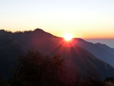
Sunrise at Poon Hill from where we had a great view back towards the Daulagiri massif and across to the Annapurnas.
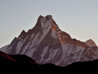
Machhapuchhare (the “fishtail”) at daybreak from Poon Hill.
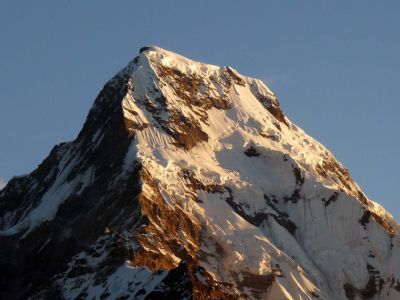
Annapurna 1 at daybreak from Poon Hill.
We then trekked up and down steep valleys covered in huge rhodendron trees for the next 4 days climbing up to Annapurna Base Camp (ABC). We saw some monkeys and an amazing long tailed bird. The views at ABC were spectacular although Martin suffered from the altitude (we had climbed 920 metres rather fast to get to ABC).
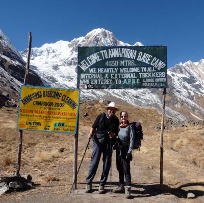
We arrive at Annapurna Base Camp (4130m).
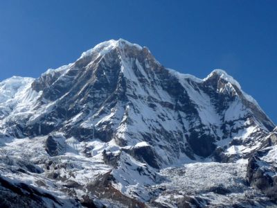
The view at Annapurna Base Camp.
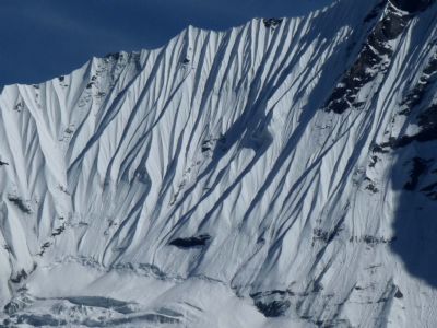
Fantastic fluting of the snow on the mountains.
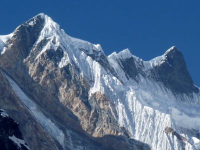
More of that great view.
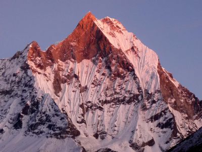
Annapurna 1 at sunset.
Then it was back down the Modi valley at top speed - descending 2225 metre on one day - largely on endless staircases of stone steps.
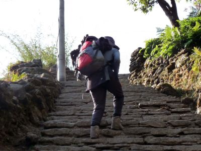
The endless stone steps around Chhomrong.
We trekked out via Landruk and down to pick up the road and transport at Phedi and cruised into Pokhara. We had a couple of days there enjoying the comforts of civilisation again before returning to Kathmandu.
We felt very tired at the end of our second trek. It had taken 22 days; we had ascended and descended slightly more than on the Everest Base Camp trek. Ascent = 15,440m and descent = 15,045m. Our daily averages were 701m up and 684m down.
Returning to Kathmandu, Maila very kindly invited us round to his room for a gut-busting lunch of the National dish “Daal bhaat”, embellished with some lovely chicken curry and preceded by lots of chips with tomato ketchup! Beer flowed freely. Maila’s wife and baby daughter and Kanchha helped with the proceedings. It was a great end to our time in Nepal.
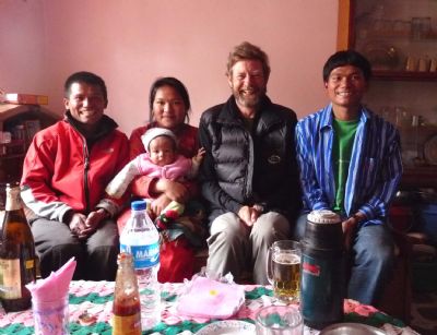
When we couldn’t eat ANY more I took a photo of a very replete Martin with Maila, his wife and baby, and Kanchha.
|    |
 Tilly and Martin's expeditions | sitemap | log in


