 Project Reports Project Reports
An artefact when recovered from the ground means little by itself. The history of the land only comes to life when the objects are seen in the context of the other objects around them. A single artefact saved from the ground is like an isolated piece in a jigsaw, it means nothing by itself, and it is only when put together with the pieces around it that a picture starts to emerge.
Therefore, in order to understand the history of the land in a historic context, each significant project the Sussex Pastfinders undertake is concluded with a detailed Project report covering what has been found and the conotations this has for the history of the area.
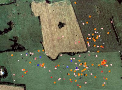
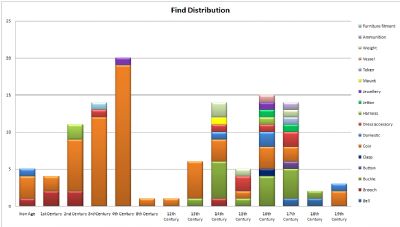
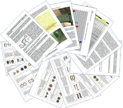
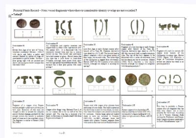
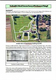
 Recording finds to a 10 figure grid reference allows them to be overlaid on satellite imagery. Click on the image to see an enlargement |  Graph showing artefact date and type of object recovered. Click on the image to see an enlargement | | 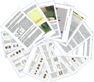 Pages from a Sussex Pastfinders Project report. Click on the image to see an enlargement. |  Table showing photos of artefacts recovered during a typical Sussex Pastfinders project. Click on an image to see an enlargement. | | | | |
The report format covers the basic history of the area and lists all the finds recovered with their identification, date and a 10 figure National Grid Reference. Graphs are plotted to illustrate the date spread of objects and mapping software is used to plot the find locations on satellite imagery. This information is then used to draw conclusions about the history and heritage of the area.
Site Last Updated - 22/12/2022 18:18:13 |  Sussex Pastfinders | sitemap | log in