Ansó, 8 July
by Isabel Isherwood - 21:40 on 11 July 2017
We are just back from a fantastic four-day Pyrenean trek, a circuit of the Vignemale massif: three 2500 m + passes, glaciers, snowfields, towering peaks, remote valleys, mountain refuges, marmots, chamois, and fabulous wild campsites.
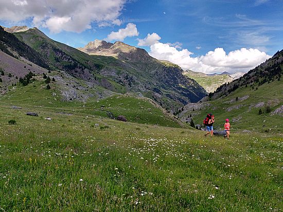
We started the walk from Bujaruelo not far from Ordesa. Our first day’s walk was a steady climb up the valley of the Rio Ara; a beautiful valley somewhat marred for us by the abundant horseflies that prevented any stopping for breaks, photos or simply to look at the view. However the girls managed to gather wild strawberries and wood sorrel as we climbed up through the beechwoods. Eventually we arrived at a beautiful rocky meadow at the confluence of two rivers, and here a huge herd of cows were grazing. Five minutes up the valley above the cows, the horseflies disappeared, and we were finally able to relax our pace and enjoy our surroundings. And our surroundings were wonderful: marmots and their delightfully unafraid babies were everywhere among the irises and rockroses and houseleek; the mountains towered on all sides. Another kilometre up the valley we came over a steep rise and before us was a little hanging valley, flower-studded green meadow among huge boulders and a clear shallow stream running through it to meet the river. This was where we set up camp for the night – one of the most beautiful places I have ever camped. The girls played in the river and found tritons and salamanders while Jake and I set up tents.
The following morning we got up as the first sunlight touched the tops of the mountains to the west of us, struck camp and made our way on up the valley. Our – by and large successful – plan was to get most of the climb up the west-facing Collado de los Mulos (the Pass of the Mules) done by the time the sun came round, while it was still cool.
It was a fairly tough climb over loose scree, and quite stressful for Iona who appears to have developed vertigo recently, but we made it up surprisingly quickly, joining the route of the HRP not far below the pass, and were soon at the top and the French border.
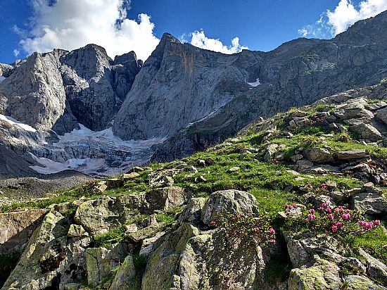
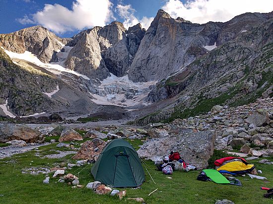
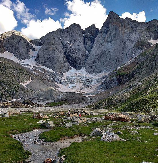
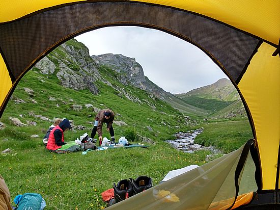
Below, the head of the Gaube valley – the Oulettes de Gaube - was a disorder of boulders, pebble banks and shallow meandering streams clearly capable of transporting phenomenal amounts of water during storms or spring snowmelt. As we descended from the col the view opened out little by little – the lower part of the Oulettes de Gaube was green with grass between the streams, frosted here and there with cottongrass heads, and here the braided streams came together into one single rushing turquoise river that plunged through a rocky channel and down into the main valley below. Just above this the point the Refuge des Oulettes de Gaube perches on a rocky outcrop, looking up the valley to the crowning glory of the walk – the magnificent north face of Vignemale, flanked by glaciers.
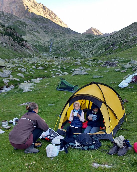
We spent the middle of the day at the refuge to keep out of the sun, but by mid-afternoon the girls could be kept in no longer and we headed back up the side of the valley to a low green meadow which is the refuge’s designated bivouac area. Camping is allowed here but strictly restricted – tents cannot be pitched before 7pm and must be removed again by 9am. However nothing says that you can’t spread your gear around the spot you want to occupy…..
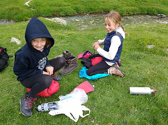
While I watched rock thrushes and dozed in the shade of a boulder and Jake went off down the valley to explore, the girls played amongst the boulders and braided streams.
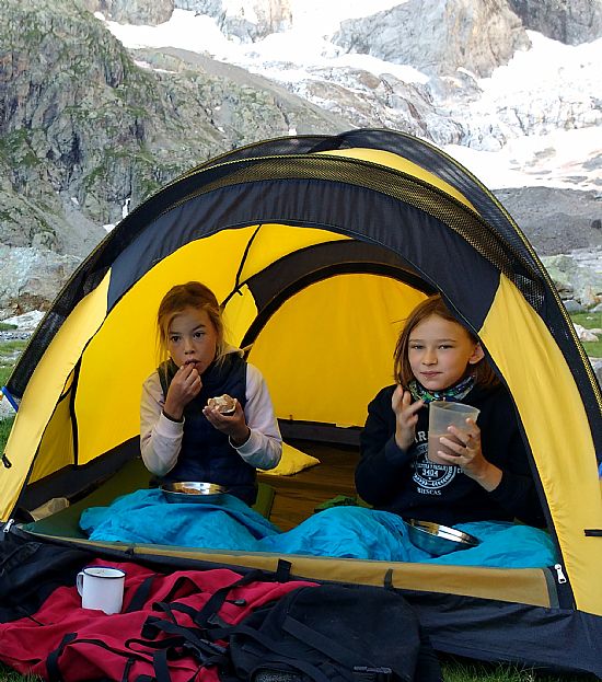
 We enjoyed how well they got on during the trek – a lot of genuine enjoyment of each other’s company and much less squabbling and winding up than tends to go on at home. Even in the mornings, woken up earlier than they would normally like in order to get going while the days were cool, they emerged from their tent cheerful and positive instead of counter-suggestive and grumpy as they are inclined to do at home. Something about the exercise? Or the fresh air? Or the surroundings? Or simply being just the four of us, together, with plenty of time for each other and no distractions……
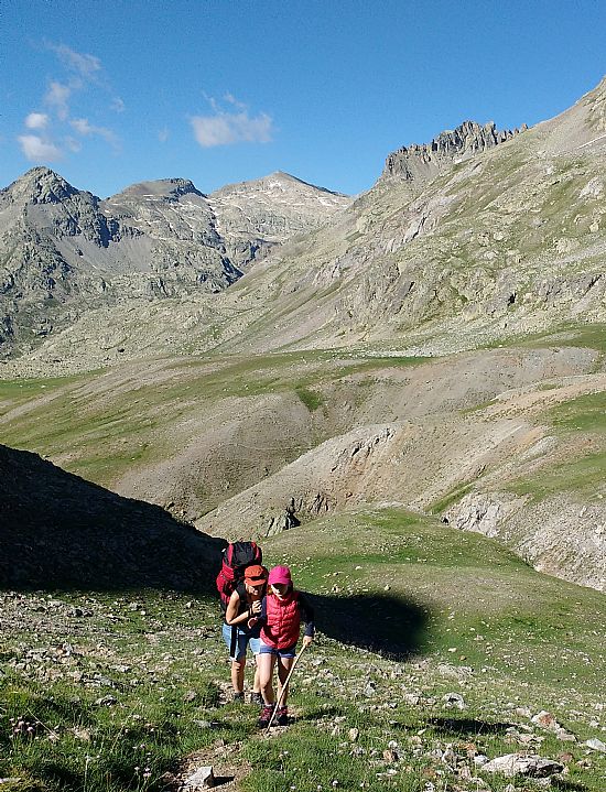
We woke early again after a beautiful moonlit night and prepared ourselves for the next pass: the Horquettes de Ossue, six hundred metres of ascent to the shoulder of Petit Vignemale, one of the four main summits on the Vignemale massif. It was a glorious morning. We set off in the shade, but with the sun touching the sheer rocky face of Vignemale itself away at the head of the valley. Here, out route was shared by two of the three pyrenean long-distance walking routes between the Atlantic and the Mediteranean, the HRP which is the high-level route winding its way along the spine of the pyrenees and crossing frequently into both France and Spain, and the (usually!) lower-level GR10 which runs along the French flank of the mountains. Perhaps because of the popularity of this section, the path was excellent, well-built and rising in a series of long zigzags with a surprisingly gentle gradient, making it an easy and enjoyable ascent for two adults carrying four peoples’ gear…. Each switchback brought us in closer to the dramatic cirque of rock, ice and snow at the head of the valley, and before the pass we were crossing snowfields and looking down onto the crevasses of the Oulettes and Petit Vignemale glaciers.
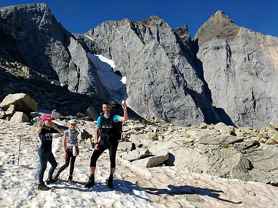
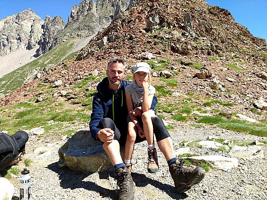
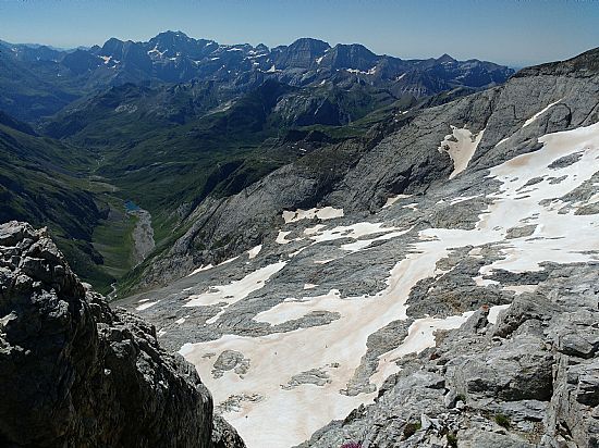
At the top of the pass the rocky peaks towered around us, and we could see east towards Monte Perdido, the Cirque de Gavarnie and the odd square nick of the Breche de Roland. From here the ascent of Petit Vignemale is relatively easy – a walk rather than a climb. Jake left his pack among the rocks and ran up and down in less than an hour, passing numerous less-fit toiling people to his delight and doubtless not to theirs….. The picture below is one of Jake's from the summit of Petit Vignemale.
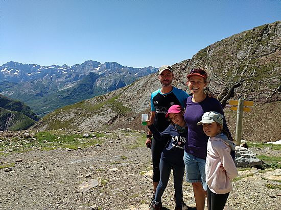
Meanwhile the girls and I made our way the short way down to the Refuge de Baysellance which is the highest refuge in the Pyrenees. We sat on a bench looking out over the dramatic and precipitous view while snow-finches fluttered and foraged around our feet like chaffinches.
We met and chatted to a number of walkers at both refuges, and were rather taken aback by the number of people who seemed to be walking without maps or a clear idea of where they were, where they were trying to get to, and how long a given section of walk was likely to take them. A delightful couple of evidently fairly experienced walkers from New Zealand set off west rather than east from the Refuge des Oulettes de Gaube, then turned out to be attempting to walk the GR10 by following signs – a fairly rare commodity and certainly not frequent enough to follow without a map. A young British couple were doing the tour of Vignemale like ourselves, but appeared to have no idea what or where Vignemale actually was. It was interesting to realise that many of the well-equipped and dauntingly competent-looking walkers one sees in the mountains might look the part but could actually be rather less competent than our eight and eleven year old offspring.
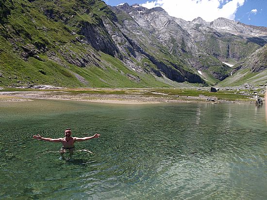
The descent from the Refuge de Baysellance was tough. We decided to walk through the heat of the day rather than rest at the refuge and go on in the afternoon, mainly because the girls love the camping part so much and enjoy having time to play at the end of the day; so it was a long, hot, airless descent down a difficult, loose and sometimes quite exposed path. We stopped for lunch in the intriguing Grottes de Russell, caves dynamited out of the rock by the slightly loopy Henry Russell, a French-Irish aristocrat who became obsessed with Vignemale, climbing it 33 times and eventually securing a 99-year lease on it from the French government. The caves were cool and rather damp but at least out of the sun….. The descent continued steep and hot and hard on the feet until we reached the Ossue valley with its inviting turquoise reservoir. Jake and Iona went straight in. Rowan and I dabbled feet – the water was icy cold.
We left the lake rather reluctantly and turned uphill again over a shoulder of the land into another valley. The character of the land was suddenly very different here – rocky outcrops with heather, separated by boggy streams with butterworts and marsh marigolds and spotted orchids, almost Scottish despite the continuing heat. We trudged along rather slowly, all very tired by this point, eventually reaching the next valley. Exhausted and not really thinking very clearly, we found a spot to camp next to the stream and slumped down to rest. A steady trickle of people seemed to be passing by, and we found ourselves being both scrutinised through binoculars and photographed, as well as having a group of lost walkers stumbling right through our camp. After three days in truly remote country this felt like rather a disappointing last night’s camp….. We had a quick look at the map and worked out that as well as still being on the route of the HRP and GR10, we were also on a very obvious day walk route from Gavarnie. So we loaded up our packs again and with protesting children in tow we walked another ten minutes up the valley, away from the main path.
Here we found ourselves in a different world. Flowery meadows, a beautiful stream with a deep swimming hole, marmots and choughs and distant chamois….. And not a walker to be seen.
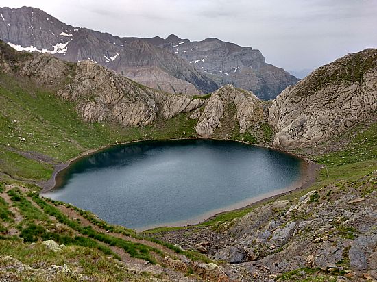
The next morning we headed on up the valley, towards the Spanish border. We had a brief stop for the girls to commune with marmot babies – probably one of the highlights of the trip for them – and made the ridge after only just over an hour of walking. The ridge was really a double ridge, with hidden in the fold between the two, a beautiful and almost perfectly circular lake.
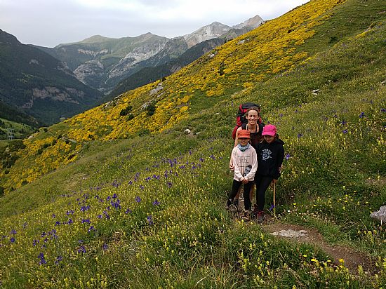
Beyond the second ridge was another long and very tough descent, through lightly-vegetated scree, then alpine meadow, then an astonishing mix of yellow hedgehog broom and purple pyrenean iris, and eventually down into the welcome shade of the woods.
Here, after we had been descending solidly for almost three hours, and with probably only fifteen minutes to go to Bujaruelo, we met a catalan family evidently heading out for the day. They told us they were going up to the lake. The children asked rather mournfully – ‘is it all uphill?’ to which we were obliged to answer ‘yes’…… About 1000 m uphill….. In the heat, with no shade, and you evidently with next to no gear or food or a map or any idea of what you are undertaking……
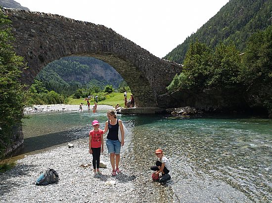
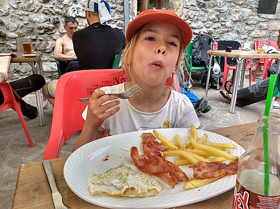
Half an hour later we were down and swum and ordering omelettes, chips, cheese, beer and chocolate milkshake in the Bujaruelo restaurant. Well-earned and much appreciated!
Add your comment