Under Construction
As shown above, the principle towns in the County Borough are:
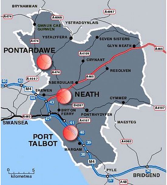
- Neath
- Pontardawe
- Port Talbot
Neath Port Talbot (Welsh: Castell-nedd Port Talbot) is a county borough and one of the unitary authority areas of Wales. Neath Port Talbot is the eighth most populous local authority area in Wales and the third most populous county borough. The actual population taken at the 2011 census was 139,812. The coastal areas are mainly English-speaking, however there are many Welsh-speaking communities in the Valleys to the north of the borough.
The county borough borders the other principal areas of Bridgend and Rhondda Cynon Taff to the east, Powys and Carmarthenshire to the north and Swansea to the west. Its principal towns are Neath, Port Talbot and Pontardawe.
Geography
The local authority area stretches from the coast to the borders of the Brecon Beacons National Park. The majority of land is upland or semi-upland in character, and 43% is covered by forestry with major conifer plantations in upland areas. Most of the lower lying flat land is near the coast around Port Talbot. An extensive dune system stretches along much of the coast, broken by river mouths and areas of development. The upland areas are cut by five valleys: Vale of Neath, Dulais Valley, Afan Valley, Swansea Valley, Upper Amman Valley.
Modern settlement patterns reflect the industrial history of the area, with urban development along the flatter areas of the valleys and some parts of the coast. The largest town is Neath with a population of 47,020, followed by Port Talbot (35,633), Briton Ferry (7,186), Pontardawe (5,035), and Glynneath (4,368). The majority of the population live in the coastal plain around Port Talbot and the land around the River Neath in the vicinity of Neath. Much of the larger towns in the borough lie within the Swansea Urban Area.
Neath Port Talbot County Borough is at the western end of the South Wales valleys.
Demographics
The population in the region reached its peak in the 1930s. Census figures show a population of 151,563 in 1931. The population has shown a steady decline throughout the rest of the 20th century. The population stood at 134,471 in 2001. In the 1990s, most areas within the region showed a fall or little change in population with the notable exception of Bryncoch South and Margam where the population grew by 47.29% and 41.36% respectively. Local council estimates show the population to have grown during the 2000s.
Government and politics
Neath Port Talbot was created from the former districts of Neath, Port Talbot and part of Lliw Valley on 1 April 1996 as Neath and Port Talbot; it changed its name on the following day, 2 April 1996. At the time of the reorganization, many local people expected that Neath and Port Talbot districts would become separate unitary authorities, and there were protests when the new authority was announced.
Local Government
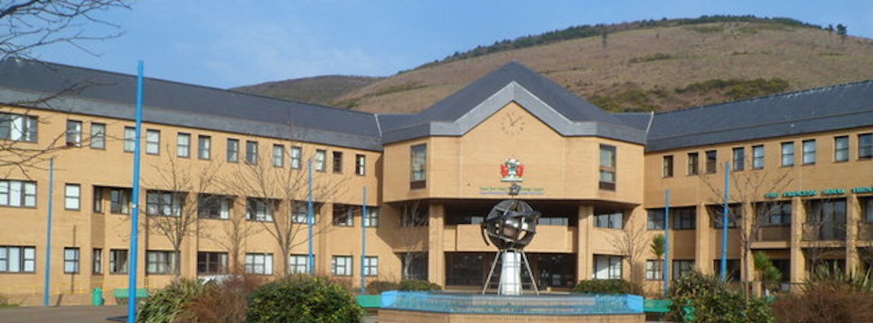
The whole of the Neath Port Talbot area was once part of the county of West Glamorgan, which in turn was part of the historic county of Glamorgan. Since local government re-organisation in 1996, Neath Port Talbot is governed by Neath Port Talbot County Borough Council.
Neath Port Talbot is a staunch Labour stronghold, who have been in power since the authority's formation in 1996.
Source: Wikipedia.
Disclaimer
The administrators of this website are not responsible for the advertisements that are put on by the hosting service and do not endorse them in any way whatsoever.
No responsibility is accepted for any errors, omissions or the content of any third party website linked with this one.
All news items are produced in good faith and credit is given to the source.
Format and design are copyright and all rights are reserved - December 2017
Produced by
THE NEATH FERRET
